SUMMARY
This is AI generated summarization, which may have errors. For context, always refer to the full article.
What’s the weather like in your area? Report the situation through Rappler’s Agos or tweet us at @rapplerdotcom.
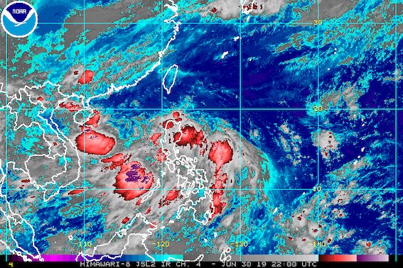
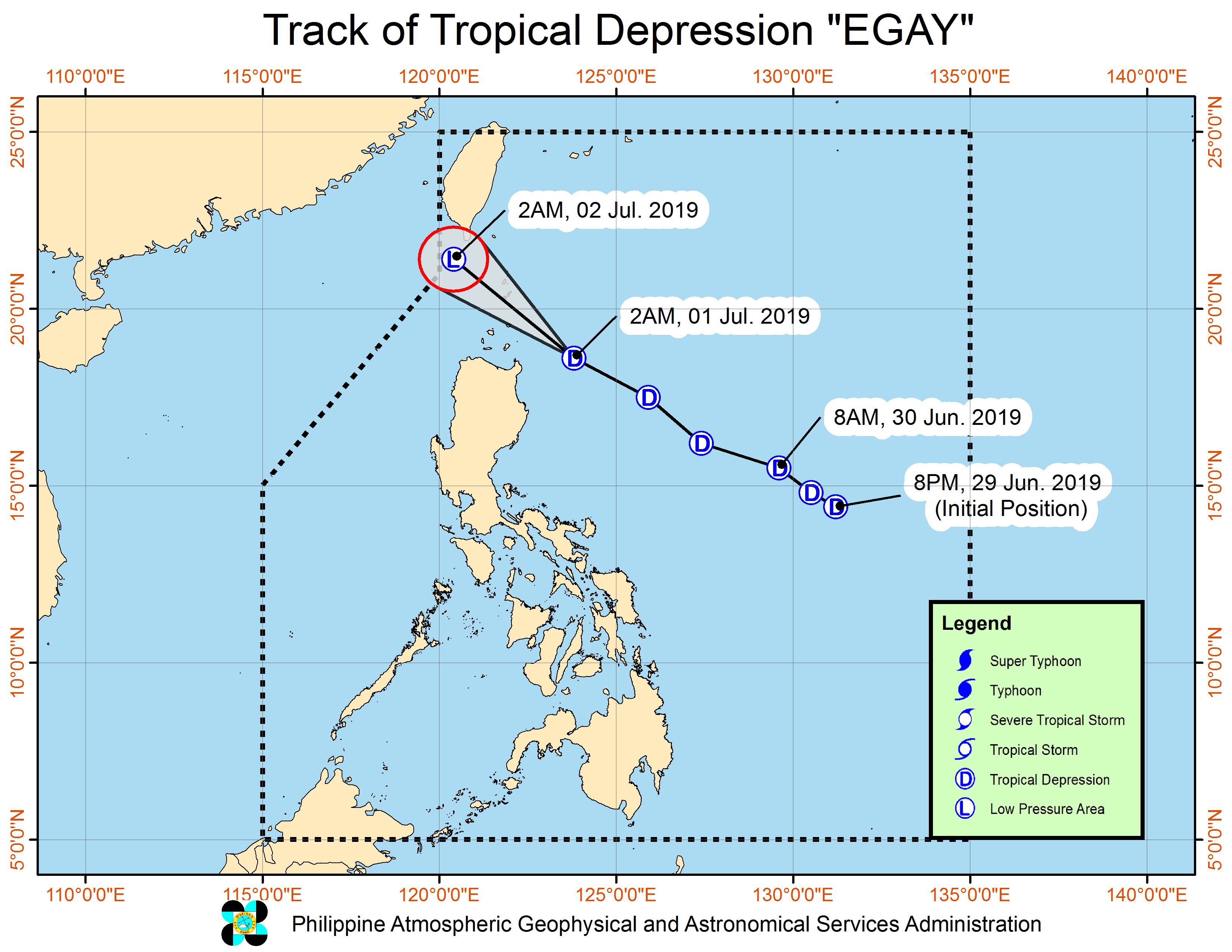
MANILA, Philippines – Tropical Depression Egay slightly weakened before dawn on Monday, July 1, but it continued to enhance the southwest monsoon or hanging habagat, which is bringing rain to Luzon and the Visayas.
In a press briefing at 5 am on Monday, the Philippine Atmospheric, Geophysical, and Astronomical Services Administration (PAGASA) said Egay is already 195 kilometers east northeast of Aparri, Cagayan, or 205 kilometers east of Calayan, Cagayan.
Its maximum winds are down to 45 kilometers per hour (km/h) from the previous 55 km/h, while its gustiness is down to 60 km/h from the previous 65 km/h. It is expected to weaken into a low pressure area (LPA) on Monday.
Egay also slightly accelerated again, now moving northwest at a fast 40 kilometers per hour (km/h) from the previous 35 km/h.
Egay will not make landfall in the Philippines, but Signal No. 1 is raised in Batanes and the Babuyan Group of Islands since the tropical depression may pass near their area. (READ: FAST FACTS: Tropical cyclones, rainfall advisories)
PAGASA said fishermen and those with small seacraft should not set sail in the seaboards of Batanes and the Babuyan Group of Islands due to moderate to rough seas.
The rain from the southwest monsoon enhanced by Egay also continued in Luzon and the Visayas on Monday.
Light to heavy monsoon rain
- Metro Manila
- Ilocos Region
- Cordillera Administrative Region
- Central Luzon
- Calabarzon
- Mimaropa
- Bicol
- Antique
- Aklan
- western Iloilo
Scattered rainshowers and thunderstorms
- rest of Luzon
- rest of Western Visayas
Residents of those areas, especially if they live in flood-prone or landslide-prone communities, must be on alert.
Classes have already been suspended for Monday in certain areas. (READ: #WalangPasok: Class suspensions, Monday, July 1)
Meanwhile, PAGASA is also monitoring an LPA outside the Philippine Area of Responsibility (PAR).
This LPA is 575 kilometers west of Northern Luzon, located over the West Philippine Sea. It is not expected to enter PAR, and will likely head for China.
Egay is the Philippines’ 5th tropical cyclone for 2019, after Amang in January, Betty in February, Chedeng in March, and Dodong also in June – all tropical depressions as well. (READ: LIST: PAGASA’s names for tropical cyclones in 2019)
The Philippines gets an average of 20 tropical cyclones annually, but since 2019 is an El Niño year, only 14 to 18 tropical cyclones are expected.
Below is the estimated number of tropical cyclones from July to December:
- July – 2 or 3
- August – 2 to 4
- September – 2 to 4
- October – 2 or 3
- November – 1 or 2
- December – 0 or 1
PAGASA declared the start of the rainy season last June 14. – Rappler.com
Add a comment
How does this make you feel?
There are no comments yet. Add your comment to start the conversation.