SUMMARY
This is AI generated summarization, which may have errors. For context, always refer to the full article.
What’s the weather like in your area? Tweet us at @rapplerdotcom.
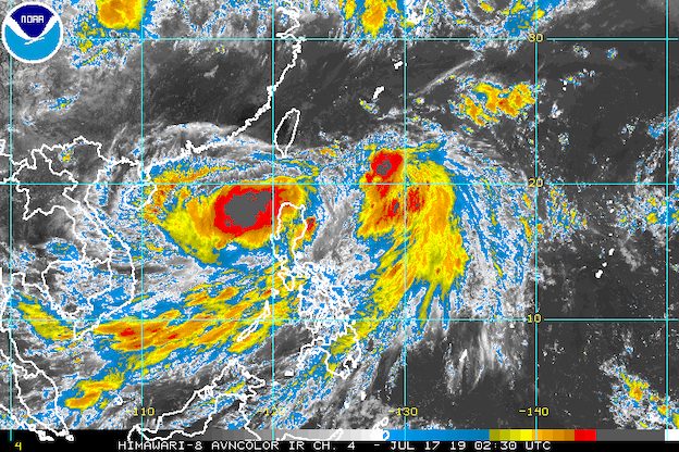
MANILA, Philippines – Heavy rain will persist in parts of Luzon and the Visayas on Wednesday, July 17, as Tropical Storm Falcon (Danas) maintains its strength and continues to enhance the southwest monsoon or hanging habagat.
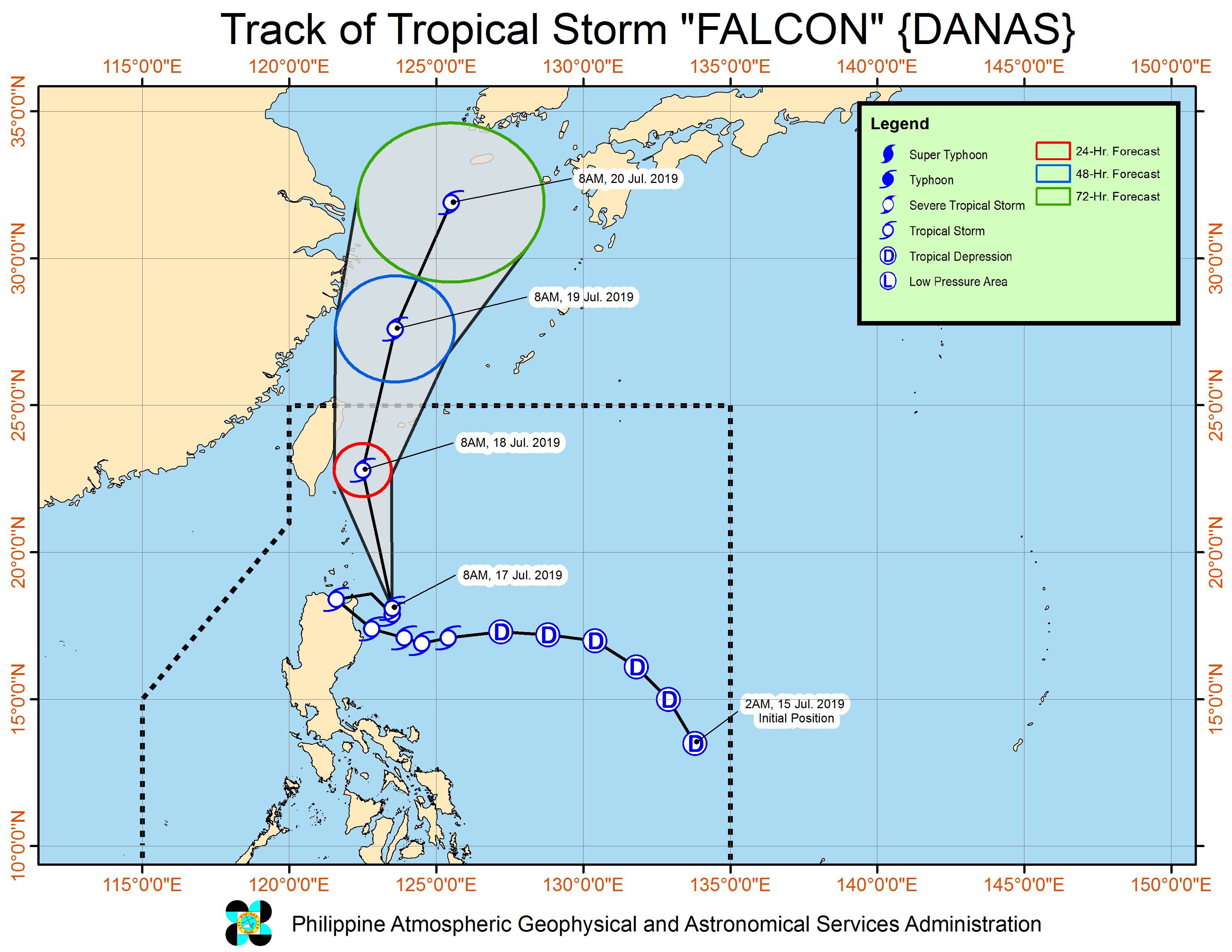
In a briefing past 11 am on Wednesday, the Philippine Atmospheric, Geophysical, and Astronomical Services Administration (PAGASA) said Falcon is already 195 kilometers east of Aparri, Cagayan.
The tropical storm is moving north northwest at the same speed of 20 kilometers per hour (km/h).
It also maintained its strength, with maximum winds of 65 km/h and gustiness of up to 80 km/h. (READ: FAST FACTS: Tropical cyclones, rainfall advisories)
There are now fewer areas under tropical cyclone wind signals, but PAGASA reminded the public that hazards may still result from Falcon.
Signal No. 2:
- Batanes
Signal No. 1:
- Apayao
- Cagayan
- Ilocos Norte
- Babuyan Group of Islands
Falcon had made landfall in Gattaran, Cagayan, at 12:30 am on Wednesday.
Aside from the tropical storm, a low pressure area (LPA) is also seen to enhance the southwest monsoon. This LPA is already 125 kilometers west of Sinait, Ilocos Sur.
Here is the latest on the expected rainfall:
Wednesday, July 17
- Moderate to heavy rain
- Isabela
- La Union
- Zambales
- Bataan
- Cavite
- Batangas
- Occidental Mindoro
- northern Palawan including Calamian and Cuyo islands
- Aklan
- Antique
- Light to heavy rain
- rest of Luzon
- rest of the Visayas
Thursday, July 18
- Moderate to heavy rain
- Ilocos Region
- Zambales
- Bataan
- Occidental Mindoro
- Light to heavy rain
- rest of Luzon
Flash floods and landslides remain possible in areas affected by Falcon and the enhanced southwest monsoon.
Classes were suspended in some areas for Wednesday. (READ: #WalangPasok: Class suspensions, Wednesday, July 17, 2019)
Sea travel also remains risky in the seaboards of areas under Signal Nos. 1 and 2, and in the eastern seaboard of Luzon, the western and southern seaboards of Southern Luzon, and the western seaboard of the Visayas.
Falcon is expected to leave the Philippine Area of Responsibility on Friday, July 19.
Falcon is the Philippines’ 6th tropical cyclone for 2019. The first 5 were all tropical depressions. (READ: LIST: PAGASA’s names for tropical cyclones in 2019)
The Philippines gets an average of 20 tropical cyclones annually, but since 2019 is an El Niño year, only 14 to 18 tropical cyclones are expected.
Below is the estimated number of tropical cyclones from July to December:
- July – 2 or 3
- August – 2 to 4
- September – 2 to 4
- October – 2 or 3
- November – 1 or 2
- December – 0 or 1
PAGASA declared the start of the rainy season last June 14. – Rappler.com
Add a comment
How does this make you feel?
There are no comments yet. Add your comment to start the conversation.