SUMMARY
This is AI generated summarization, which may have errors. For context, always refer to the full article.
What’s the weather like in your area? Tweet us at @rapplerdotcom.
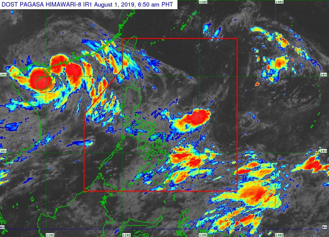
MANILA, Philippines – The trough or extension of the low pressure area (LPA) off Catanduanes will continue to affect some areas on Thursday, August 1.
In a Facebook Live video at 5 am on Thursday, the Philippine Atmospheric, Geophysical, and Astronomical Services Administration (PAGASA) said the LPA is already 460 kilometers east of Virac, Catanduanes.
The trough of the LPA will again bring scattered rainshowers and thunderstorms to these regions:
- Bicol
- Eastern Visayas
- Caraga
- Davao Region
Flash floods and landslides are possible during severe thunderstorms. (READ: FAST FACTS: Tropical cyclones, rainfall advisories)
PAGASA Weather Specialist Ariel Rojas said the LPA is unlikely to develop into a tropical depression, but it may merge with another weather system.
“Ito ay posibleng sumama sa isang malaking sirkulasyon dito sa may silangan ng ating bansa, kung saan posibleng magmula ang isang panibagong LPA na papasok sa PAR (Philippine Area of Responsibility), at posibleng maging isang ganap na bagyo. Pero ‘yung bagyong papasok inaasahang kikilos lamang pahilaga o hilagang kanluran at hindi makakaapekto sa ating bansa. Pero ito’y posibleng humila sa habagat sa papasok na weekend,” said Rojas.
(It could combine with a big circulation here in the east of the country, from which a new LPA might form and enter PAR, and possibly become a tropical cyclone. But the potential tropical cyclone is expected to just move north or northwest and is unlikely to directly affect the country. However, it could enhance the southwest monsoon this coming weekend.)
Meanwhile, Rojas explained that Tropical Storm Wipha, located outside PAR, is pulling the southwest monsoon or hanging habagat towards its center.
This is why the southwest monsoon is only brushing the western part of Luzon. Scattered rainshowers and thunderstorms from the southwest monsoon will persist in:
- Pangasinan
- Zambales
- Bataan
Wipha is 1,195 kilometers west of extreme Northern Luzon, moving west northwest or nearing China at a speed of 20 kilometers per hour. It will not enter PAR.
As for the rest of the country, not affected by the trough of the LPA or the southwest monsoon, there will only be isolated rainshowers or localized thunderstorms.
So far, the Philippines has had 7 tropical cyclones in 2019. (READ: LIST: PAGASA’s names for tropical cyclones in 2019)
The country gets an average of 20 tropical cyclones annually, but since 2019 is an El Niño year, only 14 to 18 tropical cyclones are expected.
Below is the estimated number of tropical cyclones from August to December:
- August – 2 to 4
- September – 2 to 4
- October – 2 or 3
- November – 1 or 2
- December – 0 or 1
PAGASA declared the start of the rainy season last June 14. – Rappler.com
Add a comment
How does this make you feel?
There are no comments yet. Add your comment to start the conversation.