SUMMARY
This is AI generated summarization, which may have errors. For context, always refer to the full article.
What’s the weather like in your area? Tweet us at @rapplerdotcom.
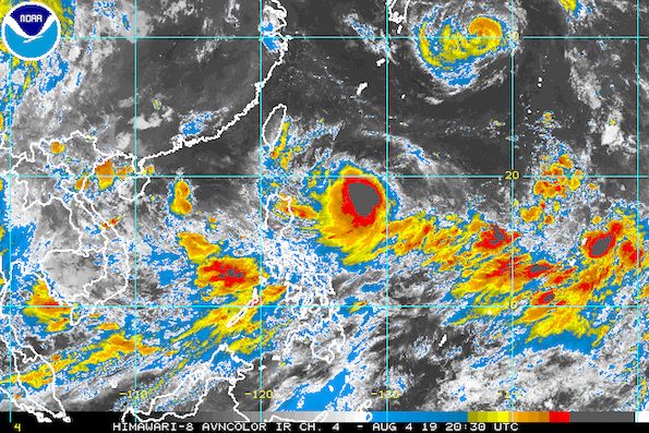
MANILA, Philippines – Tropical Storm Hanna (Lekima) slightly intensified before dawn on Monday, August 5, while still enhancing the southwest monsoon or hanging habagat.
In a briefing at 5 am on Monday, the Philippine Atmospheric, Geophysical, and Astronomical Services Administration (PAGASA) said Hanna now has maximum winds of 75 kilometers per hour (km/h) from the previous 65 km/h and gustiness of up to 90 km/h from the previous 80 km/h.
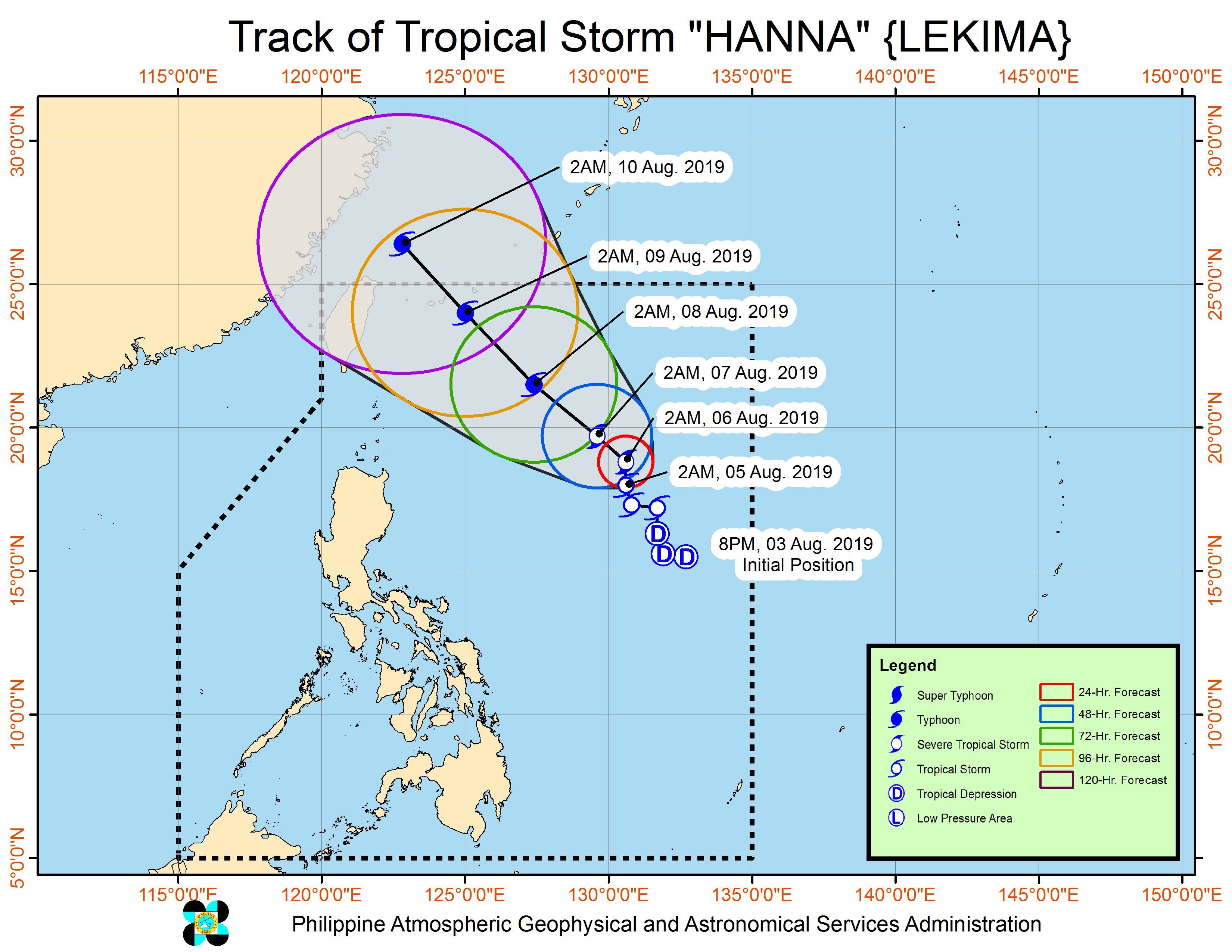
Hanna is expected to intensify further into a severe tropical storm and then a typhoon while inside the Philippine Area of Responsibility (PAR).
Its current location is 940 kilometers east of Tuguegarao City, Cagayan. The tropical storm shifted north northwest from west northwest, still moving at 15 km/h.
There are no areas under tropical cyclone wind signals, since Hanna is far from land. It is also unlikely to make landfall in the country.
But the tropical storm is enhancing the southwest monsoon, which is affecting Luzon and the Visayas.
On Monday, these are the areas which are affected by the enhanced southwest monsoon.
- Moderate to heavy monsoon rain
- Cavite
- Batangas
- Mimaropa
- Scattered rainshowers and thunderstorms
- rest of Calabarzon
- Metro Manila
- Ilocos Region
- Cordillera Administrative Region
- Central Luzon
- Bicol
- Western Visayas
Residents of those areas must remain on alert for possible flash floods and landslides. (READ: FAST FACTS: Tropical cyclones, rainfall advisories)
Hanna’s trough or extension may also trigger scattered rainshowers and thunderstorms in Cagayan Valley on Monday.
Due to the southwest monsoon and Hanna, PAGASA issued a gale warning at 5 am on Monday.
PAGASA warned of rough to very rough seas with wave heights reaching 2.8 meters to 4.5 meters in the following areas:
- western and southern seaboards of Southern Luzon
- Batangas
- Occidental Mindoro
- Palawan
- Oriental Mindoro
- Marinduque
- Romblon
- western seaboard of Northern Luzon and Central Luzon
- Pangasinan
- Zambales
- Bataan
- eastern and southern seaboards of Southern Luzon
- Camarines Norte
- Camarines Sur
- Catanduanes
- Quezon including Polillo Island
- Albay
- Sorsogon
- Masbate
- Burias Island
- western seaboard of the Visayas
- Negros Occidental
- Guimaras
- Iloilo
- Capiz
- Aklan
- Antique
- central and eastern seaboards of the Visayas and eastern seaboard of Mindanao
- Bohol
- Cebu
- Negros Oriental
- Siquijor
- Samar
- Leyte
- Biliran
- Surigao
- Davao Oriental
- Dinagat Islands
- Siargao
PAGASA said fishing boats and other small vessels should not set sail, while larger vessels must watch out for big waves.
Based on Hanna’s latest forecast track, it is expected to leave PAR on Friday, August 9.
Hanna is the Philippines’ 8th tropical cyclone for 2019, and the 1st for the month of August. (READ: LIST: PAGASA’s names for tropical cyclones in 2019)
The country gets an average of 20 tropical cyclones annually, but since 2019 is an El Niño year, only 14 to 18 tropical cyclones are expected.
Below is the estimated number of tropical cyclones from August to December:
- August – 2 to 4
- September – 2 to 4
- October – 2 or 3
- November – 1 or 2
- December – 0 or 1
PAGASA declared the start of the rainy season last June 14. – Rappler.com
Add a comment
How does this make you feel?


There are no comments yet. Add your comment to start the conversation.