SUMMARY
This is AI generated summarization, which may have errors. For context, always refer to the full article.
What’s the weather like in your area? Tweet us at @rapplerdotcom.
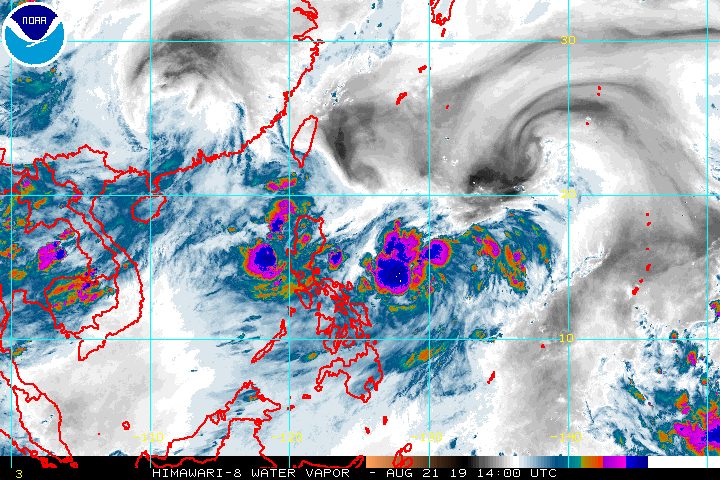
MANILA, Philippines – The outer rainbands of Tropical Storm Ineng (Bailu) and the southwest monsoon or hanging habagat are expected to trigger rain in parts of Luzon and the Visayas on Thursday, August 22.
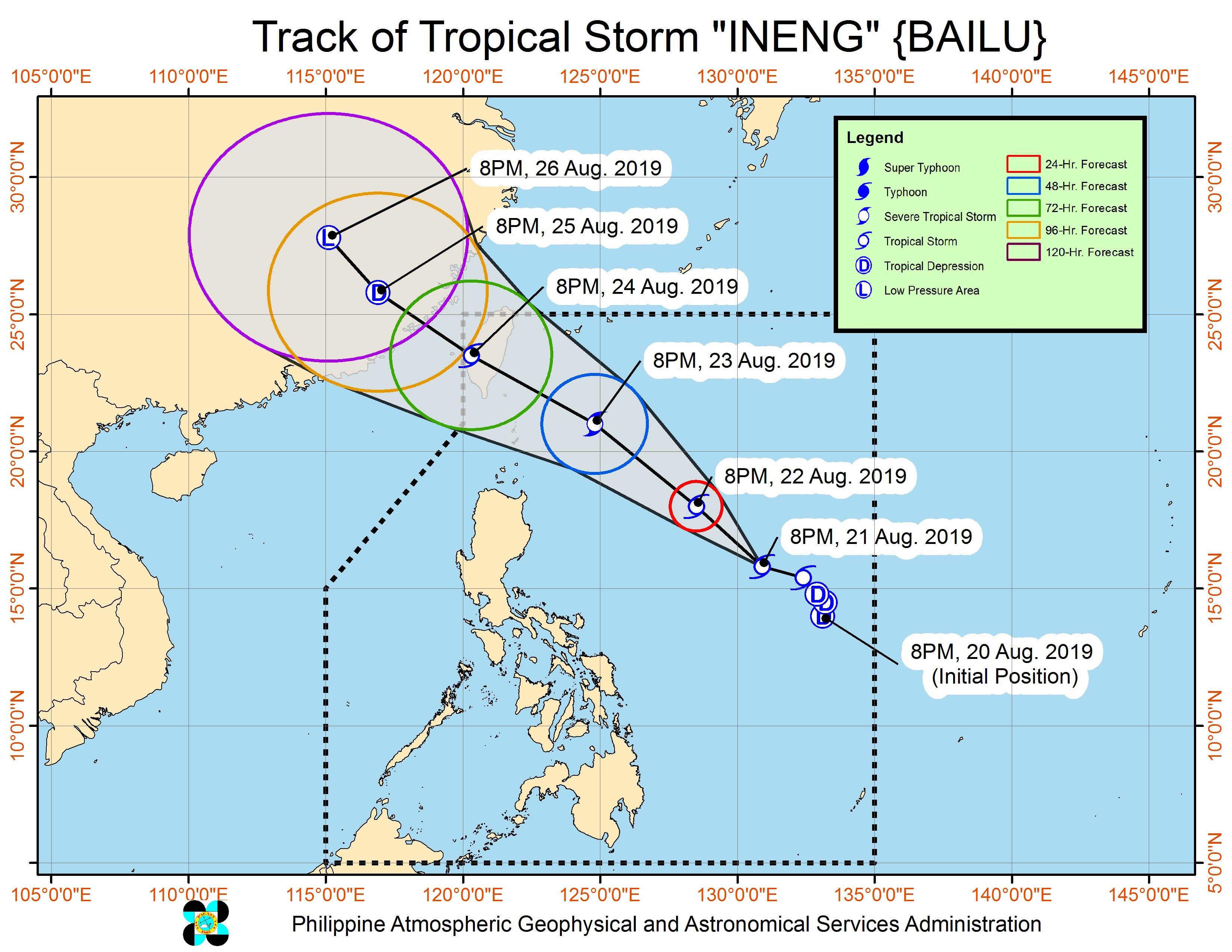
In a bulletin issued 11 pm on Wednesday, August 21, the Philippine Atmospheric, Geophysical, and Astronomical Services Administration (PAGASA) said Ineng is already 970 kilometers east of Infanta, Quezon, or 910 kilometers east of Casiguran, Aurora.
It accelerated and is now moving west northwest at 25 kilometers per hour (km/h) from the previous 15 km/h.
The tropical storm maintained its strength, with maximum winds of 65 km/h and gustiness of up to 80 km/h. But it is now seen to possibly intensify further into a severe tropical storm while inside the Philippine Area of Responsibility (PAR).
There are no tropical cyclone wind signals raised at the moment, since Ineng remains far from land. It is also unlikely to make landfall.
But the outer rainbands of the tropical storm, plus the southwest monsoon, will cause rain on Thursday. Below are the affected areas.
Moderate to heavy rain due to Ineng’s outer rainbands
- Bicol
- Quezon
- Aurora
Moderate to heavy rain due to the southwest monsoon
- Pangasinan
- Zambales
- Bataan
- Cavite
- Batangas
- Occidental Mindoro
- Oriental Mindoro
Light to heavy rain due to the southwest monsoon
- Metro Manila
- rest of Central Luzon
- rest of Calabarzon
- rest of Mimaropa
- Batanes
- Babuyan Group of Islands
- Visayas
PAGASA warned that flash floods and landslides are possible in areas affected by either Ineng’s outer rainbands or the southwest monsoon. (READ: FAST FACTS: Tropical cyclones, rainfall advisories)
PAGASA also said eastern sections of Southern Luzon, the Visayas, and Mindanao should watch out for moderate to rough seas.
Based on its latest forecast track, Ineng will leave PAR on Saturday, August 24. This is a day earlier than initially projected since the tropical storm is currently moving faster.
Ineng is the Philippines’ 9th tropical cyclone for 2019 and the 2nd for August. (READ: LIST: PAGASA’s names for tropical cyclones in 2019)
The country gets an average of 20 tropical cyclones annually, but since 2019 is an El Niño year, only 14 to 18 tropical cyclones are expected.
Below is the estimated number of tropical cyclones from August to December:
- August – 2 to 4
- September – 2 to 4
- October – 2 or 3
- November – 1 or 2
- December – 0 or 1
PAGASA declared the start of the rainy season last June 14. – Rappler.com
Add a comment
How does this make you feel?
There are no comments yet. Add your comment to start the conversation.