SUMMARY
This is AI generated summarization, which may have errors. For context, always refer to the full article.
What’s the weather like in your area? Tweet us at @rapplerdotcom.
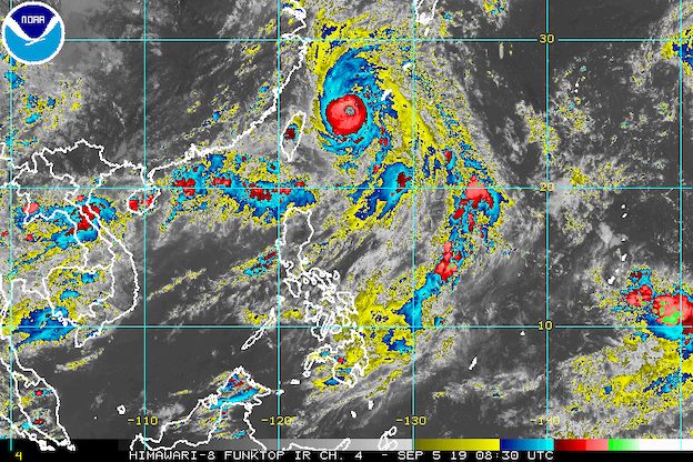
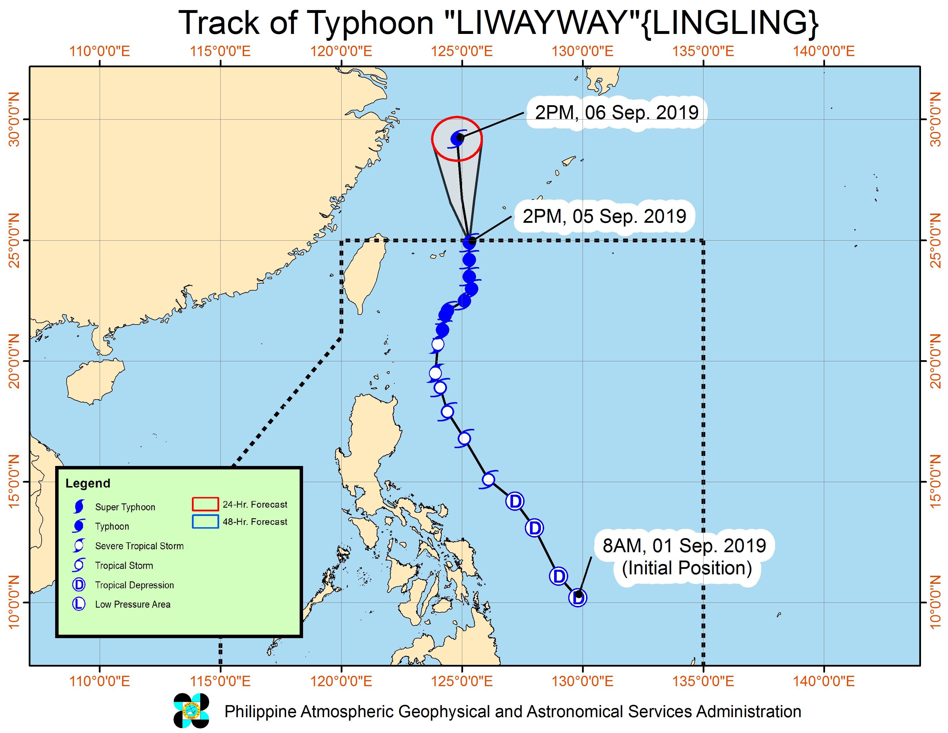
MANILA, Philippines – Typhoon Liwayway (Lingling) and the low pressure area (LPA) that forecasters have been monitoring both left the Philippine Area of Responsibility (PAR) at 3 pm on Thursday, September 5.
In a bulletin issued 5 pm on Thursday, the Philippine Atmospheric, Geophysical, and Astronomical Services Administration (PAGASA) said Liwayway is now 630 kilometers north northeast of Basco, Batanes.
The typhoon is moving north at 15 kilometers per hour (km/h).
It gained even more strength as it left PAR, and now has maximum winds of 175 km/h and gustiness of up to 215 km/h.
Liwayway did not make landfall in the Philippines. But it made landfall in Japan’s Miyako Island, which is part of the southern Ryukyu Islands, at 12:05 pm on Thursday.
Liwayway’s outer rainbands also affected extreme Northern Luzon. (READ: FAST FACTS: Tropical cyclones, rainfall advisories)
Even though Liwayway is already outside PAR, it continues to enhance the southwest monsoon or hanging habagat, which is affecting Northern Luzon.
Due to the southwest monsoon, there will be scattered rainshowers and thunderstorms in these areas:
- Ilocos Region
- Cordillera Administrative Region
- Zambales
- Bataan
PAGASA warned that flash floods and landslides are possible.
Occasional gusty conditions might also occur in these areas due to the southwest monsoon:
- Batanes
- Babuyan Group of Islands
- Ilocos Region
- Cordillera Administrative Region
PAGASA added that travel remains risky in the seaboards of Northern Luzon and the western seaboard of Central Luzon, especially for small seacraft.
Meanwhile, the LPA that left PAR is now 1,070 kilometers east of Eastern Visayas.
Even though the LPA is already outside, its trough or extension could bring scattered rainshowers and isolated thunderstorms to the following areas:
- Central Visayas
- Eastern Visayas
- Caraga
- Northern Mindanao
- Davao Region
- Soccsksargen
The LPA remains less likely to develop into a tropical depression within the next 48 hours.
Liwayway was the Philippines’ 12th tropical cyclone for 2019, and the 2nd for September. (READ: LIST: PAGASA’s names for tropical cyclones in 2019)
The country gets an average of 20 tropical cyclones annually, but since 2019 is an El Niño year, only 14 to 18 tropical cyclones are expected.
Below is the estimated number of tropical cyclones from September to December:
- September – 2 to 4
- October – 2 or 3
- November – 1 or 2
- December – 0 or 1
PAGASA declared the start of the rainy season last June 14. – Rappler.com
Add a comment
How does this make you feel?
There are no comments yet. Add your comment to start the conversation.