SUMMARY
This is AI generated summarization, which may have errors. For context, always refer to the full article.
What’s the weather like in your area? Tweet us at @rapplerdotcom.
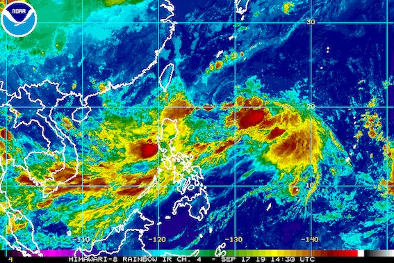
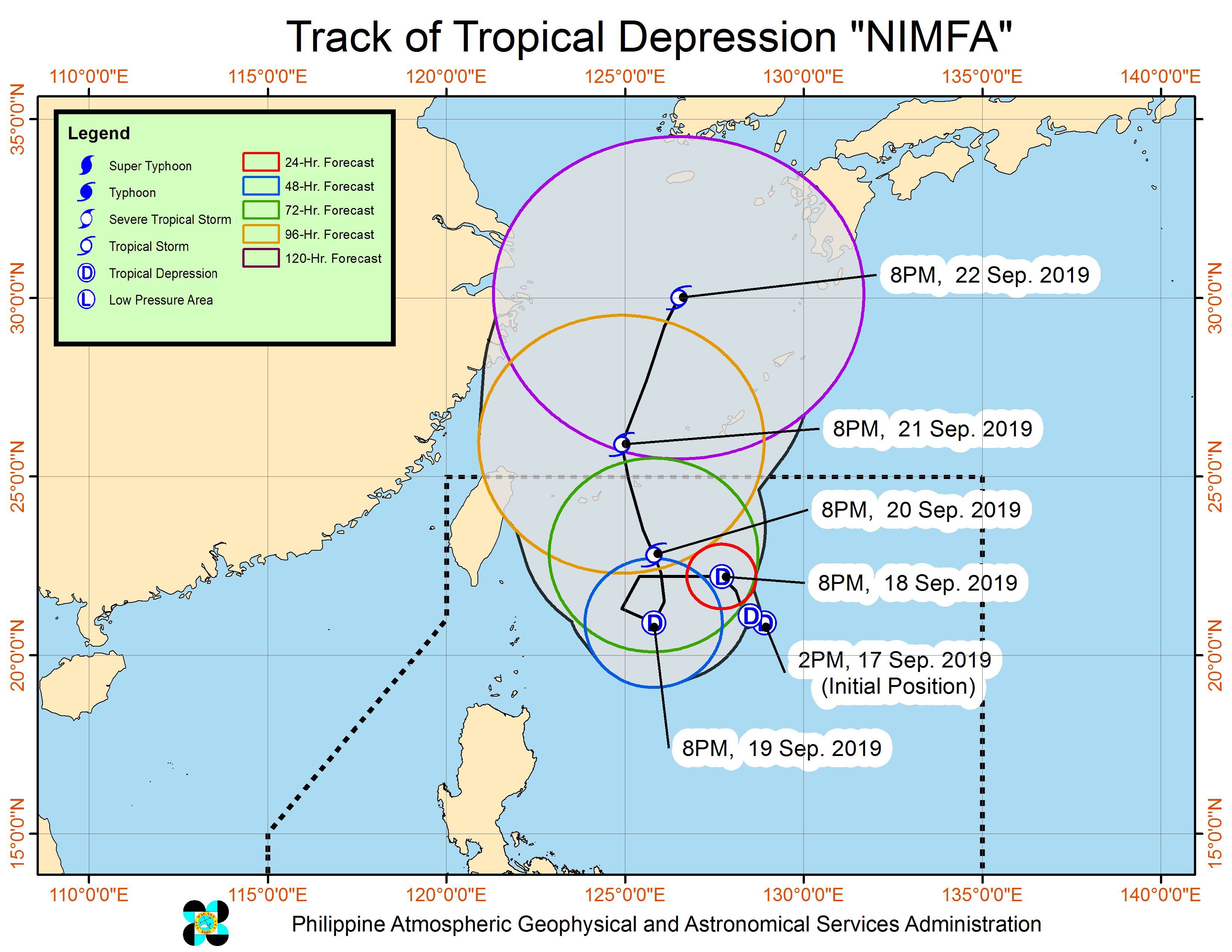
MANILA, Philippines – Tropical Depression Nimfa maintained its strength on Tuesday evening, September 17, while moving slowly over the Philippine Sea.
In a briefing past 11 pm on Tuesday, the Philippine Atmospheric, Geophysical, and Astronomical Services Administration (PAGASA) said Nimfa is 685 kilometers east of Basco, Batanes. It is slowly moving west northwest.
Nimfa still has maximum winds of 55 kilometers per hour (km/h) and gustiness of up to 70 km/h. But it could become a tropical storm while inside the Philippine Area of Responsibility (PAR).
It appears Nimfa will not make landfall in the country, and there are no areas under tropical cyclone wind signals.
But the tropical depression’s trough or extension is bringing rain, along with the southwest monsoon or hanging habagat.
PAGASA provided the following rainfall forecast:
Tuesday night, September 17, until Wednesday night, September 18
- Frequent light to moderate rain with occasional heavy rain
- Central Luzon
- Batangas
- Cavite
- Occidental Mindoro
- northern part of Palawan including Calamian and Cuyo islands
- Scattered light to moderate rain and intermittent heavy rainshowers
- rest of Luzon
- Western Visayas
PAGASA advised the public to watch out for possible flash floods and landslides. (READ: FAST FACTS: Tropical cyclones, rainfall advisories)
Classes have been suspended in some areas for Wednesday, September 18. (READ: #WalangPasok: Class suspensions, Wednesday, September 18, 2019)
Travel is also risky in the northern and eastern seaboards of Northern Luzon, with rough to very rough sea conditions. Most of the other seaboards of the country will remain moderate to rough, said PAGASA.
Based on Nimfa’s latest forecast track, it will leave PAR on Saturday, September 21.
Meanwhile, the low pressure area that forecasters have been monitoring is already in the vicinity of Mayantoc, Tarlac, and could cross Central Luzon. PAGASA said it may eventually dissipate within Nimfa’s circulation.
Nimfa is the Philippines’ 14th tropical cyclone for 2019, and the 4th in September. (READ: LIST: PAGASA’s names for tropical cyclones in 2019)
The country gets an average of 20 tropical cyclones annually, but since 2019 is an El Niño year, only 14 to 18 tropical cyclones are expected.
Below is the estimated number of tropical cyclones from September to December:
- September – 2 to 4
- October – 2 or 3
- November – 1 or 2
- December – 0 or 1
PAGASA declared the start of the rainy season last June 14. – Rappler.com
Add a comment
How does this make you feel?
There are no comments yet. Add your comment to start the conversation.