SUMMARY
This is AI generated summarization, which may have errors. For context, always refer to the full article.
What’s the weather like in your area? Tweet us at @rapplerdotcom.
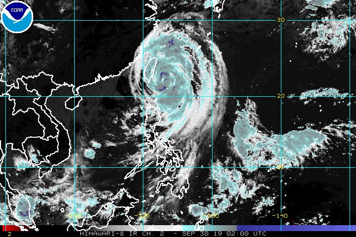
MANILA, Philippines – Typhoon Onyok (Mitag) will not make landfall in the Philippines, but its rainbands will continue to affect Batanes.
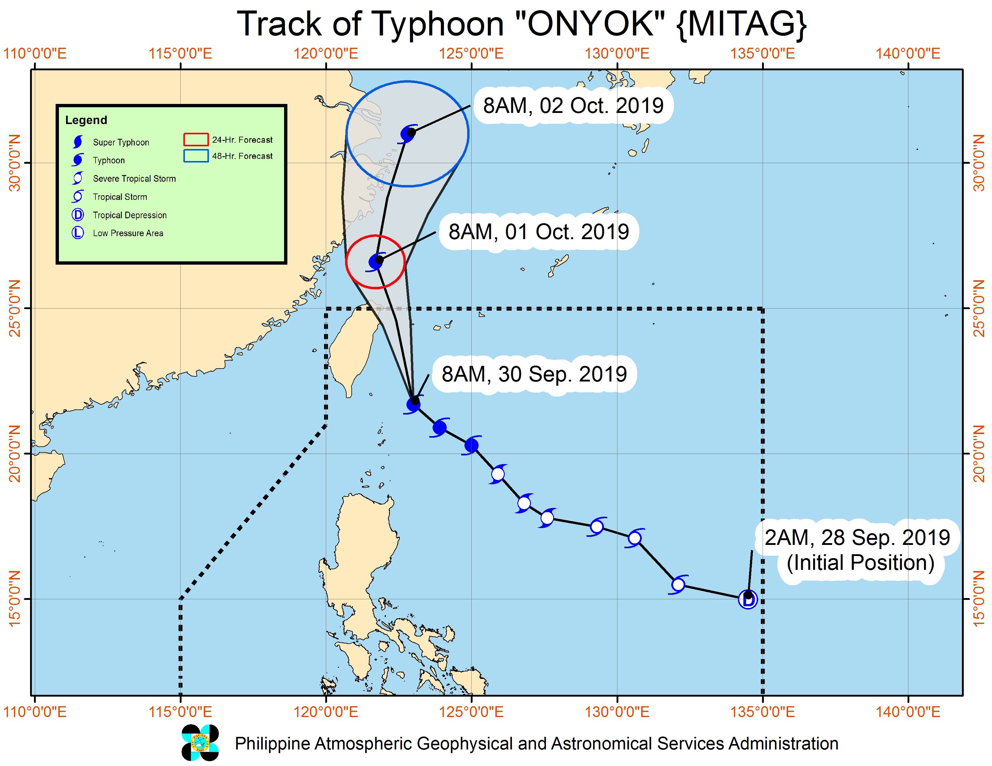
In a bulletin issued 11 am on Monday, September 30, the Philippine Atmospheric, Geophysical, and Astronomical Services Administration (PAGASA) said Onyok is already 200 kilometers north northeast of Basco, Batanes.
It is still moving northwest at 20 kilometers per hour (km/h).
The typhoon still has maximum winds of 120 km/h and gustiness of up to 150 km/h. (READ: FAST FACTS: Tropical cyclones, rainfall advisories)
Signal No. 1, which means winds of 30 km/h to 60 km/h, remains up in:
- Batanes
- Babuyan Group of Islands
PAGASA said Batanes is experiencing occasional rain, mostly light to moderate but may be heavy at times.
Scattered rainshowers are possible in these provinces, too:
- Ilocos Norte
- Apayao
- Cagayan including Babuyan Group of Islands
Travel remains risky, especially for small vessels, in the northern and eastern seaboards of Luzon, including those areas under Signal No. 1.
Based on Onyok’s latest forecast track, it is expected to leave the Philippine Area of Responsibility on Monday evening.
Onyok is the Philippines’ 15th tropical cyclone for 2019, and the 5th in September. (READ: LIST: PAGASA’s names for tropical cyclones in 2019)
The country gets an average of 20 tropical cyclones annually, but since 2019 is an El Niño year, only 14 to 18 tropical cyclones are expected.
At most 4 tropical cyclones had been previously forecast for September. Below is the estimated number of tropical cyclones from September to December:
- September – 2 to 4
- October – 2 or 3
- November – 1 or 2
- December – 0 or 1
PAGASA declared the start of the rainy season last June 14. – Rappler.com
Add a comment
How does this make you feel?
There are no comments yet. Add your comment to start the conversation.