SUMMARY
This is AI generated summarization, which may have errors. For context, always refer to the full article.
What’s the weather like in your area? Tweet us at @rapplerdotcom.
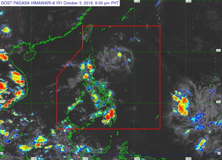
MANILA, Philippines – The state weather bureau continues to monitor a low pressure area (LPA) inside the Philippine Area of Responsibility (PAR), while a shallow LPA was spotted outside.
In a briefing at 4 pm on Thursday, October 3, the Philippine Atmospheric, Geophysical, and Astronomical Services Administration (PAGASA) said the LPA inside PAR is already 790 kilometers east of Casiguran, Aurora.
PAGASA Weather Specialist Gener Quitlong said the LPA could make landfall in Northern Luzon on Saturday, October 5. But it is not expected to develop into a tropical cyclone.
Meanwhile, the shallow LPA outside PAR could become an LPA and possibly enter this coming weekend. Updates are expected in the next few days. (READ: FAST FACTS: Tropical cyclones, rainfall advisories)
At the moment, Quitlong said both the LPA and the shallow LPA are still too far to affect the Philippines.
The entire country will continue to have fair weather, with just isolated rainshowers or localized thunderstorms.
The Philippines has had 15 tropical cyclones in 2019. (READ: LIST: PAGASA’s names for tropical cyclones in 2019)
The country gets an average of 20 tropical cyclones annually, but since 2019 is an El Niño year, only 14 to 18 tropical cyclones are expected.
Below is the estimated number of tropical cyclones from October to December:
- October – 2 or 3
- November – 1 or 2
- December – 0 or 1
PAGASA declared the start of the rainy season last June 14. – Rappler.com
Add a comment
How does this make you feel?
There are no comments yet. Add your comment to start the conversation.