SUMMARY
This is AI generated summarization, which may have errors. For context, always refer to the full article.
What’s the weather like in your area? Tweet us at @rapplerdotcom.
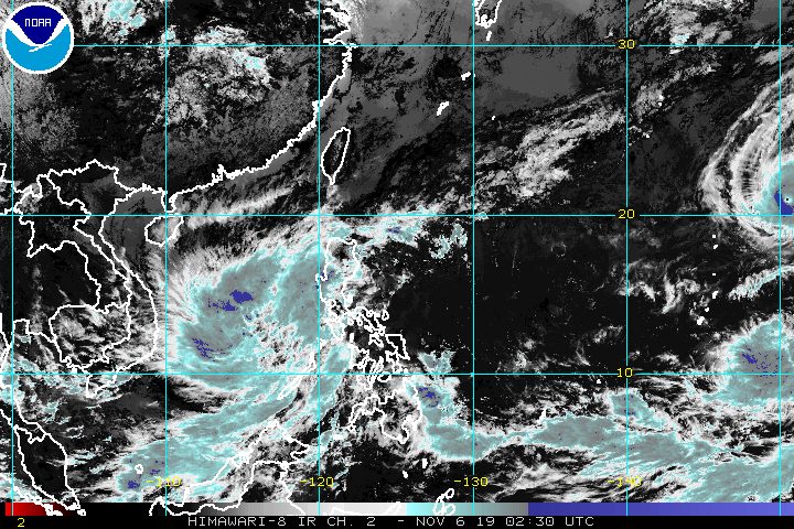
MANILA, Philippines – Tropical Storm Quiel (Nakri) slightly intensified on Wednesday morning, November 6, while almost stationary over the West Philippine Sea.
In a bulletin issued 11 am on Wednesday, the Philippine Atmospheric, Geophysical, and Astronomical Services Administration (PAGASA) said Quiel now has maximum winds of 75 kilometers per hour (km/h) from the previous 65 km/h and gustiness of up to 90 km/h from the previous 80 km/h.
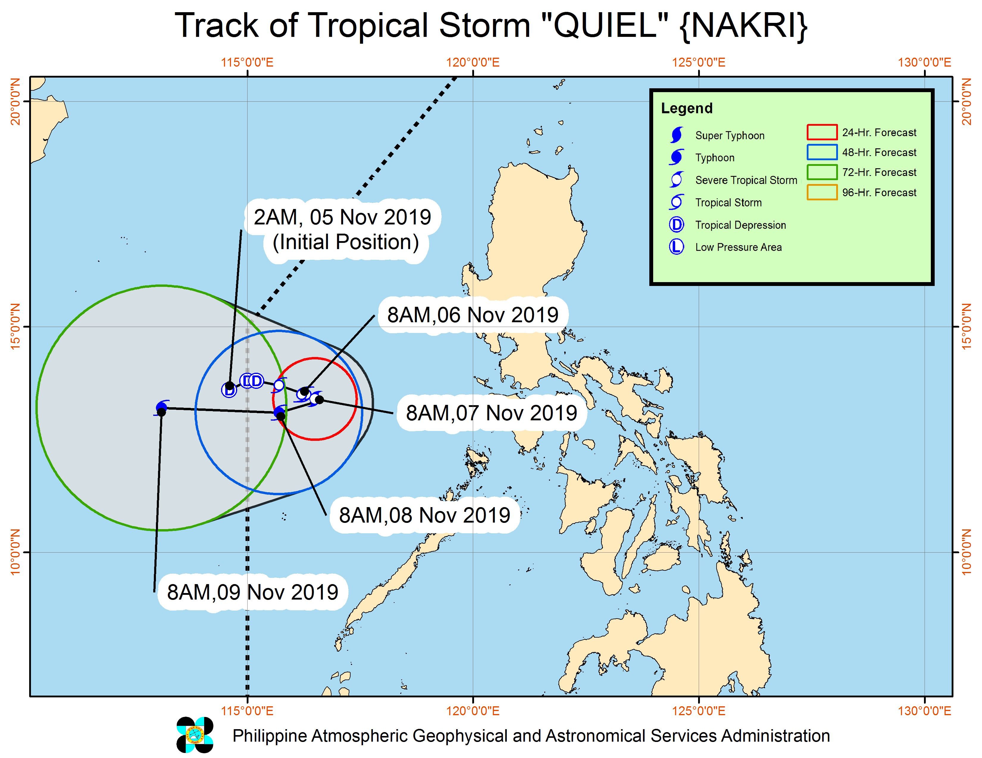
It is expected to strengthen further into a severe tropical storm within 24 hours, and then into a typhoon. (READ: FAST FACTS: Tropical cyclones, rainfall advisories)
Quiel is now 465 kilometers west southwest of Subic, Zambales, or 465 kilometers west northwest of Coron, Palawan. It is barely moving in that spot.
Quiel remains unlikely to make landfall in the country and there are no areas under tropical cyclone wind signals.
But PAGASA warned that rain from Quiel and the tail-end of a cold front will continue in parts of Luzon and the Visayas. Below are the affected areas from Wednesday until Thursday morning, November 7.
Light to moderate rain with occasionally heavy rain
- Babuyan Group of Islands
- Pangasinan
- Zambales
- Bataan
- Occidental Mindoro
- Antique
- parts of Palawan (Cuyo Islands and Kalayaan Islands)
Light to moderate rain with intermittent heavy rain
- Batanes
- Apayao
- Ilocos Norte
- Aklan
- Iloilo
- Oriental Mindoro
- rest of Cagayan
- rest of Palawan (including Calamian Islands)
Flash floods and landslides are possible in those areas, so residents must stay on alert.
Travel is also risky, especially for small vessels, in the northern and western seaboards of Luzon.
Based on Quiel’s latest forecast track, it might leave the Philippine Area of Responsibility (PAR) on Friday, November 8.
Quiel is the Philippines’ 17th tropical cyclone for 2019, and the 1st in November. (READ: LIST: PAGASA’s names for tropical cyclones in 2019)
Meanwhile, PAGASA continues to monitor Typhoon Halong outside PAR.
Halong continues to strengthen as well. It now has maximum winds of 215 km/h from the previous 205 km/h and gustiness of up to 265 km/h from the previous 250 km/h.
The typhoon is now 2,960 kilometers east of extreme Northern Luzon, slowly moving north. It is not expected to enter PAR.
The country gets an average of 20 tropical cyclones annually, but since 2019 is an El Niño year, only 14 to 18 tropical cyclones are expected.
Below is the estimated number of tropical cyclones for the last two months of 2019:
- November – 1 or 2
- December – 0 or 1
PAGASA declared the start of the rainy season last June 14. – Rappler.com
Add a comment
How does this make you feel?
There are no comments yet. Add your comment to start the conversation.