SUMMARY
This is AI generated summarization, which may have errors. For context, always refer to the full article.
What’s the weather like in your area? Tweet us at @rapplerdotcom.
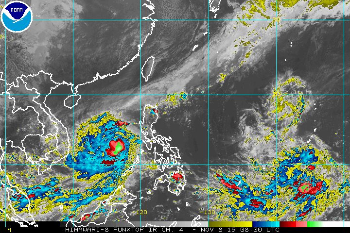
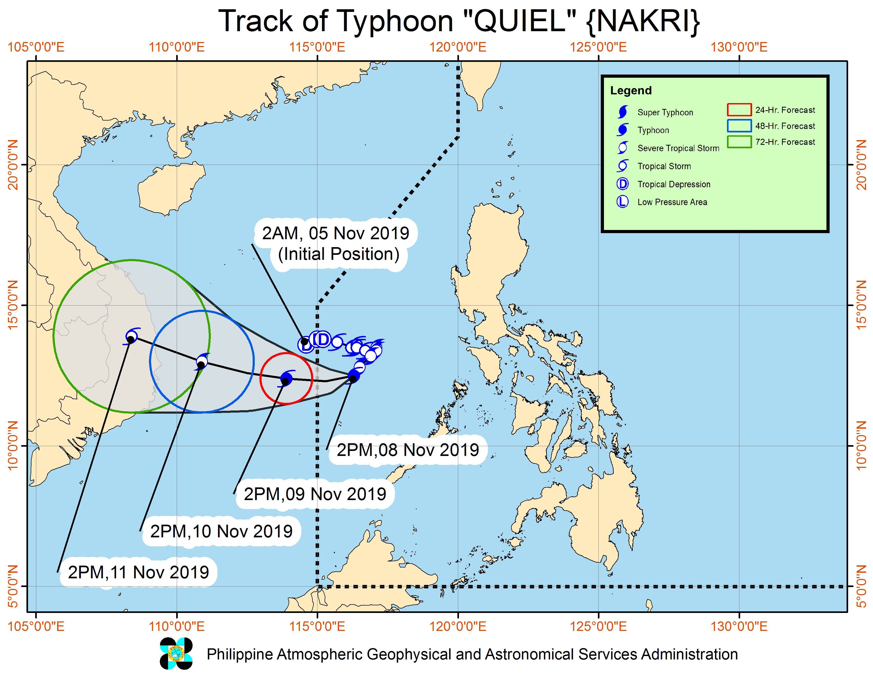
MANILA, Philippines – Quiel (Nakri) intensified from a severe tropical storm into a typhoon at 2 pm on Friday, November 8, as it continued to move away from the Philippines.
In a bulletin issued 5 pm on Friday, the Philippine Atmospheric, Geophysical, and Astronomical Services Administration (PAGASA) said Typhoon Quiel now has maximum winds of 120 kilometers per hour (km/h) from the previous 110 km/h and gustiness of up to 150 km/h from the previous 135 km/h.
The typhoon remains 430 kilometers west of Coron, Palawan, over the West Philippine Sea. It is still moving southwest at a slow pace of 10 km/h. (READ: FAST FACTS: Tropical cyclones, rainfall advisories)
Quiel will not make landfall in the country and there are no areas under tropical cyclone wind signals.
But the typhoon and the tail-end of a cold front continue to affect parts of Luzon, which have been seeing rain the past days. Here is the latest on what to expect for the rest of Friday until Saturday afternoon, November 9:
Moderate to occasionally heavy rain
- Cagayan, including Babuyan Group of Islands
- Isabela
- Apayao
- Ilocos Norte
Light to moderate rain with intermittent heavy rain
- Occidental Mindoro
- Oriental Mindoro
- Palawan
- Western Visayas
PAGASA advised residents to stay alert for flash floods and landslides.
Travel also remains risky, especially for small vessels, in the seaboards of Northern Luzon and the western seaboards of Central Luzon and Southern Luzon.
Based on Quiel’s latest forecast track, it might leave the Philippine Area of Responsibility (PAR) either on Friday night or Saturday morning. PAGASA said the typhoon will then “head generally westward towards Vietnam.”
Quiel is the Philippines’ 17th tropical cyclone for 2019, and the 1st in November. (READ: LIST: PAGASA’s names for tropical cyclones in 2019)
Meanwhile, Halong – the tropical cyclone outside PAR that PAGASA has been monitoring – weakened from a typhoon into a severe tropical storm on Friday afternoon.
Severe Tropical Storm Halong is now 3,525 kilometers east northeast of extreme Northern Luzon, which PAGASA said is already outside the state weather bureau’s “tropical cyclone information domain.”
This means PAGASA will no longer be monitoring Halong and it is not seen to enter PAR.
The country gets an average of 20 tropical cyclones annually, but since 2019 is an El Niño year, only 14 to 18 tropical cyclones are expected.
Below is the estimated number of tropical cyclones for the last two months of 2019:
- November – 1 or 2
- December – 0 or 1
PAGASA declared the start of the rainy season last June 14. – Rappler.com
Add a comment
How does this make you feel?
There are no comments yet. Add your comment to start the conversation.