SUMMARY
This is AI generated summarization, which may have errors. For context, always refer to the full article.
What’s the weather like in your area? Tweet us at @rapplerdotcom.
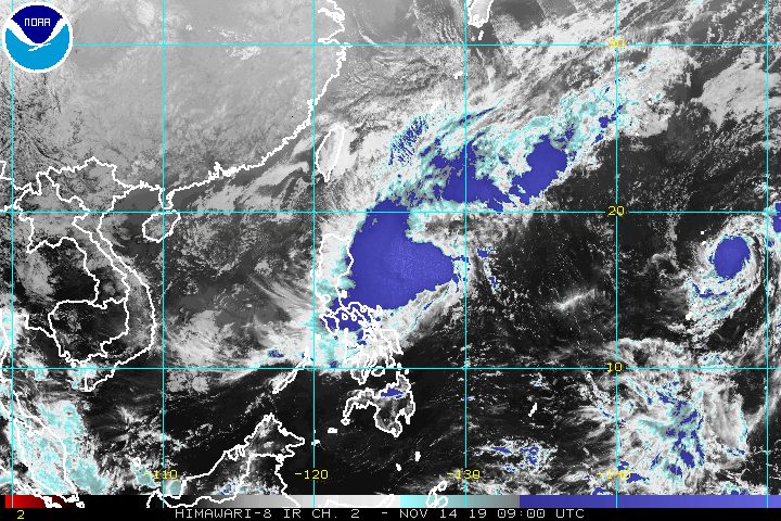
MANILA, Philippines – Tropical Storm Ramon (Kalmaegi) maintained its strength on Thursday afternoon, November 14, as it continued to head for Northern Luzon.
In a briefing at 5 pm on Thursday, the Philippine Atmospheric, Geophysical, and Astronomical Services Administration (PAGASA) said Ramon is already 500 kilometers east of Baler, Aurora.
It slightly slowed down, and is now moving north northwest at 15 kilometers per hour (km/h) from the previous 20 km/h.
Ramon continues to have maximum winds of 65 km/h and gustiness of up to 80 km/h.
There are fewer areas under tropical cyclone wind signals, as Signal No. 1 has been lifted over Sorsogon, Northern Samar, and Eastern Samar. This is the latest list of areas with wind signals:
Signal No. 2 (winds of 61 km/h to 120 km/h)
- Catanduanes
Signal No. 1 (winds of 30 km/h to 60 km/h)
- eastern part of Isabela (Divilacan, Palanan, Dinapigue)
- northern part of Aurora (Dilasag, Casiguran, Dinalungan)
- Polillo Island
- Camarines Norte
- Camarines Sur
- Albay
Ramon will also continue to trigger rain in parts of Luzon. Below are the areas still to be affected in the next two days.
Friday, November 15
- Light to moderate rain with occasionally heavy rain
- eastern part of Cagayan
- eastern part of Isabela
- Light to moderate rain with intermittent heavy rain
- northern part of Aurora
- Camarines Norte
- Polillo Island
Saturday, November 16
- Light to moderate rain with occasionally heavy rain
- Cagayan
- northern part of Aurora
- eastern part of Isabela
- Light to moderate rain with intermittent heavy rain
- Apayao
- rest of Aurora
- rest of Isabela
PAGASA reiterated that Ramon might cause flash floods and landslides. (READ: FAST FACTS: Tropical cyclones, rainfall advisories)
Some areas already suspended classes for Friday, November 15, anticipating the possible effects of heavy rain. (READ: #WalangPasok: Class suspensions, Friday, November 15, 2019)
Travel is also risky, especially for small vessels, in the seaboards of areas under Signal Nos. 1 and 2, the seaboards of Northern Luzon, and the eastern seaboards of Aurora and Quezon.
Based on Ramon’s latest forecast track, it could make landfall in the Isabela-Cagayan area on Sunday, November 17. It is expected to weaken into a tropical depression after hitting land, but may reintensify into a tropical storm after it leaves landmass.
Depending on Ramon’s direction, PAGASA Weather Specialist Aldczar Aurelio said the tropical storm could leave the Philippine Area of Responsibility either on Tuesday, November 19, or Wednesday, November 20.
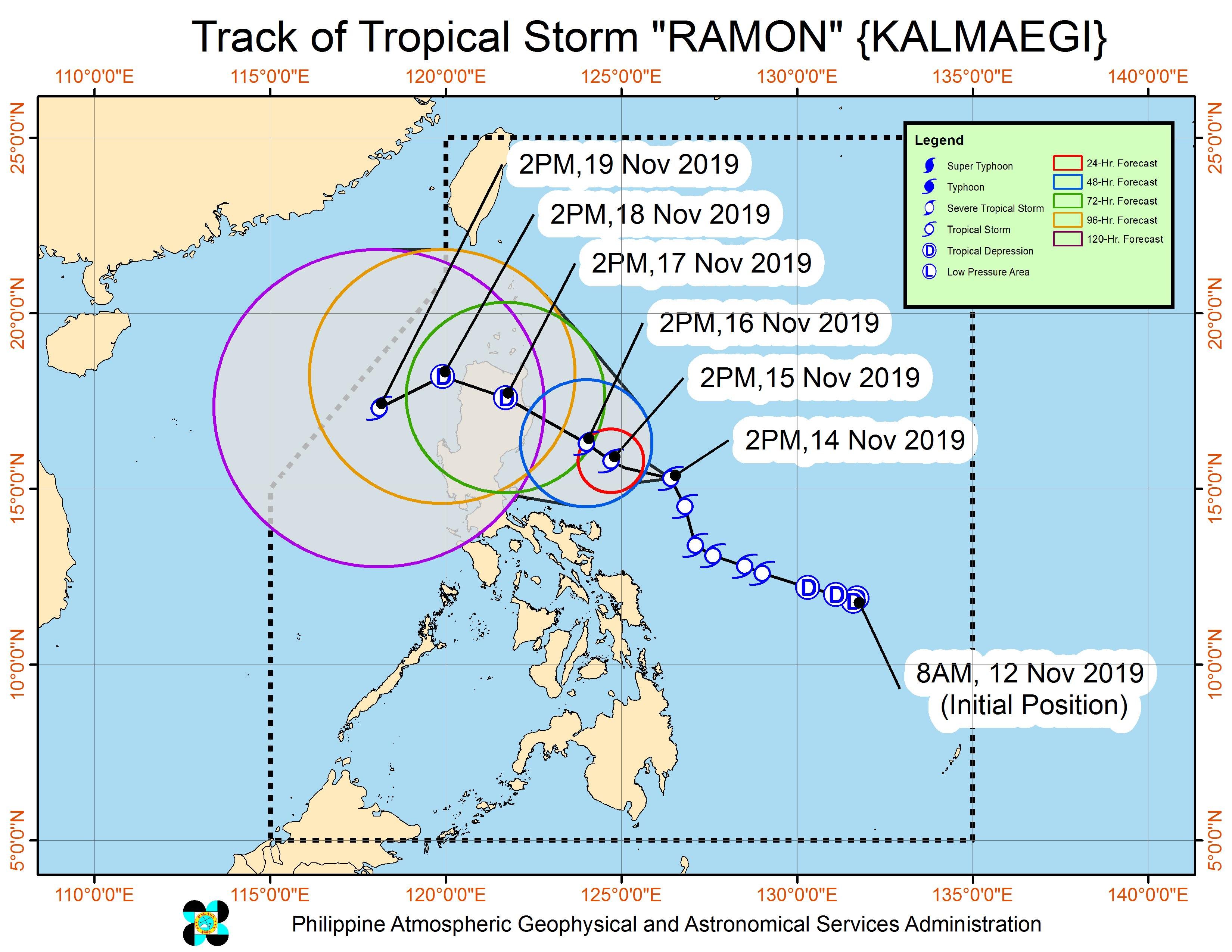
Ramon is the Philippines’ 18th tropical cyclone for 2019, and the 2nd for November. (READ: LIST: PAGASA’s names for tropical cyclones in 2019)
The country gets an average of 20 tropical cyclones annually, but since 2019 is an El Niño year, only 14 to 18 tropical cyclones are expected.
Below is the estimated number of tropical cyclones for the last two months of 2019:
- November – 1 or 2
- December – 0 or 1
PAGASA declared the start of the rainy season last June 14. – Rappler.com
Add a comment
How does this make you feel?
There are no comments yet. Add your comment to start the conversation.