SUMMARY
This is AI generated summarization, which may have errors. For context, always refer to the full article.
What’s the weather like in your area? Tweet us at @rapplerdotcom.
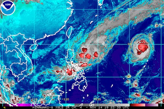
MANILA, Philippines – Tropical Storm Ramon (Kalmaegi) slightly intensified and shifted from a north northwest direction to north before dawn on Friday, November 15.
In a bulletin issued 5 am on Friday, the Philippine Atmospheric, Geophysical, and Astronomical Services Administration (PAGASA) said Ramon now has maximum winds of 75 kilometers per hour (km/h) from the previous 65 km/h and gustiness of up to 90 km/h from the previous 80 km/h.
The tropical storm is 445 kilometers east northeast of Casiguran, Aurora, now moving north at 15 km/h.
The change in direction means Ramon appears most likely to hit the tip of Cagayan instead of provinces below it, such as Isabela or Aurora. But this may still change if Ramon shifts again.
Below are the areas remaining under Signal No. 1. Catanduanes has been removed from the list.
Signal No. 1 (winds of 30 km/h to 60 km/h)
- southeastern part of Cagayan (Peñablanca, Baggao)
- eastern part of Isabela (Divilacan, Palanan, Dinapigue, Maconacon)
- northern part of Aurora (Dilasag, Casiguran, Dinalungan)
- Polillo Island
Here is the latest on the rainfall from Ramon:
Friday, November 15
- Light to moderate rain with intermittent heavy rain
- eastern part of Cagayan
- eastern part of Isabela
- Bicol
- Romblon
- Panay Island
- Cuyo Island
Saturday, November 16
- Light to moderate rain with occasionally heavy rain
- eastern part of Cagayan
- eastern part of Isabela
- Light to moderate rain with intermittent heavy rain
- Apayao
- northern part of Aurora
- rest of Cagayan
- rest of Isabela
Flash floods and landslides are possible in areas affected by Ramon. (READ: FAST FACTS: Tropical cyclones, rainfall advisories)
Classes in some areas were suspended for Friday. (READ: #WalangPasok: Class suspensions, Friday, November 15, 2019)
Travel is also risky, especially for small vessels, in the seaboards of areas under Signal No. 1, the seaboards of Northern Luzon, and the eastern seaboards of Central Luzon and Southern Luzon.
Based on Ramon’s latest forecast track, it could make landfall in Cagayan between Sunday evening, November 17, and Monday morning, November 18.
Ramon might leave the Philippine Area of Responsibility on Wednesday, November 20.
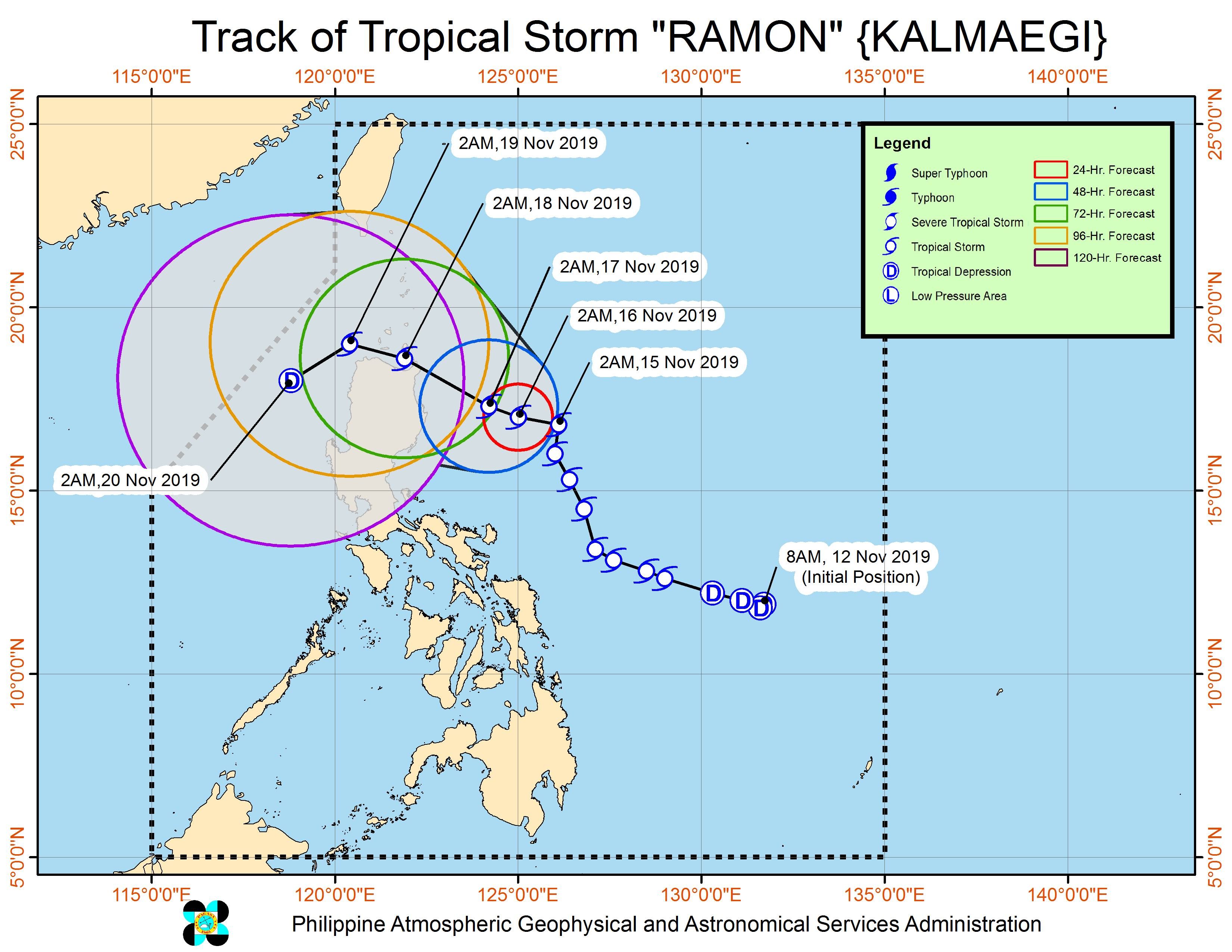
Ramon is the Philippines’ 18th tropical cyclone for 2019, and the 2nd for November. (READ: LIST: PAGASA’s names for tropical cyclones in 2019)
The country gets an average of 20 tropical cyclones annually, but since 2019 is an El Niño year, only 14 to 18 tropical cyclones are expected.
Below is the estimated number of tropical cyclones for the last two months of 2019:
- November – 1 or 2
- December – 0 or 1
PAGASA declared the start of the rainy season last June 14. – Rappler.com
Add a comment
How does this make you feel?
There are no comments yet. Add your comment to start the conversation.