SUMMARY
This is AI generated summarization, which may have errors. For context, always refer to the full article.
What’s the weather like in your area? Tweet us at @rapplerdotcom.
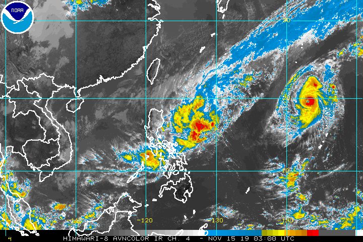
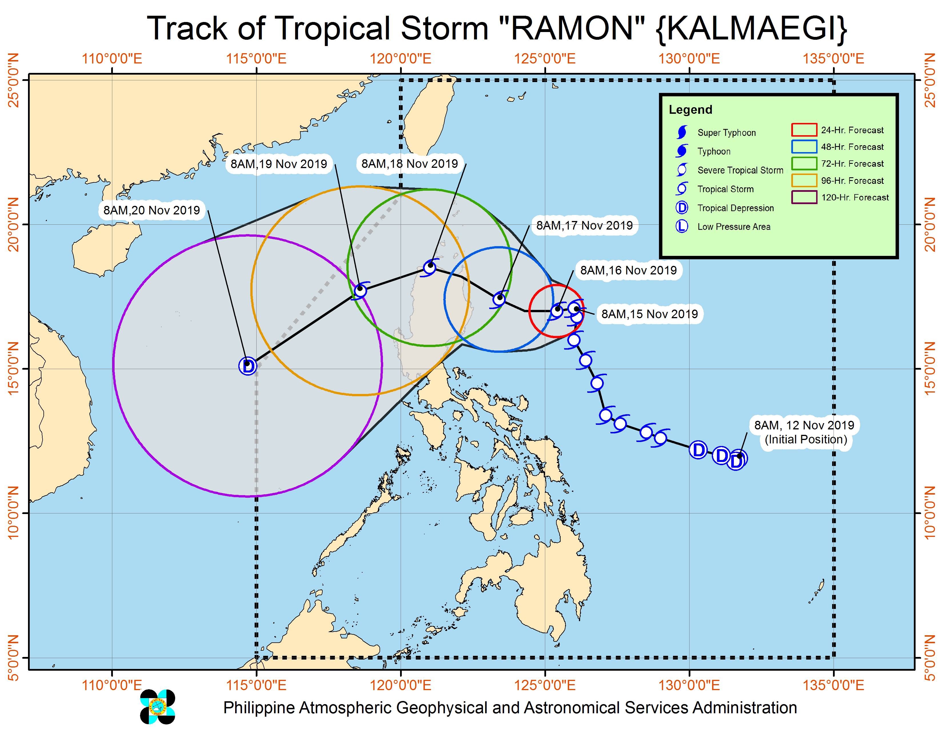
MANILA, Philippines – Tropical Storm Ramon (Kalmaegi) slowed down on Friday morning, November 15, as it continued making its way toward Northern Luzon, where it is expected to make landfall.
In a briefing past 11 am on Friday, the Philippine Atmospheric, Geophysical, and Astronomical Services Administration (PAGASA) said Ramon is now 420 kilometers east northeast of Casiguran, Aurora, or 460 kilometers east of Tuguegarao City, Cagayan.
It is slowly moving north northwest, from its pace of 15 kilometers per hour (km/h) before dawn on Friday.
Ramon continues to have maximum winds of 75 km/h and gustiness of up to 90 km/h.
Here is the latest list of areas under a tropical cyclone wind signal:
Signal No. 1 (winds of 30 km/h to 60 km/h)
- eastern part of Cagayan (Santa Ana, Gonzaga, Lal-lo, Gattaran, Baggao, Peñablanca)
- eastern part of Isabela (Maconacon, Divilacan, Palanan, Dinapigue)
- northern part of Aurora (Dilasag, Casiguran, Dinalungan)
Ramon is still bringing rain to parts of Luzon and also to Panay Island in Western Visayas.
Friday, November 15
- Light to moderate rain with intermittent heavy rain
- eastern part of Cagayan
- eastern part of Isabela
- Bicol
- Romblon
- Cuyo Island
- Panay Island
Saturday, November 16
- Light to moderate rain with occasionally heavy rain
- eastern part of Cagayan
- eastern part of Isabela
- Light to moderate rain with intermittent heavy rain
- Apayao
- northern part of Aurora
- rest of Cagayan
- rest of Isabela
PAGASA advised these areas to watch out for possible flash floods and landslides. (READ: FAST FACTS: Tropical cyclones, rainfall advisories)
The state weather bureau added that gusty conditions may be experienced in Northern Luzon on Friday, especially in coastal and mountainous areas, due to the northeast monsoon or hanging amihan enhanced by Ramon.
Classes in some areas were suspended for Friday. (READ: #WalangPasok: Class suspensions, Friday, November 15, 2019)
Travel is also risky, especially for small vessels, in the seaboards of areas under Signal No. 1, the seaboards of Northern Luzon, and the eastern seaboards of Central Luzon and Southern Luzon.
Based on Ramon’s latest forecast track, it could make landfall in Cagayan between Sunday evening, November 17, and Monday morning, November 18.
It would then exit landmass on Tuesday, November 19, and leave the Philippine Area of Responsibility on Wednesday, November 20.
Ramon is the Philippines’ 18th tropical cyclone for 2019, and the 2nd for November. (READ: LIST: PAGASA’s names for tropical cyclones in 2019)
The country gets an average of 20 tropical cyclones annually, but since 2019 is an El Niño year, only 14 to 18 tropical cyclones are expected.
Below is the estimated number of tropical cyclones for the last two months of 2019:
- November – 1 or 2
- December – 0 or 1
PAGASA declared the start of the rainy season last June 14. – Rappler.com
Add a comment
How does this make you feel?
There are no comments yet. Add your comment to start the conversation.