SUMMARY
This is AI generated summarization, which may have errors. For context, always refer to the full article.
What’s the weather like in your area? Tweet us at @rapplerdotcom.
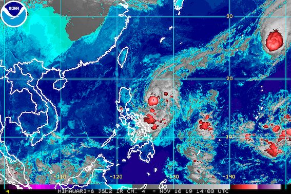
MANILA, Philippines – Tropical Storm Ramon (Kalmaegi) returned to being almost stationary on Saturday evening, November 16, still lingering over the Philippine Sea.
In a bulletin issued 11 pm on Saturday, the Philippine Atmospheric, Geophysical, and Astronomical Services Administration (PAGASA) said Ramon is 450 kilometers east of Casiguran, Aurora.
It is barely moving, from its previous pace of 15 kilometers per hour (km/h) in the afternoon.
Ramon continues to have maximum winds of 65 km/h and gustiness of up to 80 km/h.
The same areas remain under a tropical cyclone wind signal.
Signal No. 1 (winds of 30 km/h to 60 km/h)
- eastern part of Cagayan (Santa Ana, Gonzaga, Lal-lo, Gattaran, Baggao, Peñablanca)
- eastern part of Isabela (Maconacon, Divilacan, Palanan, Dinapigue)
- northern part of Aurora (Dilasag, Casiguran, Dinalungan)
Ramon is expected to continue bringing rain for the next two days.
Sunday, November 17
- Light to moderate rain with intermittent heavy rain
- eastern part of Cagayan
- eastern part of Isabela
- Bicol
- Samar
- Northern Samar
- Eastern Samar
Monday, November 18
- Light to moderate rain with occasionally heavy rain
- Apayao
- Kalinga
- eastern part of Cagayan
- eastern part of Isabela
- Light to moderate rain with intermittent heavy rain
- northern part of Aurora
- Quirino
- rest of Cagayan
- rest of Isabela
Flash floods and landslides remain possible. (READ: FAST FACTS: Tropical cyclones, rainfall advisories)
PAGASA added that gusty conditions may persist on Sunday, November 17, in Northern Luzon, Aurora, and Bicol, especially in coastal and mountainous areas, due to the northeast monsoon or hanging amihan.
Travel remains risky, especially for small vessels, in the seaboards of areas under Signal No. 1, the seaboards of Northern Luzon, and the eastern seaboards of Central Luzon and Southern Luzon.
Based on Ramon’s latest forecast track, it could make landfall in Cagayan on Monday, November 18.
Its exit from the Philippine Area of Responsibility might be on Wednesday, November 20.
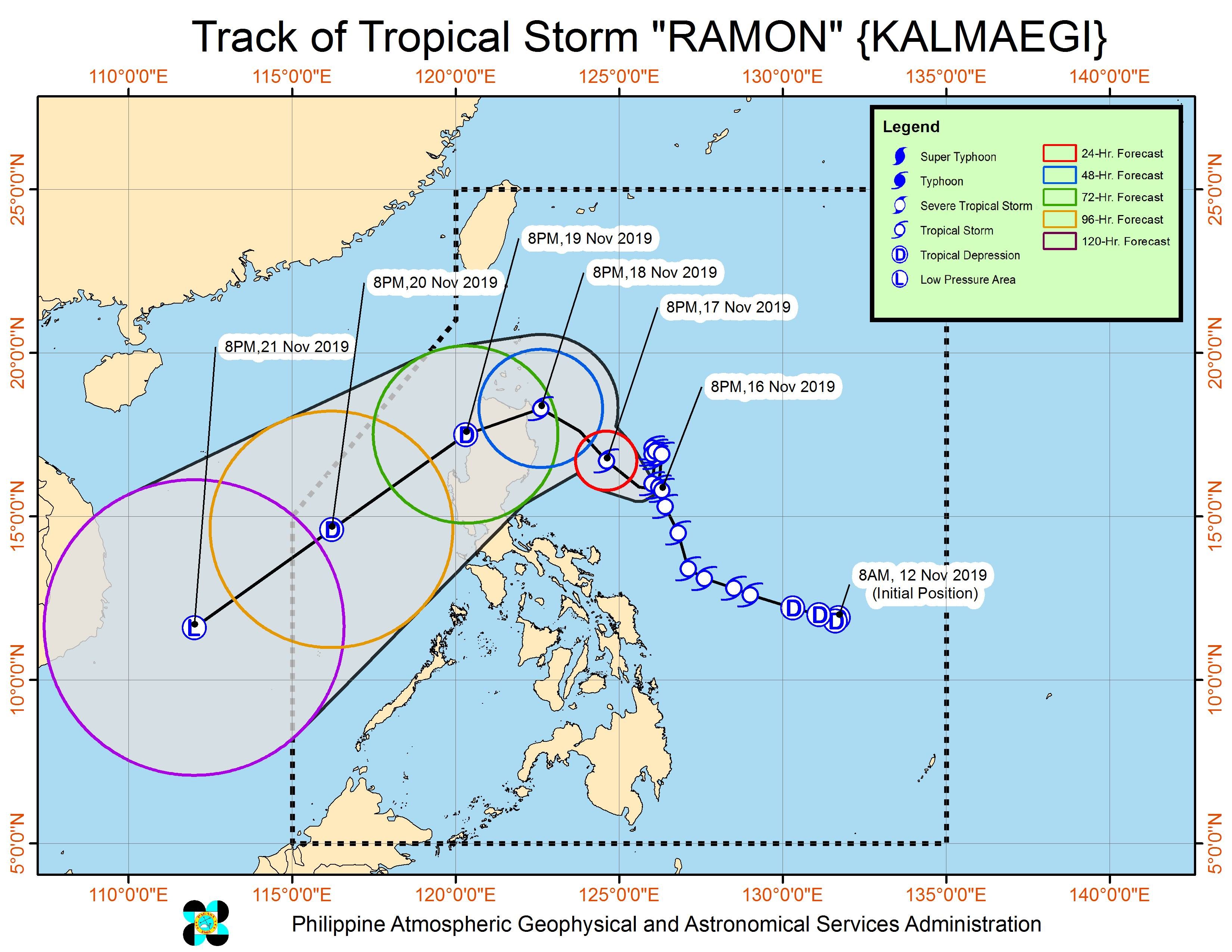
Ramon is the Philippines’ 18th tropical cyclone for 2019, and the 2nd for November. (READ: LIST: PAGASA’s names for tropical cyclones in 2019)
The country gets an average of 20 tropical cyclones annually, but since 2019 is an El Niño year, only 14 to 18 tropical cyclones are expected.
Below is the estimated number of tropical cyclones for the last two months of 2019:
- November – 1 or 2
- December – 0 or 1
PAGASA declared the start of the rainy season last June 14. – Rappler.com
Add a comment
How does this make you feel?
There are no comments yet. Add your comment to start the conversation.