SUMMARY
This is AI generated summarization, which may have errors. For context, always refer to the full article.
What’s the weather like in your area? Tweet us at @rapplerdotcom.
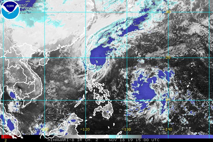
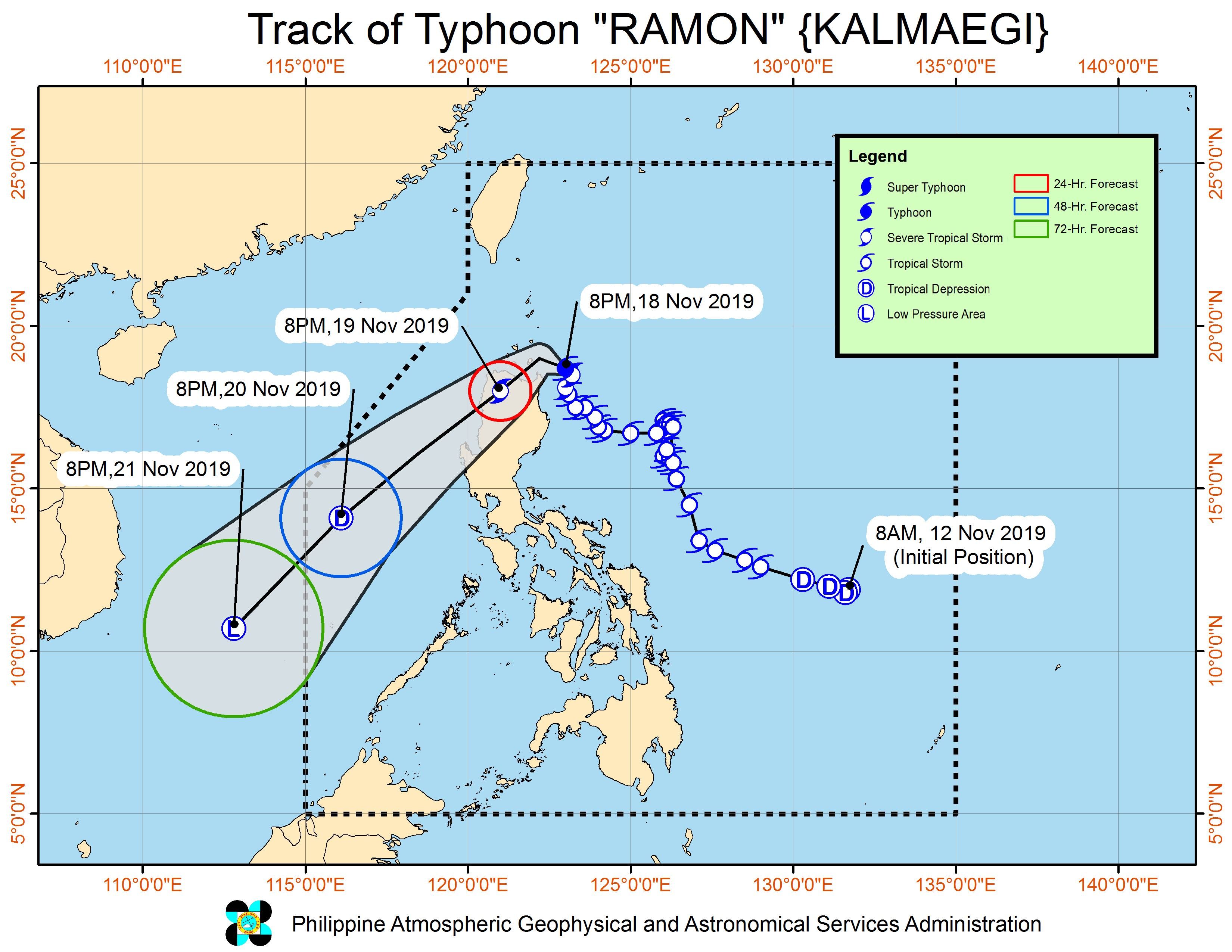
MANILA, Philippines – Ramon (Kalmaegi) intensified from a severe tropical storm into a typhoon late Monday evening, November 18, shortly before its expected landfall.
In a briefing past 11 pm on Monday, the Philippine Atmospheric, Geophysical, and Astronomical Services Administration (PAGASA) said Ramon now has maximum winds of 120 kilometers per hour (km/h) from the previous 110 km/h and gustiness of up to 150 km/h from the previous 135 km/h.
The typhoon is already 135 kilometers east northeast of Aparri, Cagayan, or 145 kilometers east southeast of Calayan, Cagayan. It is moving northwest at the same slow pace of 10 km/h.
Ramon could make landfall either in Santa Ana, Cagayan, or in the Babuyan Group of Islands – an archipelago also part of Cagayan province – between Monday evening and Tuesday morning, November 19.
In Santa Ana, at least 445 individuals or 111 families have evacuated as of 9:49 pm on Monday, according to the Philippine Information Agency-Cagayan Valley, citing municipal authorities.
Signal No. 3 has now been raised, in addition to Signal Nos. 1 and 2. Here is the latest list of areas under tropical cyclone wind signals:
Signal No. 3 (winds of 121 km/h to 170 km/h)
- northern part of Cagayan (Santa Praxedes, Claveria, Sanchez Mira, Pamplona, Abulug, Ballesteros, Aparri, Calayan, Camalaniugan, Buguey, Santa Teresita, Gonzaga, Santa Ana)
Signal No. 2 (winds of 61 km/h to 120 km/h)
- rest of Cagayan
- northern part of Isabela (Sta Maria, San Pablo, Maconacon, Cabagan, Sto Tomas, Quezon, Delfin Albano, Tumauini, Divilacan)
- Apayao
- Kalinga
- lIocos Norte
Signal No. 1 (winds of 30 km/h to 60 km/h)
- Batanes
- Ilocos Sur
- Abra
- Mountain Province
- Benguet
- Ifugao
- La Union
- Pangasinan
- rest of Isabela
Ramon will continue to bring rain, which may trigger flash floods and landslides. (READ: FAST FACTS: Tropical cyclones, rainfall advisories)
Monday evening, November 18, to Tuesday morning, November 19
- Moderate rain with occasional to frequent heavy rain
- Cagayan, including Babuyan Group of Islands
- Batanes
- Apayao
- northern part of Ilocos Norte
- Light to moderate rain with intermittent heavy rain
- Isabela
- Kalinga
- Abra
- rest of Ilocos Norte
Tuesday afternoon to evening, November 19
- Light to moderate rain with occasionally heavy rain
- northern part of Cagayan, including Babuyan Group of Islands
- Batanes
- Apayao
- northern part of Ilocos Norte
- Light to moderate rain with intermittent heavy rain
- rest of Cagayan
- rest of Ilocos Norte
- Isabela
- Kalinga
- Abra
- Ilocos Sur
Some areas have suspended classes for Tuesday. (READ: #WalangPasok: Class suspensions, Tuesday, November 19, 2019)
Travel also remains risky, especially for small vessels, in the seaboards of areas under tropical cyclone wind signals, the western seaboard of Northern Luzon, and the eastern seaboards of Central Luzon and Southern Luzon.
Ramon could leave the Philippine Area of Responsibility (PAR) early Thursday, November 21. By then, it would have likely weakened into a tropical depression or a low pressure area (LPA) already.
Ramon is the Philippines’ 18th tropical cyclone for 2019, and the 2nd for November.
Meanwhile, the LPA outside PAR is now 1,210 kilometers east of Eastern Visayas. It is expected to enter within 24 hours and may develop into a tropical depression within 48 hours.
If it becomes a tropical depression and enters PAR, it would be given the local name Sarah. (READ: LIST: PAGASA’s names for tropical cyclones in 2019)
The country gets an average of 20 tropical cyclones annually, but since 2019 is an El Niño year, only 14 to 18 tropical cyclones are expected.
Below is the estimated number of tropical cyclones for the last two months of 2019:
- November – 1 or 2
- December – 0 or 1
PAGASA declared the start of the rainy season last June 14. – Rappler.com
Add a comment
How does this make you feel?
There are no comments yet. Add your comment to start the conversation.