SUMMARY
This is AI generated summarization, which may have errors. For context, always refer to the full article.
What’s the weather like in your area? Tweet us at @rapplerdotcom.
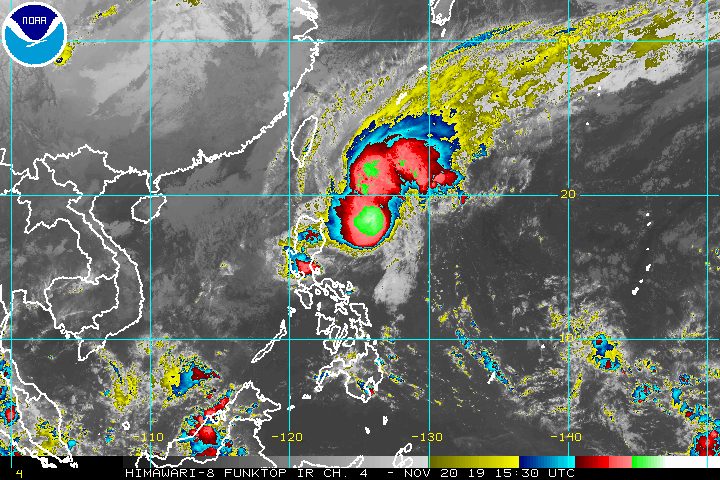
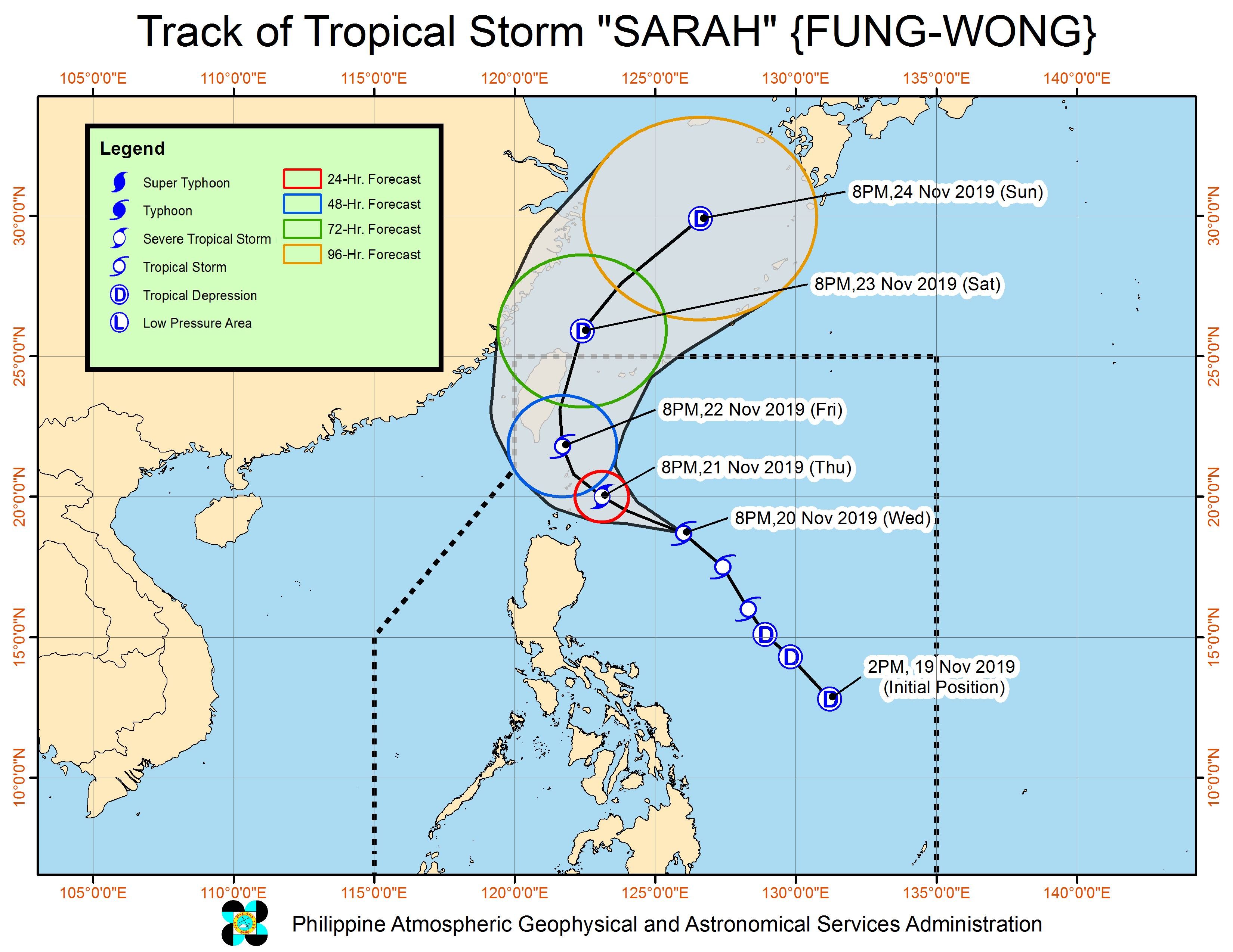
MANILA, Philippines – Tropical Storm Sarah (Fung-wong) slightly intensified and accelerated on Wednesday evening, November 20.
In a briefing at 11 pm on Wednesday, the Philippine Atmospheric, Geophysical, and Astronomical Services Administration (PAGASA) said Sarah is already 440 kilometers east northeast of Tuguegarao City, Cagayan, or 430 kilometers east of Aparri, Cagayan.
The tropical storm is now moving northwest at 35 kilometers per hour (km/h) from the previous 30 km/h.
It now has maximum winds of 75 km/h from the previous 65 km/h and gustiness of up to 90 km/h from the previous 80 km/h.
Parts of Cagayan Valley are still under a tropical cyclone wind signal.
Signal No. 1 (winds of 30 km/h to 60 km/h)
- Batanes
- northeastern part of Cagayan (Calayan, Aparri, Camalaniugan, Buguey, Santa Teresita, Gonzaga, Santa Ana, Lal-lo, Gattaran)
Sarah is also expected to cause rain in parts of Cagayan Valley and the Cordillera Administrative Region on Thursday, November 21, so flash floods and landslides are possible. Here is the latest rainfall outlook from PAGASA:
Light to moderate rain with occasional heavy rain
- eastern part of Cagayan
- eastern part of Isabela
Light to moderate rain with intermittent heavy rain
- rest of Cagayan
- rest of Isabela
- Apayao
- Kalinga
- Abra
- Mountain Province
- Ifugao
Due to Sarah and the northeast monsoon, travel is risky in the seaboards of areas under Signal No. 1, the seaboards of Northern Luzon and Central Luzon, and the western seaboard of Southern Luzon.
PAGASA Weather Specialist Loriedin de la Cruz said the tropical storm will make its closest approach to the Batanes-Babuyan Group of Islands area within 24 hours. The possibility of landfall is not being ruled out.
Sarah might leave the Philippine Area of Responsibility on Saturday, November 23. (READ: FAST FACTS: Tropical cyclones, rainfall advisories)
Meanwhile, the low pressure area (LPA) which used to be Tropical Depression Ramon (Kalmaegi) is already in the vicinity of Capas, Tarlac.
PAGASA said the LPA will continue to bring light to moderate rain with intermittent heavy rain to most of Central Luzon until Thursday.
Ramon had made landfall as a typhoon in Santa Ana, Cagayan, at 12:20 am on Wednesday.
Ramon and Sarah are the Philippines’ 18th and 19th tropical cyclones for 2019, and the 2nd and 3rd for November, respectively. (READ: LIST: PAGASA’s names for tropical cyclones in 2019)
The country gets an average of 20 tropical cyclones annually, but since 2019 is an El Niño year, only 14 to 18 tropical cyclones had been projected.
With Sarah’s arrival, the estimate has been exceeded for the year and also for the month of November.
These had been the projections for the last two months of 2019:
- November – 1 or 2
- December – 0 or 1
PAGASA declared the start of the rainy season last June 14. – Rappler.com
Add a comment
How does this make you feel?
There are no comments yet. Add your comment to start the conversation.