SUMMARY
This is AI generated summarization, which may have errors. For context, always refer to the full article.
What’s the weather like in your area? Tweet us at @rapplerdotcom.
MANILA, Philippines – The tropical depression outside the Philippine Area of Responsibility (PAR) intensified into a tropical storm on Sunday morning, December 22.
It has been given the international name Phanfone, a name contributed by Laos which means “animal.”
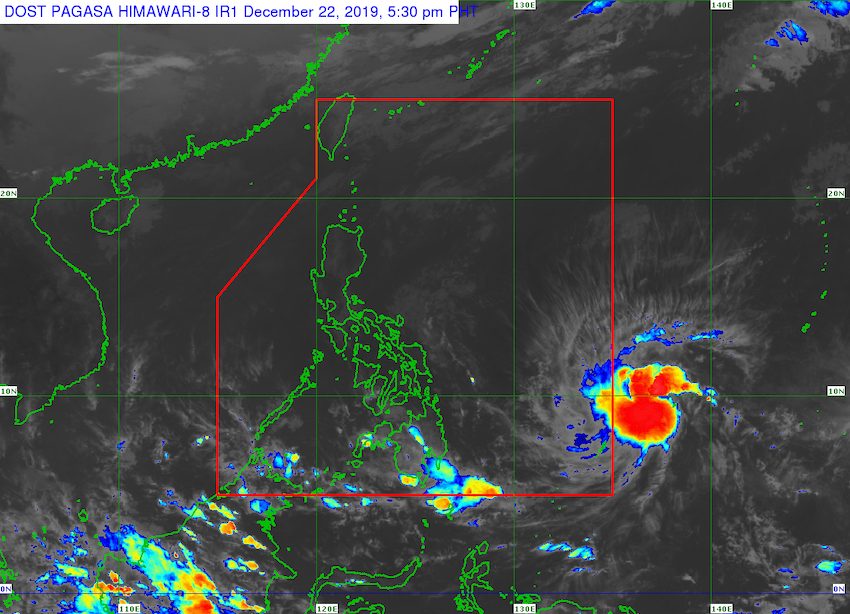
In a briefing past 4 pm on Sunday, the Philippine Atmospheric, Geophysical, and Astronomical Services Administration (PAGASA) said Tropical Storm Phanfone is already 1,265 kilometers east of Mindanao.
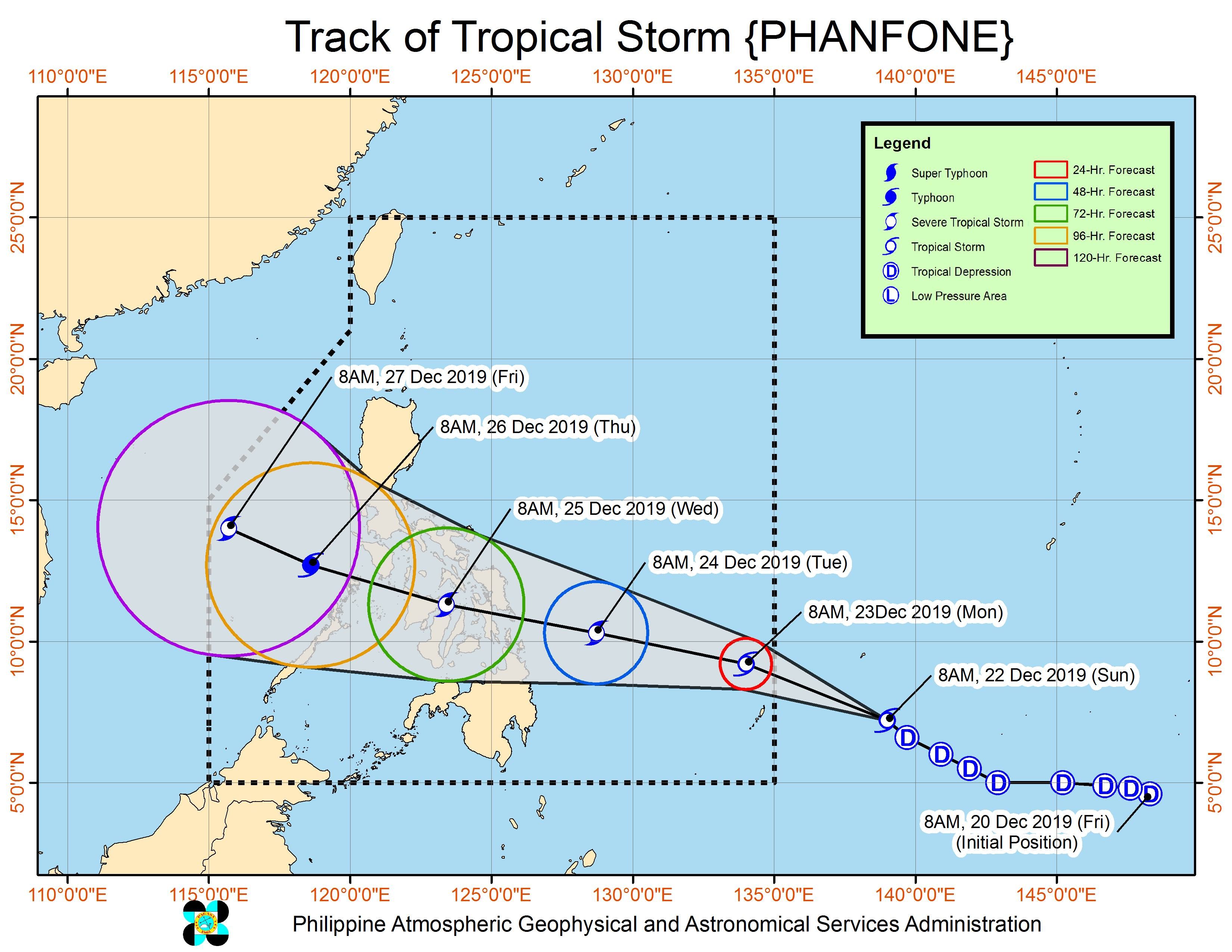
It is now moving west northwest at 25 kilometers per hour (km/h). If it maintains its speed, it could enter PAR on Sunday night or at the latest on Monday morning, December 23.
When the tropical storm enters PAR, it will be given the local name Ursula. (READ: LIST: PAGASA’s names for tropical cyclones in 2019)
So far, Phanfone has maximum winds of 65 km/h and gustiness of up to 80 km/h. But it is likely to strengthen further since it remains over water.
PAGASA also warned that even before Phanfone’s entry, its trough or extension is already affecting Mindanao. Isolated rainshowers and thunderstorms are expected in the island region in the next 24 hours due to Phanfone’s trough.
Beginning Tuesday, December 24, Christmas Eve, moderate to occasionally heavy rain may hit the Visayas and the northeastern part of Mindanao.
PAGASA said the tropical storm could make landfall in Eastern Visayas or the Caraga area on Tuesday evening, and then cross the Visayas until Wednesday, December 25, Christmas Day. (READ: FAST FACTS: Tropical cyclones, rainfall advisories)
Meanwhile, the easterlies or warm winds blowing from the east continue to cause isolated rainshowers and thunderstorms in other parts of the country.
The low pressure area (LPA) inside PAR which PAGASA has been monitoring already dissipated on Sunday morning. The LPA had affected the eastern parts of the Visayas and of Mindanao the past days.
The Philippines has had 20 tropical cyclones in 2019 – the country’s yearly average.
The latest was Typhoon Tisoy (Kammuri), which left at least 4 people dead and 318 others injured in early December, according to the December 13 report of disaster management authorities.
In PAGASA’s latest climate outlook, the state weather bureau said it expects 1 or 2 tropical cyclones for December.
PAGASA declared the start of the rainy season last June 14. – Rappler.com
Add a comment
How does this make you feel?
There are no comments yet. Add your comment to start the conversation.