SUMMARY
This is AI generated summarization, which may have errors. For context, always refer to the full article.
What’s the weather like in your area? Tweet us at @rapplerdotcom.
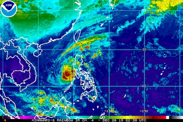
MANILA, Philippines – Typhoon Ursula (Phanfone) slightly weakened while moving over the West Philippine Sea on Thursday morning, December 26, prompting the lifting of Signal No. 2.
In a briefing at 11 am on Thursday, the Philippine Atmospheric, Geophysical, and Astronomical Services Administration (PAGASA) said Ursula is already 235 kilometers northwest of Coron, Palawan.
The typhoon is still moving west northwest at 15 kilometers per hour (km/h), inching away from the Philippines.
Its maximum winds slightly decreased to 120 km/h from the previous 130 km/h, while its gustiness is down to 150 km/h from the previous 160 km/h.
Only Signal No. 1 remains raised in a couple of areas. (READ: Why is it now called tropical cyclone ‘wind’ – and not ‘warning’ – signals?)
Signal No. 1 (winds of 30 km/h to 60 km/h)
- northwestern part of Occidental Mindoro including Lubang Island (Lubang, Looc, Paluan, Abra de Ilog, Mamburao)
- Calamian Islands (Coron, Culion, Busuanga)
Weather will gradually improve as well, but for now, there may be some rain from Ursula’s outer rainbands. (READ: FAST FACTS: Tropical cyclones, rainfall advisories)
Light to moderate rain with intermittent heavy rain
- northern part of Palawan including Calamian Islands and Lubang Island
Scattered rain
- Central Luzon
- Metro Manila
- Rizal
- northern part of Quezon
PAGASA said residents of those areas must continue to watch out for possible flash floods and landslides, in case of heavy rain.
The Office of Civil Defense said at least 3 people are confirmed dead from Ursula. Heavy flooding and serious damage were seen in areas in the typhoon’s path.
Travel also remains risky in the seaboards of areas under Signal No. 1. Ursula earlier left at least 23,789 passengers stranded.
More than 150 domestic flights have been canceled since Christmas Eve until Friday, December 27.
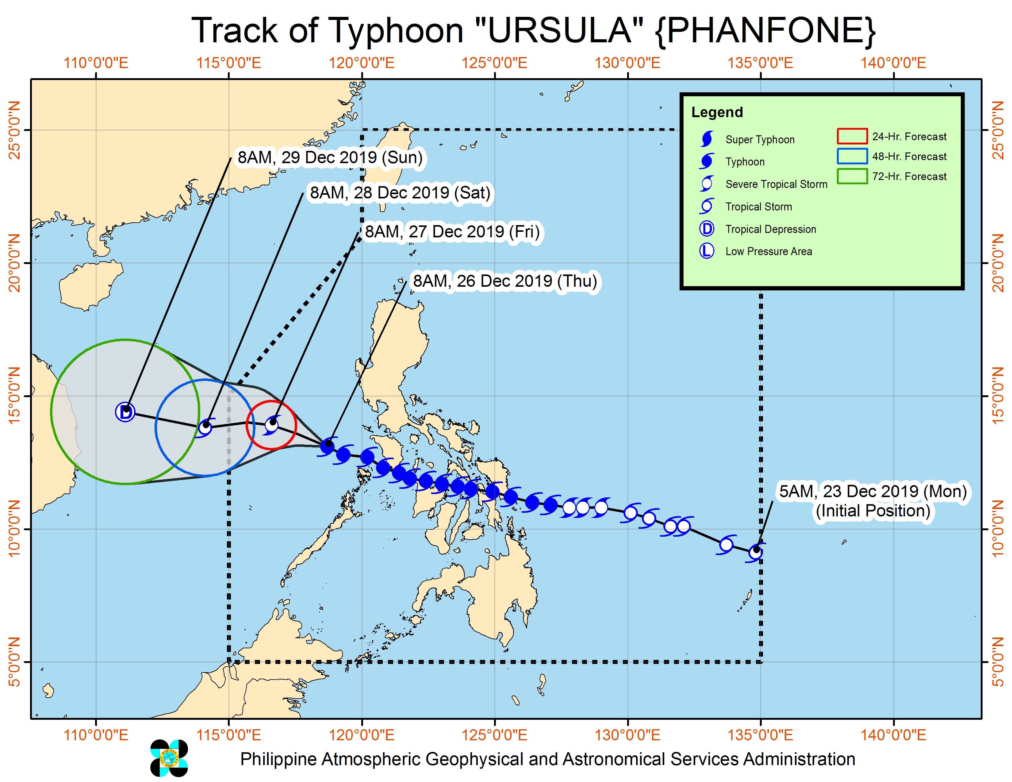
Ursula’s first 3 landfalls were in Eastern Visayas on Christmas Eve, the next 3 in Western Visayas on Christmas Day, and the 7th in Oriental Mindoro, also on Christmas Day.
Tuesday, December 24
- Salcedo, Eastern Samar – 4:45 pm
- Tacloban City, Leyte – 7:30 pm
- Cabucgayan, Biliran – 9:15 pm
Wednesday, December 25
- Gigantes Islands, Carles, Iloilo – 2:30 am
- Ibajay, Aklan – 8:40 am
- Semirara Island, Caluya, Antique – 1 pm
- Bulalacao, Oriental Mindoro – 3 pm
Based on its latest forecast track, Ursula is expected to leave the Philippine Area of Responsibility on Saturday morning, December 28.
Ursula is the Philippines’ 21st tropical cyclone for 2019, exceeding the yearly average of 20. (READ: LIST: PAGASA’s names for tropical cyclones in 2019)
Ursula is also the second tropical cyclone for December, after Typhoon Tisoy (Kammuri). PAGASA earlier said it was expecting one or two tropical cyclones during the month.
So far, there is no other weather disturbance – low pressure area or tropical cyclone – being monitored, according to PAGASA Weather Specialist Raymond Ordinario.
PAGASA declared the start of the rainy season last June 14. – Rappler.com
Add a comment
How does this make you feel?
There are no comments yet. Add your comment to start the conversation.