SUMMARY
This is AI generated summarization, which may have errors. For context, always refer to the full article.
What’s the weather like in your area? Tweet us at @rapplerdotcom.
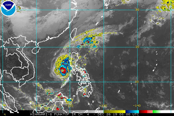
MANILA, Philippines – There are no longer any areas under tropical cyclone wind signals as Typhoon Ursula (Phanfone) continues to move away from the country. Its trough or extension, however, will still bring some rain.
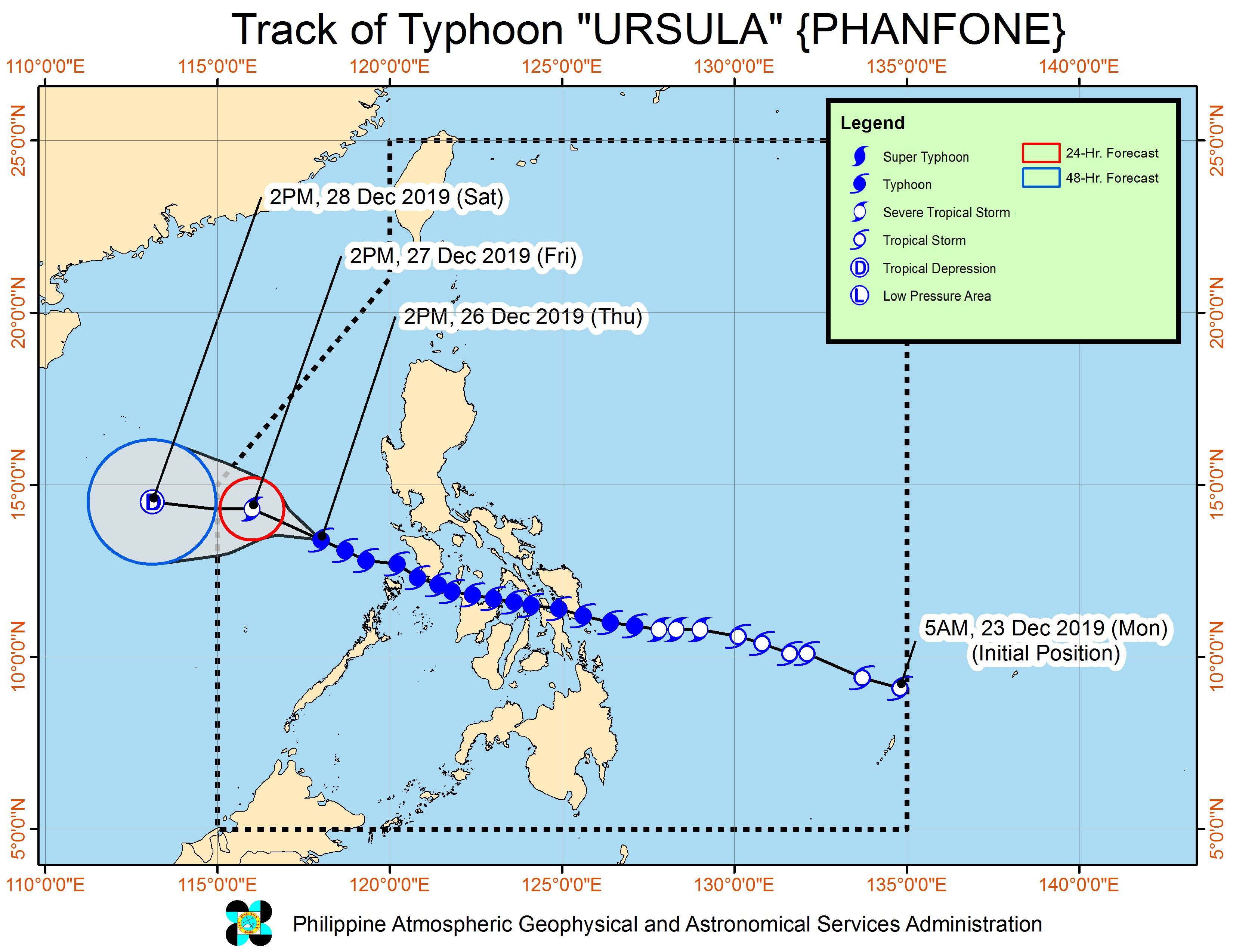
In a bulletin issued 5 pm on Thursday, December 26, the Philippine Atmospheric, Geophysical, and Astronomical Services Administration (PAGASA) said Ursula is already 300 kilometers northwest of Coron, Palawan, or 295 kilometers west southwest of Subic, Zambales.
The typhoon is still moving west northwest at 15 kilometers per hour (km/h).
It maintained its strength, with maximum winds of 120 km/h and gustiness of up to 150 km/h.
While Ursula is moving away, its trough will continue to trigger rain in parts of Luzon. (READ: FAST FACTS: Tropical cyclones, rainfall advisories)
Light to moderate rain with intermittent heavy rain
- Lubang Island
- northern part of Palawan including Calamian Islands
Scattered rain
- Zambales
- Bataan
- rest of Palawan
PAGASA warned that flash floods and landslides may still occur.
Ursula had caused deaths, heavy flooding, and serious damage, especially in Western Visayas and Eastern Visayas. At least 16 people were confirmed dead as of Thursday, based on figures from the Western Visayas Regional Disaster Risk Reduction and Management Council and the Office of Civil Defense.
Travel is still risky in the northern and western seaboards of Northern Luzon, as waters are rough due to the northeast monsoon or hanging amihan. Ursula earlier left at least 23,789 passengers stranded.
More than 150 domestic flights have been canceled since Christmas Eve until Friday, December 27.
Ursula’s first 3 landfalls were in Eastern Visayas on Christmas Eve, the next 3 in Western Visayas on Christmas Day, and the 7th in Oriental Mindoro, also on Christmas Day.
Tuesday, December 24
- Salcedo, Eastern Samar – 4:45 pm
- Tacloban City, Leyte – 7:30 pm
- Cabucgayan, Biliran – 9:15 pm
Wednesday, December 25
- Gigantes Islands, Carles, Iloilo – 2:30 am
- Ibajay, Aklan – 8:40 am
- Semirara Island, Caluya, Antique – 1 pm
- Bulalacao, Oriental Mindoro – 3 pm
Based on its latest forecast track, Ursula is expected to leave the Philippine Area of Responsibility on Saturday morning, December 28.
Ursula is the Philippines’ 21st tropical cyclone for 2019, exceeding the yearly average of 20. (READ: LIST: PAGASA’s names for tropical cyclones in 2019)
Ursula is also the second tropical cyclone for December, after Typhoon Tisoy (Kammuri). PAGASA earlier said it was expecting one or two tropical cyclones during the month.
So far, there is no other weather disturbance – low pressure area or tropical cyclone – being monitored, according to PAGASA.
PAGASA declared the start of the rainy season last June 14. – Rappler.com
Add a comment
How does this make you feel?
There are no comments yet. Add your comment to start the conversation.