SUMMARY
This is AI generated summarization, which may have errors. For context, always refer to the full article.
What’s the weather like in your area? Tweet us at @rapplerdotcom.
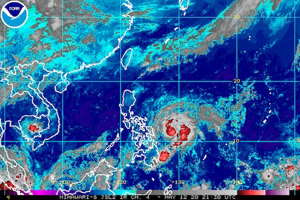
MANILA, Philippines – Signal No. 1 was raised in parts of Eastern Samar and Northern Samar before dawn on Wednesday, May 13, as Tropical Storm Ambo (Vongfong) further intensified over the Philippine Sea.
In a bulletin issued 5 am on Wednesday, the Philippine Atmospheric, Geophysical, and Astronomical Services Administration (PAGASA) said Ambo now has maximum winds of 85 kilometers per hour (km/h) from the previous 65 km/h and gustiness of up to 105 km/h from the previous 80 km/h.
Ambo is expected to strengthen further into a severe tropical storm, and then into a typhoon, as it approaches the Eastern Visayas-Bicol area. It was earlier only expected to reach severe tropical storm status, but it is likely to gather even more strength over water. (READ: FAST FACTS: Tropical cyclones, rainfall advisories)
Ambo is now 410 kilometers east of Borongan City, Eastern Samar, moving north northwest at a slightly slower 15 km/h from the previous 20 km/h.
Signal No. 1, which means winds of 30 to 60 km/h are expected in at least 36 hours, is up over these areas:
- northern part of Eastern Samar (Jipapad, Maslog, Arteche, San Policarpio, Oras, Dolores, Can-avid, Taft, Sulat, San Julian, Borongan City)
- eastern part of Northern Samar (Lapinig, Gamay, Mapanas, Palapag, Laoang, Catubig, Las Navas)
PAGASA said strong to near-gale force winds will begin affecting the areas under Signal No. 1 on Thursday afternoon, May 14. (READ: Why is it now called tropical cyclone ‘wind’ – and not ‘warning’ – signals?)
In terms of rainfall, PAGASA gave the following outlook for the next two days:
Wednesday, May 13
Scattered light to moderate rain, with at times heavy rain during thunderstorms
- Eastern Visayas
Thursday, May 14
Moderate to heavy rain
- Eastern Visayas
- Catanduanes
- Albay
- Sorsogon
- Masbate
Areas to be affected by rainfall from Ambo should prepare for possible floods and landslides, especially in high-risk areas, said PAGASA.
The state weather bureau also warned that rough seas will be experienced in the eastern seaboard of Bicol and the northern and eastern seaboards of Eastern Visayas on Wednesday. Travel is risky.
PAGASA Weather Specialist Meno Mendoza said in an online briefing that Ambo might make landfall in Bicol on Friday, May 15 – no longer Thursday as initially projected due to its relatively slow movement. The exact area in the region will be determined as the tropical storm nears.
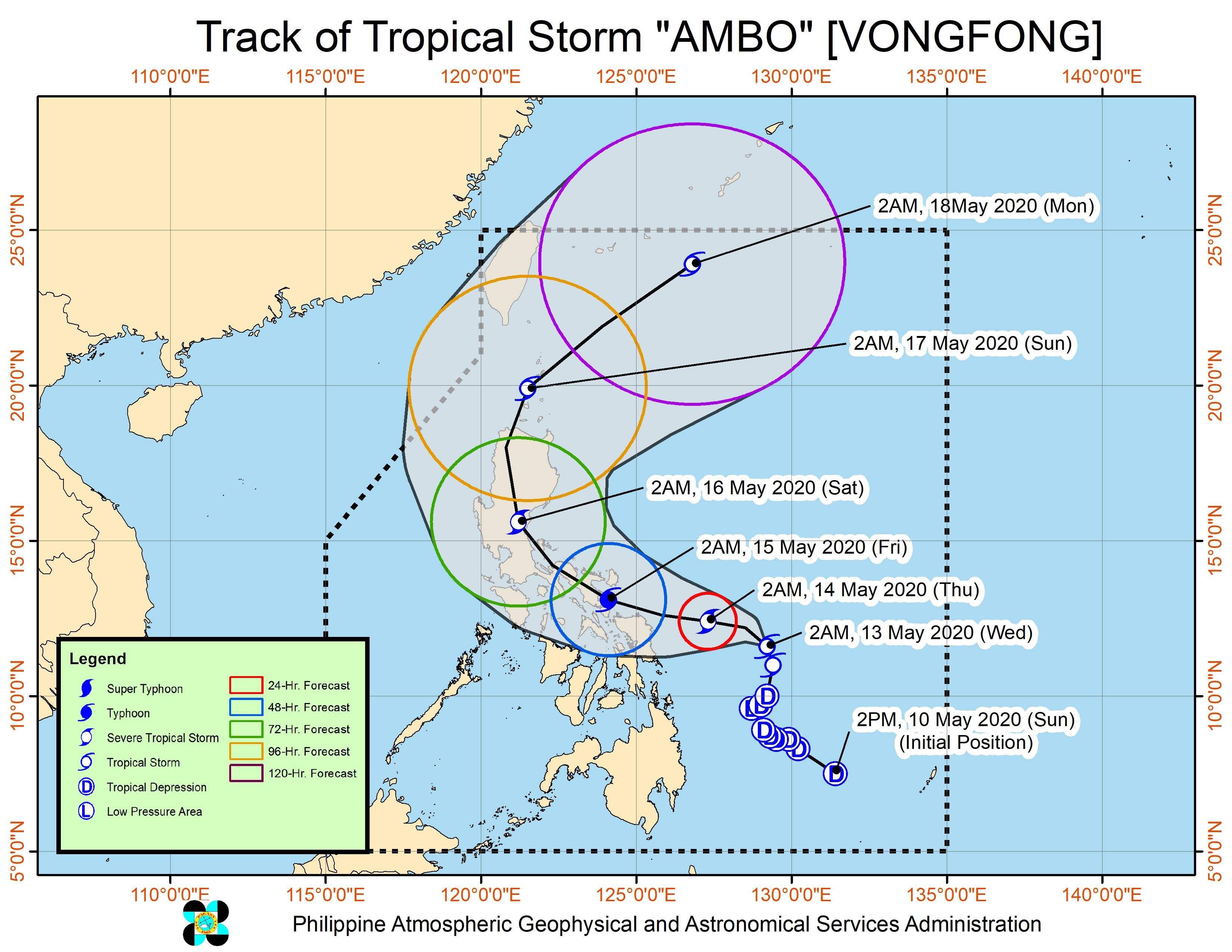
Ambo is the Philippines’ first tropical cyclone for 2020. The country gets an average of 20 tropical cyclones per year. (READ: LIST: PAGASA’s names for tropical cyclones in 2020)
In PAGASA’s climate outlook, it gave the following estimates for the number of tropical cyclones in the next 6 months:
- May – 1 or 2
- June – 1 or 2
- July – 2 to 4
- August – 2 or 3
- September – 2 or 3
- October – 2 or 3
While bracing for Ambo, the Philippines is also combating the coronavirus outbreak. The number of COVID-19 cases in the country rose to 11,350 on Tuesday, May 12. – Rappler.com
Add a comment
How does this make you feel?
There are no comments yet. Add your comment to start the conversation.