SUMMARY
This is AI generated summarization, which may have errors. For context, always refer to the full article.
What’s the weather like in your area? Tweet us at @rapplerdotcom.
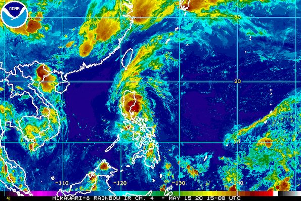
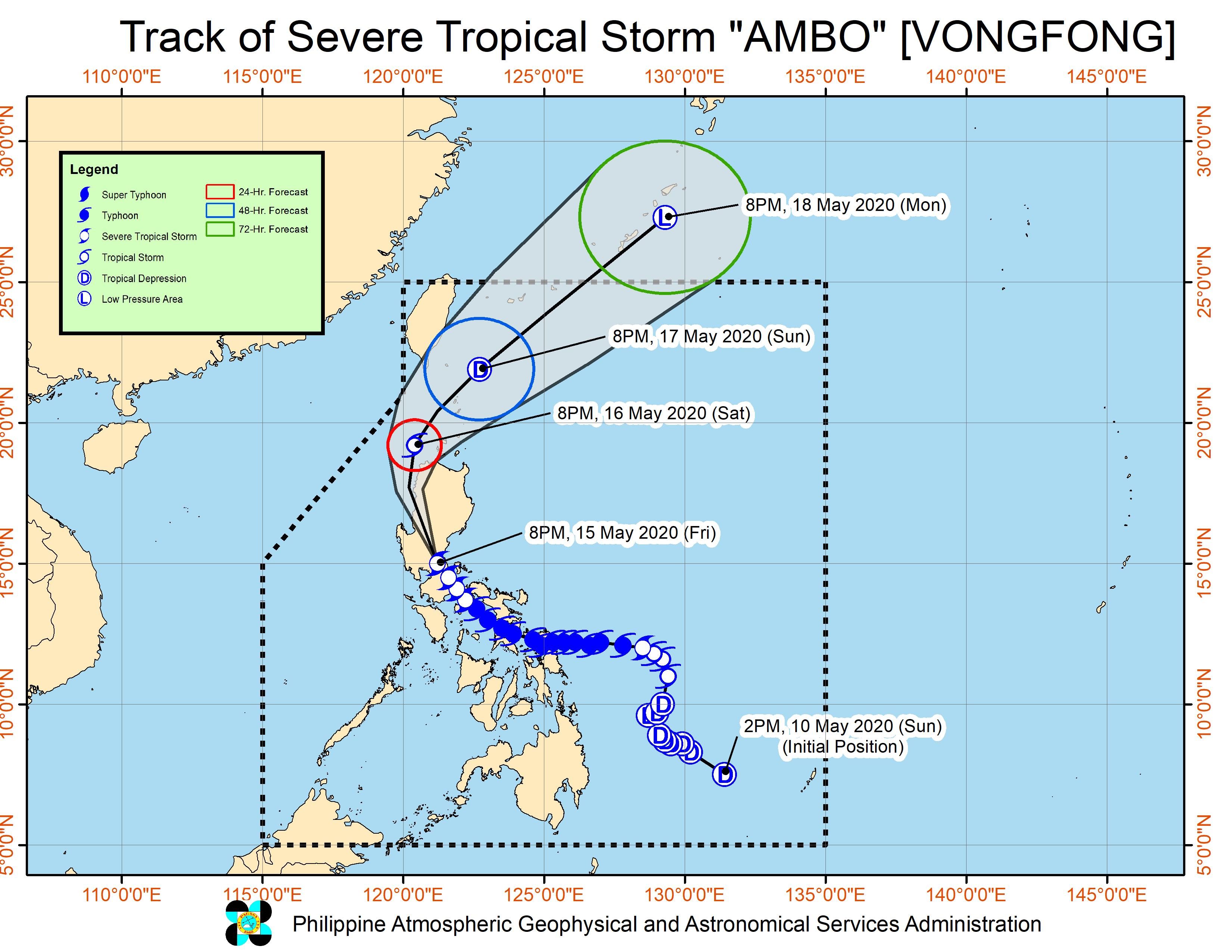
MANILA, Philippines – Severe Tropical Storm Ambo (Vongfong) continued to weaken late Friday evening, May 15, as it began moving over the northern part of Bulacan and the southern part of Nueva Ecija.
In a bulletin released past 11 pm on Friday, the Philippine Atmospheric, Geophysical, and Astronomical Services Administration (PAGASA) said Ambo is already in the vicinity of San Miguel, Bulacan, still moving northwest at 20 kilometers per hour (km/h).
The severe tropical storm now has maximum winds of 95 km/h from the previous 100 km/h and gustiness of up to 160 km/h from the previous 165 km/h. It is expected to continue weakening while crossing land. (READ: FAST FACTS: Tropical cyclones, rainfall advisories)
Ambo earlier made landfall 6 times as a typhoon, and once – the latest – as a severe tropical storm.
Thursday, May 14
- San Policarpo, Eastern Samar – 12:15 pm
- Dalupiri Island, Northern Samar – 10:15 pm
- Capul Island, Northern Samar – 10:30 pm
Friday, May 15
- Ticao Island, Masbate – 12 am
- Burias Island, Masbate – 3 am
- San Andres, Quezon – 7:45 am
- Real, Quezon – 5 pm
While in the vicinity of Quezon on Friday night, Ambo had also triggered strong winds and heavy rain in Metro Manila. Conditions in the capital region improved later in the evening.
As of 11 pm on Friday, Signal Nos. 1 and 2 remain raised in many parts of Luzon. (READ: Why is it now called tropical cyclone ‘wind’ – and not ‘warning’ – signals?)
Signal No. 2 (winds of 61 to 120 km/h, or strong to damaging gale-/storm-force winds during the passage of the severe tropical storm)
- Babuyan Islands
- northwestern part of mainland Cagayan (Santa Praxedes, Claveria, Sanchez Mira, Pamplona, Abulug)
- southern and western parts of Isabela (Quezon, Mallig, Roxas, Quirino, San Manuel, Burgos, Gamu, Reina Mercedes, Aurora, Luna Cabatuan, Naguilian, Benito Soliven, Cauayan, San Guillermo, Dinapigue, San Mateo, Alicia, Angadanan, Ramon, San Isidro, Echague, Jones, San Agustin, Santiago, Cordon)
- Ilocos Norte
- Ilocos Sur
- Apayao
- Abra
- Kalinga
- Mountain Province
- Ifugao
- Benguet
- La Union
- Nueva Vizcaya
- Nueva Ecija
- Quirino
- Aurora
- Pangasinan
- Tarlac
- Pampanga
- Bulacan
- Metro Manila
- Rizal
- northern part of Quezon (General Nakar, Infanta) including Polillo Island
Signal No. 1 (winds of 30 to 60 km/h, or strong to near-gale-force winds during the passage of the severe tropical storm)
- Batanes
- rest of mainland Cagayan
- rest of Isabela
- Zambales
- Bataan
- Batangas
- Cavite
- Laguna
- central part of Quezon (Real, Mauban, Sampaloc, Lucban, San Antonio, Tiaong, Dolores, Candelaria, Sariaya, Lucena City, Tayabas, Pagbilao, Atimonan, Padre Burgos, Agdangan, Unisan, Plaridel, Quezon, Alabat, Perez)
Rain from Ambo will also continue through the night, and this weekend.
Until Saturday morning, May 16
Moderate to heavy rain, with at times intense rain
- Bulacan
- Pampanga
- Tarlac
- Nueva Ecija
- Aurora
- Nueva Vizcaya
- Quirino
- Benguet
- Ifugao
- Isabela
Between Saturday morning, May 16, and Sunday morning, May 17
Moderate to heavy rain, with at times intense rain
- Cagayan Valley
- Cordillera Administrative Region
- La Union
- Pangasinan
PAGASA warned that Ambo may still cause floods and landslides even though it is gradually weakening. Tens of thousands of people earlier fled their homes as authorities enforced preemptive evacuation. (READ: Social distancing ‘per family’ at Typhoon Ambo evacuation centers)
Sea travel remains risky for all vessels in the seaboards of areas under tropical cyclone wind signals.
PAGASA said Ambo will continue crossing Luzon before emerging over the coastal waters of the Ilocos Region on Saturday morning, May 16.
Ambo is expected to leave the Philippine Area of Responsibility on Monday, May 18. By then, it is likely to have weakened already into a low pressure area.
Ambo is the Philippines’ first tropical cyclone for 2020. The country gets an average of 20 tropical cyclones per year. (READ: LIST: PAGASA’s names for tropical cyclones in 2020)
In PAGASA’s climate outlook, it gave the following estimates for the number of tropical cyclones in the next 6 months:
- May – 1 or 2
- June – 1 or 2
- July – 2 to 4
- August – 2 or 3
- September – 2 or 3
- October – 2 or 3
– Rappler.com
Add a comment
How does this make you feel?
There are no comments yet. Add your comment to start the conversation.