SUMMARY
This is AI generated summarization, which may have errors. For context, always refer to the full article.
What’s the weather like in your area? Tweet us at @rapplerdotcom.
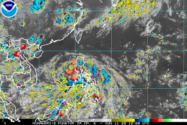
MANILA, Philippines – Tropical Depression Butchoy made landfall twice in the province of Quezon on Thursday, June 11.
The Philippine Atmospheric, Geophysical, and Astronomical Services Administration (PAGASA) said in a bulletin released past 8 pm that Butchoy first hit Polillo at 5:30 pm, then Infanta at 6 pm. The two areas are in Quezon province.
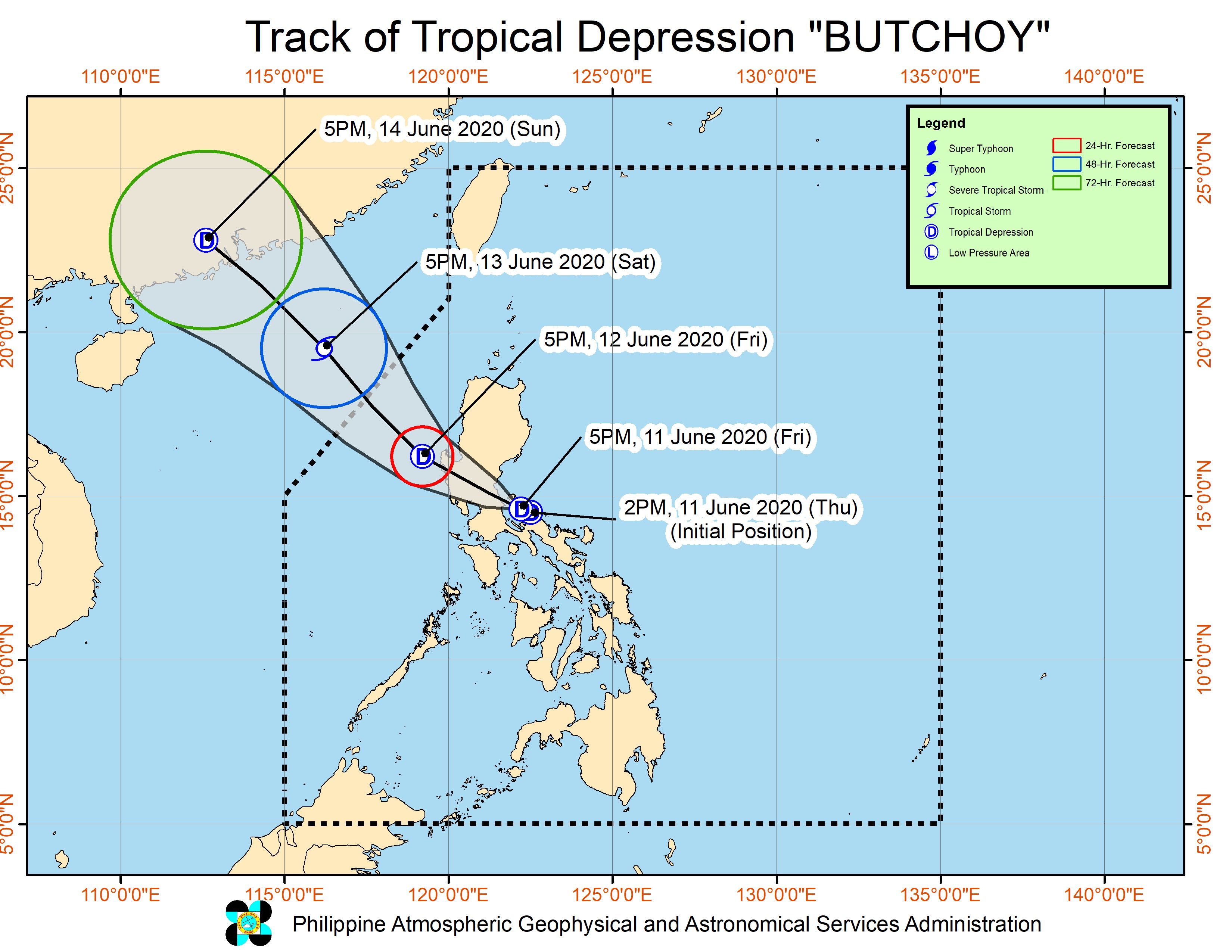
As of 7 pm, the tropical depression was already in the vicinity of General Nakar, another municipality in Quezon.
It slightly slowed down, now moving west northwest at 15 kilometers per hour (km/h) from the previous 20 km/h.
Butchoy continues to have maximum winds of 45 km/h, but its gustiness increased from 55 km/h to 75 km/h. (READ: FAST FACTS: Tropical cyclones, rainfall advisories)
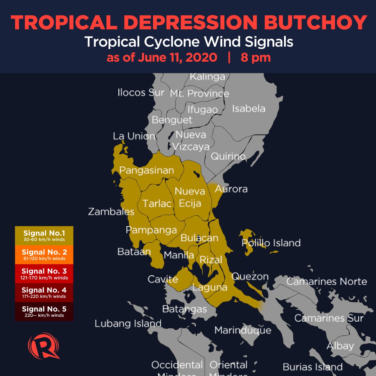
Signal No. 1 remains raised in the following areas:
- Pangasinan
- Zambales
- Bataan
- Tarlac
- Pampanga
- Nueva Ecija
- Bulacan
- southern part of Aurora (Dingalan, San Luis)
- Metro Manila
- Rizal
- Laguna
- Cavite
- northern and central parts of Quezon (General Nakar, Infanta, Real, Panukulan, Burdeos, Polillo, Patnanungan, Jomalig, Mauban, Sampaloc, Lucban, San Antonio, Tiaong, Dolores, Candelaria, Sariaya, Tayabas City, Lucena City, Pagbilao, Atimonan, Padre Burgos, Agdangan, Unisan, Plaridel, Gumaca, Pitogo, Quezon, Alabat, Perez)
PAGASA said areas under Signal No. 1, the Visayas, Southern Luzon, and the western part of Mindanao may experience occasional gusts in the next 24 hours. (READ: Why is it now called tropical cyclone ‘wind’ – and not ‘warning’ – signals?)
The rain from Butchoy will also persist as it continues to cross land. Below is PAGASA’s rainfall outlook.
Between Thursday evening, June 11, and Friday morning, June 12
Moderate to heavy rain with at times intense rain
- Calabarzon
- Camarines Norte
- Camarines Sur
- Albay
- northern part of Palawan including Calamian and Cuyo Islands
- Occidental Mindoro
- Marinduque
- Romblon
Moderate to heavy rain
- Central Luzon
- Metro Manila
- Western Visayas
- Oriental Mindoro
- rest of Bicol
- rest of Palawan
Light to moderate rain with at times heavy rain
- rest of Luzon
- Visayas
Between Friday morning, June 12, and Saturday morning, June 13
Moderate to heavy rain
- Central Luzon
- Metro Manila
- Calabarzon
- northern part of Palawan including Calamian and Cuyo Islands
- Occidental Mindoro
- Oriental Mindoro
- Pangasinan
Light to moderate rain with at times heavy rain
- rest of Luzon
- Western Visayas
Flash floods and landslides are possible.
The state weather bureau also warned that moderate to rough seas, with waves 1.2 to 3.4 meters high, will be experienced in the seaboards of Luzon and the Visayas in the next 24 hours.
Those with small vessels should not set sail, while larger vessels “must take precaution against rough seas,” said PAGASA.
Based on Butchoy’s latest forecast track, it could leave the Philippine Area of Responsibility on Saturday, June 13.
Butchoy is the Philippines’ second tropical cyclone for 2020. The first was Typhoon Ambo (Vongfong) last May.
The country gets an average of 20 tropical cyclones per year. (READ: LIST: PAGASA’s names for tropical cyclones in 2020)
In PAGASA’s climate outlook, it gave the following estimates for the number of tropical cyclones in the next 6 months:
- June – 1 or 2
- July – 2 to 4
- August – 2 or 3
- September – 2 or 3
- October – 2 or 3
- November – 1 or 2
– Rappler.com
Add a comment
How does this make you feel?
There are no comments yet. Add your comment to start the conversation.