SUMMARY
This is AI generated summarization, which may have errors. For context, always refer to the full article.
What’s the weather like in your area? Tweet us at @rapplerdotcom.
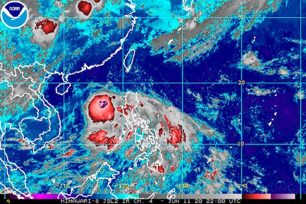
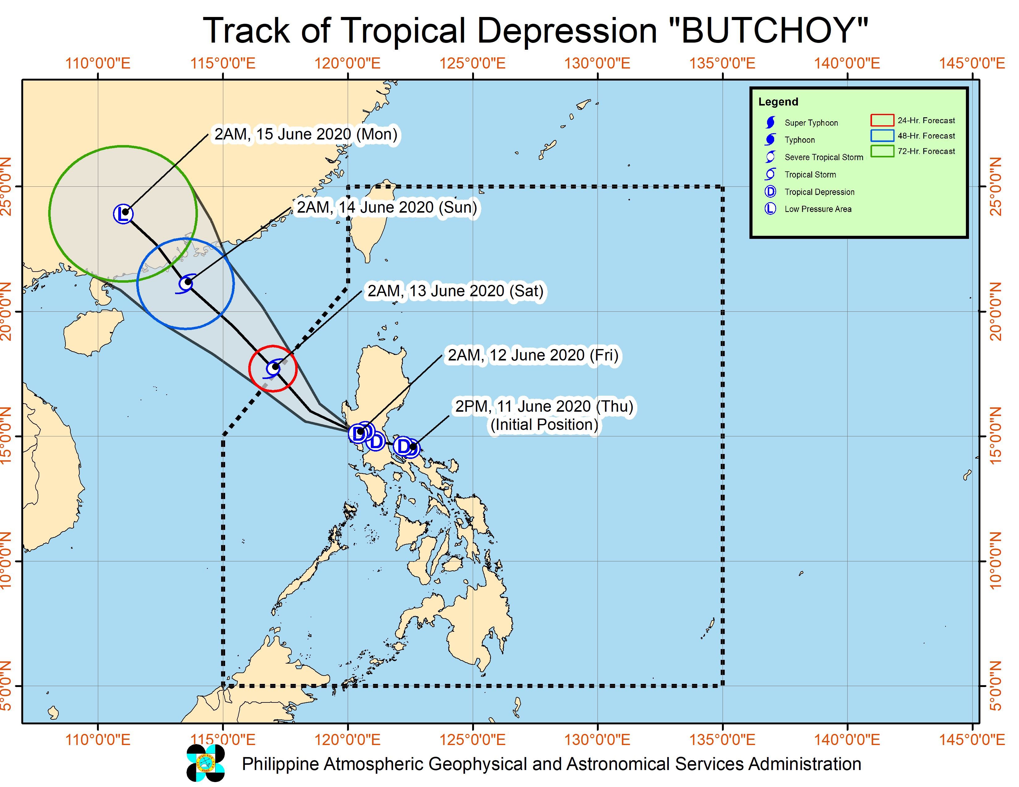
MANILA, Philippines – Signal No. 1 was lifted for Metro Manila before dawn on Friday, June 12, as Tropical Depression Butchoy was already moving over the province of Zambales after crossing other parts of Central Luzon.
In an online briefing past 5 am on Friday, the Philippine Atmospheric, Geophysical, and Astronomical Services Administration (PAGASA) said Butchoy was in the vicinity of San Felipe, Zambales.
The tropical depression slowed down to 15 kilometers per hour (km/h) from the previous 25 km/h, still moving west northwest. It is heading for the West Philippine Sea.
Butchoy made landfall twice in the province of Quezon on Thursday, June 11 – first in Polillo at 5:30 pm, then in Infanta at 6 pm.
It continues to have maximum winds of 45 km/h and gustiness of up to 75 km/h. (READ: FAST FACTS: Tropical cyclones, rainfall advisories)
Signal No. 1 is still raised in these areas:
- Pangasinan
- Zambales
- Bataan
- Tarlac
- Pampanga
- Nueva Ecija
- Bulacan
Areas under Signal No. 1, the Visayas, Southern Luzon, and the western part of Mindanao may have occasional gusts due to Butchoy and the southwest monsoon or hanging habagat. (READ: Why is it now called tropical cyclone ‘wind’ – and not ‘warning’ – signals?)
Parts of the country will also experience varying degrees of rain on Friday. Flash floods and landslides remain possible.
Moderate to heavy rain with at times intense rain
- Zambales
- Bataan
- Pampanga
- northern part of Palawan including Calamian and Cuyo Islands
- Occidental Mindoro
Light to moderate rain with at times heavy rain
- rest of Luzon
- Visayas
- Caraga
- Davao Region
Moderate to rough waters are again expected in the seaboards of Luzon and the Visayas, with waves 1.2 to 3.4 meters high.
Those with small vessels should not set sail, while larger vessels “must take precaution against rough seas,” said PAGASA.
Butchoy is likely to leave the Philippine Area of Responsibility early Saturday morning, June 13.
Butchoy is the Philippines’ second tropical cyclone for 2020. The first was Typhoon Ambo (Vongfong) last May.
The country gets an average of 20 tropical cyclones per year. (READ: LIST: PAGASA’s names for tropical cyclones in 2020)
In PAGASA’s climate outlook, it gave the following estimates for the number of tropical cyclones in the next 6 months:
- June – 1 or 2
- July – 2 to 4
- August – 2 or 3
- September – 2 or 3
- October – 2 or 3
- November – 1 or 2
– Rappler.com
Add a comment
How does this make you feel?
![[In This Economy] A counter-rejoinder in the economic charter change debate](https://www.rappler.com/tachyon/2024/04/TL-counter-rejoinder-apr-20-2024.jpg?resize=257%2C257&crop=267px%2C0px%2C720px%2C720px)
![[Vantage Point] Joey Salceda says 8% GDP growth attainable](https://www.rappler.com/tachyon/2024/04/tl-salceda-gdp-growth-04192024.jpg?resize=257%2C257&crop_strategy=attention)
![[ANALYSIS] A new advocacy in race to financial literacy](https://www.rappler.com/tachyon/2024/04/advocacy-race-financial-literacy-April-19-2024.jpg?resize=257%2C257&crop_strategy=attention)


There are no comments yet. Add your comment to start the conversation.