SUMMARY
This is AI generated summarization, which may have errors. For context, always refer to the full article.

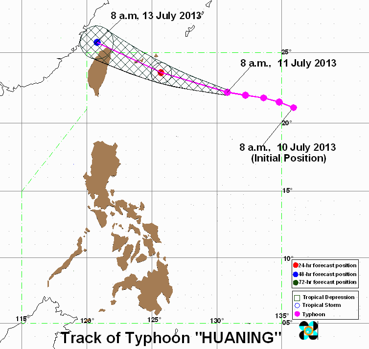
MANILA, Philippines – Typhoon Huaning (Soulik) is still on track towards Taiwan, intensifying while maintaining its speed late Thursday morning, July 11.
Huaning was 810 kilometers east northeast of Itbayat, Batanes (22.0°N, 132.0°E) as of 10 am, carrying maximum winds of 185 km/h near the center and gusts of up to 220 km/h.
Batanes is still under storm signal number 1, and the province should expect winds between 45-60 km/h within the next 36 hours, state weather bureau PAGASA said in its latest severe weather forecast.
The typhoon is estimated to carry heavy to torrential rain (10-46 mm/h) within its 800 km diameter.
Huaning, moving at a speed of 20 km/h towards the west-northwest, is forecast to be 450 km northeast of Itbayat by Friday morning, and out of the Philippine Area of Responsibility (PAR) by Saturday morning.
Taiwan bracing for impact
Neighboring Taiwan is bracing for the impact of Huaning, and the country’s Central Weather Bureau (CWB) said it could issue a storm warning as early as 8 pm Thursday.
Huaning is expected to move towards Taiwan’s northern edge as the weekend approaches. The CWB has categorized the typhoon as a “strong” typhoon.
“Soulik, which continues to intensify as it moves toward Taiwan, could cause severely impact Taiwan if it grows bigger and moves toward the island faster,” The China Post quoted Chen Yi-liang of the CWB.
A rock festival has been cancelled in Taipei, and the country’s highways bureau warned motorists to avoid landslide-prone mountain highways, the Taipei Times reported.
Residents in Taiwan’s northern and eastern regions are told to be on alert for storm surges.
Huaning/Soulik is, so far, the strongest tropical system this year, and is still intensifying, weather.com reported. – Rappler.com
Add a comment
How does this make you feel?
There are no comments yet. Add your comment to start the conversation.