SUMMARY
This is AI generated summarization, which may have errors. For context, always refer to the full article.
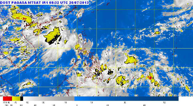
MANILA, Philippines – The state weather bureau said it spotted a low pressure area (LPA) east of General Santos City on Friday afternoon, July 26, bringing rain to parts of Mindanao the next day.
In its 5 pm bulletin on Friday, the Philippine Atmospheric, Geophysical, and Astronomical Services Administration said the LPA was estimated at 380 km east of General Santos City as of 4 pm.
It was embedded along the intertropical convergence zone (ITCZ) affecting Mindanao, PAGASA said.
PAGASA said the regions of Caraga, Davao, and Soccksargen will likely experience cloudy skies with moderate to heavy rain showers and thunderstorms. These rains will likely trigger flash floods and landslides, PAGASA said.
Central and eastern Visayas, as well as the rest of Mindanao, will experience cloudy skies and light to moderate rain showers and thunderstorms.
It will be partly cloudy to cloudy, with isolated rain showers and thunderstorms, in Metro Manila and the rest of the country. – with reports from Paterno Esmaquel II/Rappler.com
Add a comment
How does this make you feel?


There are no comments yet. Add your comment to start the conversation.