SUMMARY
This is AI generated summarization, which may have errors. For context, always refer to the full article.
What’s the weather like in your area? Tweet us the situation: Use #weatheralert and tag @rapplerdotcom.
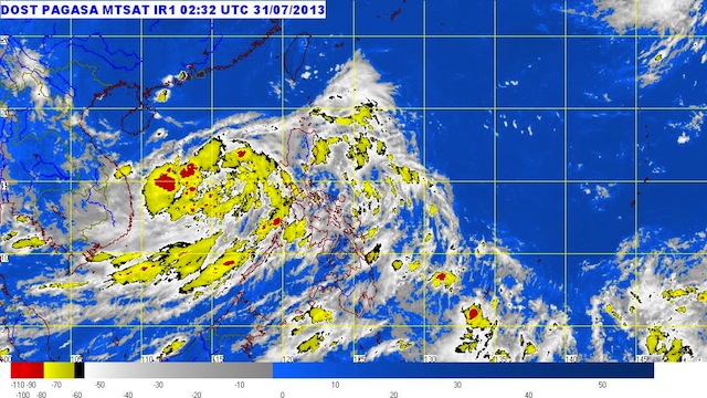
MANILA, Philippines – Jolina has intensified into a tropical storm Wednesday morning, July 31, as a new low pressure area lurks east of Bicol.
Tropical storm Jolina was spotted 450 kilometers west of Subic, Zambales (15.0°N, 115.6°E) as of 10 am, carrying maximum winds of 65 km/h near the center and gusts of up to 80 km/h.
It is carrying moderate to heavy rainfall (5-15 mm/h), state weather bureau PAGASA said in its 11 am bulletin for the storm.
No public storm warning signals have been raised in any part of the country.
Jolina is moving northwest at a speed of 11 km/h, and is expected to be 660 km west of Subic by Thursday morning, or outside the Philippine Area of Responsibility.
The tropical storm will continue to enhance the southwest monsoon, bringing moderate to occasionally heavy rain over southern Luzon.
As Jolina exits, PAGASA has spotted a low pressure area 210 km east of Virac, Catanduanes. – Rappler.com
Add a comment
How does this make you feel?
There are no comments yet. Add your comment to start the conversation.