SUMMARY
This is AI generated summarization, which may have errors. For context, always refer to the full article.
What’s the weather like in your area? Tweet us the situation: Use #weatheralert and tag @rapplerdotcom.
Manila, Philippines – Provinces on the western seaboard should expect a rainy Friday today, September 27.
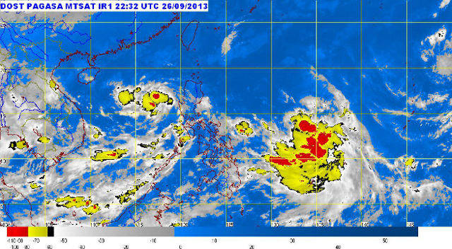
Tropical Depression Paolo was estimated to be 240 km West of Subic, Zambales (15.1°N,117.7°E) as of 4 am Friday morning. Paolo carries maximum sustained winds of 55 km/h and is forecasted to move slowly West.
The provinces of Mindoro and Northern Palawan will experience cloudy skies with moderate to occasionally heavy rainshowers and thunderstorms. These occurrences may trigger flash flooding and landslides.
MIMAROPA, Eastern Visayas, and Eastern Mindanao will have cloudy skies and light to moderate rainshowers and thunderstorms.
The rest of the country may experience isolated rainshowers and thunderstorms.
A Low Pressure Area (LPA) was also seen an estimated 980 km East of Northern Mindanao (9.5°N,136.0°E). – Rappler.com
Add a comment
How does this make you feel?
There are no comments yet. Add your comment to start the conversation.