SUMMARY
This is AI generated summarization, which may have errors. For context, always refer to the full article.
What’s the weather like in your area? Tweet us the situation: Use #weatheralert and tag @rapplerdotcom.
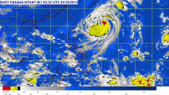
MANILA, Philippines – Tropical storm Quedan (international codename Fitow) continues to cross the Philippine Sea Thursday, October 3, as it slowly makes its way out of the Philippine Area of Responsibility (PAR).
As of 10 am, Quedan was located 680 kilometers east of Basco, Batanes (20.3°N, 129.5°E), carrying maximum sustained winds of 105 km/h and gusts of up to 135 km/h, state weather bureau PAGASA said.
The storm is estimated to carry heavy to intense rainfall (7.5-15 mm/h) within its 500 km diameter, the bureau said.
It is moving north northwest at a speed of 9 km/h, and is moving towards the general area between Taiwan and the southern Japanese islands.
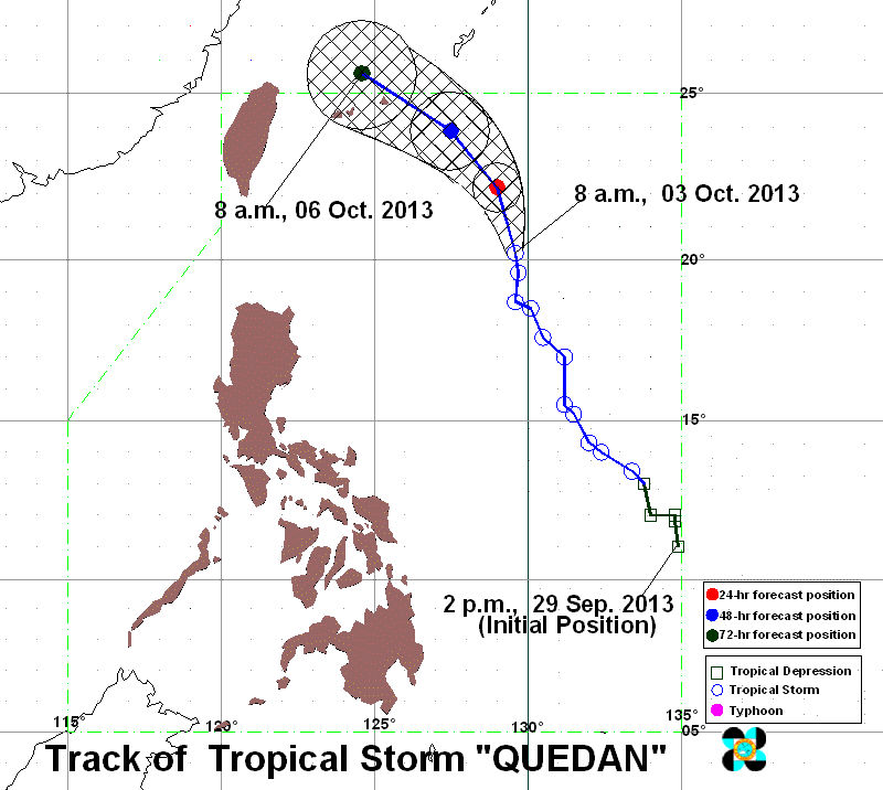
Quedan is not expected to affect any part of the country, but the bureau is still warning of risky sea travel in the eastern seaboard of Luzon. No storm warning signals have been raised.
The system is expected to exit the PAR by Sunday morning, October 6.
The next bulletin on Quedan will be released at 11 pm. – Rappler.com
Add a comment
How does this make you feel?
There are no comments yet. Add your comment to start the conversation.