SUMMARY
This is AI generated summarization, which may have errors. For context, always refer to the full article.
What’s the weather like in your area? Tweet us the situation: Use #weatheralert and tag@rapplerdotcom.

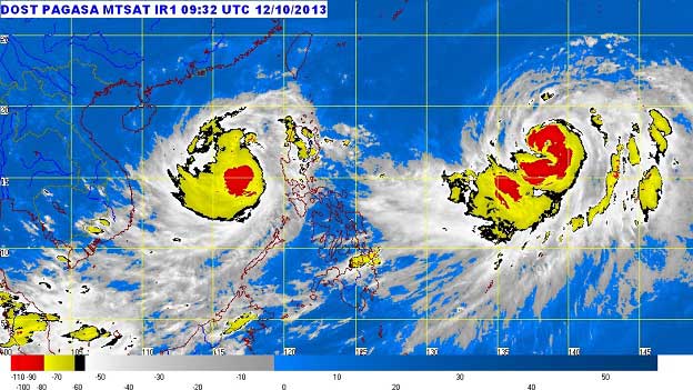
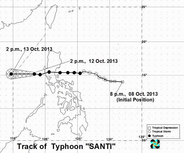
MANILA, Philippines – Typhoon Santi (international name: Nari) has slightly slowed down as it continues to move towards the West Philippine Sea (South China Sea).
As of 4 pm Saturday, October 12, the center of the typhoon was spotted 200 km West of Iba, Zambales, with maximum sustained winds of 120 kph near the center gusting up to 150 kph, weather bureau PAGASA said in its latest tropical cyclone update.
The amount of rainfall is estimated to be from 5 to 15 millimeters per hour, which is classifed as moderate to heavy, within the 400-kilometer diameter of the typhoon.
Santi has already killed 13 people as it pounded the northern Philippines on Saturday. It is forecasted to move 15 kph to the west, and by tomorrow afternoon, is expected to be at 520 km west of Iba, Zambales or outside the Philippine Area of Responsibility (PAR).

Storm Signal No. 1 is still raised over Zambales and Bataan with expected winds of 30 to 60 kph within 36 hours. These areas will have rains with gusty winds and moderate to rough seas, according to the bureau’s 24-hour weather forecast.
Meanwhile, Metro Manila and the rest of Luzon, Zamboanga Peninsula, Northern Mindanao, and CARAGA will experience cloudy skies with light to moderate rainshowers and thunderstorms.
The rest of the country will be partly cloudy to cloudy, with isolated rainshowers or thunderstorms.
Sea waters in the country will be moderate to rough due to moderate to rough winds.
Tropical storm Tino (international name: Wipha) is expected to enter the PAR by Monday morning. PAGASA estimated its current location at 1,510 km east of Northern Luzon.
The next PAGASA bulletin will issued at 11 pm, October 12. – Rappler.com
Add a comment
How does this make you feel?
There are no comments yet. Add your comment to start the conversation.