SUMMARY
This is AI generated summarization, which may have errors. For context, always refer to the full article.
What’s the weather like in your area? Tweet us the situation: Use #weatheralert and tag @rapplerdotcom.

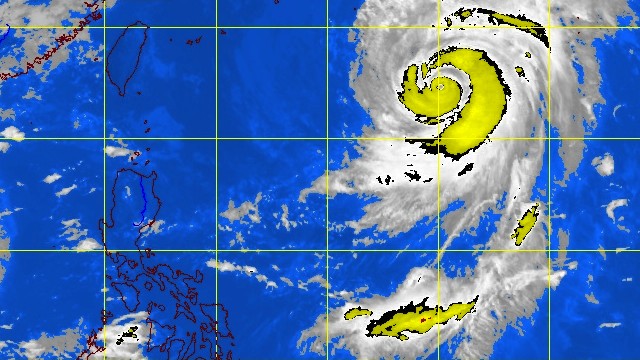
MANILA, Philippines – Typhoon Wipha has entere the Philippine Area of Responsibility (PAR) Monday, October 14, and has been named Tino, state weather bureau PAGASA said.
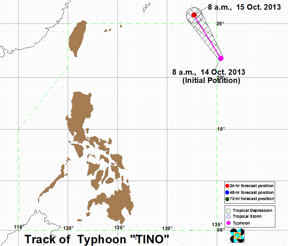
Tino was located 1,210 kilometers east northeast of Basco, Batanes (22.3°N, 135.0°E) as of 10 am Monday, carrying maximum sustained winds of 160 km/h near its center and gusts of up to 195 km/h.
The typhoon is carrying heavy to intense (7.5-15 mm/h) of rainfall within its 1000 km diameter, the bureau said in its tropical cyclone bulletin issued 11 am.
Tino is currently moving at a speed of 20 km/h, towards the north northwest.

It is not expected to affect any part of the Philippines; forecast tracks for the typhoon show that it will skirt the northeastern part of the PAR, and is expected to exit the area by Tuesday morning, October 15.
No public storm warnings have been raised.
It is expected to move towards the general direction of Japan in the next few days.
The next bulletin for Tino will be issued at 11 pm Monday. – Rappler.com
Add a comment
How does this make you feel?
There are no comments yet. Add your comment to start the conversation.