SUMMARY
This is AI generated summarization, which may have errors. For context, always refer to the full article.
What’s the weather like in your area? Tweet us the situation: Use #weatheralert and tag @rapplerdotcom.
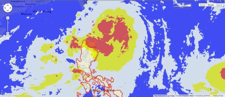
MANILA, Philippines (UPDATED) – Typhoon Henry (Matmo) continues to move closer to the Batanes area on its way towards Taiwan, state weather bureau PAGASA said Tuesday, July 22.
Henry has strengthened a bit, with maximum sustained winds of 140 kilometers per hour near the center and gusts of up to 170 km/h, and was located 170 km east northeast of Basco, Batanes as of 11 am Tuesday.
Public storm warning signal number 2 is still in effect over Batanes, while signal number 1 is in effect over Cagayan.
The typhoon is expected to enhance the Southwest Monsoon (Habagat), which is forecast to bring moderate to occasionally heavy rain over much of Luzon and Western Visayas.
Meanwhile, within the typhoon’s 500-km diameter, moderate to heavy rainfall (7.5-15 mm/h) is expected.
It is still traversing the Balintang Channel, moving at a pace of 24 km/h going northwest, or the general direction of Taiwan.
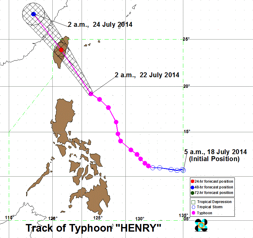
By Wednesday morning, July 23, the typhoon will be pounding Taiwan, and will leave the Philippine Area of Responsibility (PAR) by Thursday, July 24.
The next bulletin on Henry will be issued by the weather bureau at 5 pm Tuesday. – Rappler.com
Add a comment
How does this make you feel?
There are no comments yet. Add your comment to start the conversation.