SUMMARY
This is AI generated summarization, which may have errors. For context, always refer to the full article.
What’s the weather like in your area? Tweet us the situation: Use #weatheralert and tag @rapplerdotcom.
MANILA, Philippines – Typhoon Phanfone is expected to enter the Philippine Area of Responsibility (PAR) this weekend, state weather bureau PAGASA said on Friday, October 3.
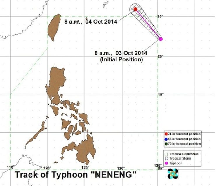
In its 11 am weather bulletin, PAGASA said that as of 10 am, the eye of Typhoon Phanfone – to be given the local name “Neneng” once it enters the PAR – was 1,385 kilometers east of Itbayat, Batanes, with maximum sustained winds of 175 kilometers per hour (kph) near the center and gustiness of up to 210 kph.
It is expected to move northwest at 20 kph.
By Saturday morning, October 4, Phanfone is expected to be at 1,180 km northeast of Itbayat, Batanes or outside the PAR.
PAGASA said the typhoon “is still too far to affect any part of the country” but advised fisherfolk not to venture out in the eastern seaboard of Northern Luzon this weekend, due to expected “very rough sea conditions” enhanced northeasterly winds.
The next bulletin will be issued at 11 pm Friday. – Rappler.com
Add a comment
How does this make you feel?
There are no comments yet. Add your comment to start the conversation.