SUMMARY
This is AI generated summarization, which may have errors. For context, always refer to the full article.
What’s the weather like in your area? Tweet us the situation: Use #weatheralert and tag @rapplerdotcom
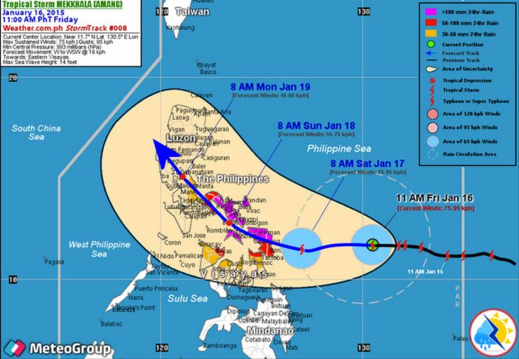
MANILA, Philippines (UPDATED) – Other weather stations predict that Tropical Storm Amang (international name Mekkhala) will make landfall in Eastern Samar on Saturday, January 17.
Independent Philippine-based group Weather Philippines said in its 1 pm bulletin on Friday, January 16, that the first storm of 2015 will likely make landfall “somewhere along the northern shores of Eastern Samar” between 4 pm to 7 pm on Saturday.
The group’s forecast differs from the Friday, 5 pm bulletin of state weather bureau PAGASA which predicts landfall in Northern Samar on Saturday evening.
At 4 pm, PAGASA spotted Amang’s center 475 kilometers east of Borongan City, Eastern Samar. It had winds with speeds of 75 to 90 kilometers/hour (km/h) and is forecasted to move west at a speed of 15 km/h.
Its forecast shows Amang turning northwestward after hitting Northern Samar towards the eastern coast of Daet in Camarines Sur on Sunday afternoon. It then leaves the Philippine land mass and will be to the east of Tuguegarao City on Monday afternoon.
PAGASA retained the public storm signal number 1 it raised over 11 provinces:
- Catanduanes
- Albay
- Burias Island
- Sorsogon
- Masbate including Ticao Island
- Camarines Sur
- Northern Samar
- Eastern Samar
- Samar
- Biliran
- Leyte
WeatherPH forecast
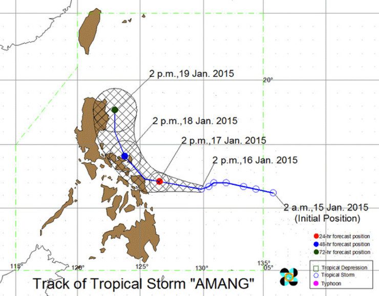
Weather Philippines says Amang is likely to maintain its strength on Saturday when it may be 175 kilometers east of Borongan City.
On Sunday, it may weaken into a tropical depression after traversing the northern part of Samar.
On Monday morning, it will weaken even further as it reaches a spot 55 kilometers north-northeast of Metro Manila.
Weather Philippines, meanwhile, listed down areas that should expect heavy to extreme rains (100 millimeters or more) from Saturday morning to Sunday (January 18) morning.
These areas are:
- Northern Samar
- Northern parts of Eastern and Western Samar
- Masbate (including Ticao Island)
- Sorsogon
- Albay (including Burias Island)
- Camarines Sur
- Southern part of Camarines Norte
- Catanduanes
Japan, US forecasts
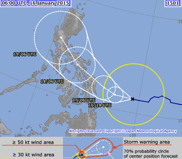
Similar to Weather Philippines, the Japan Meteorological Agency (JMA), forecasted a track that shows Amang hitting Eastern Visayas first. In their forecast, Amang moves in a northwest direction to Bicol region before heading towards Central Luzon.
Unlike the PAGASA version, the JMA forecast shows Amang staying above land mass until Monday.
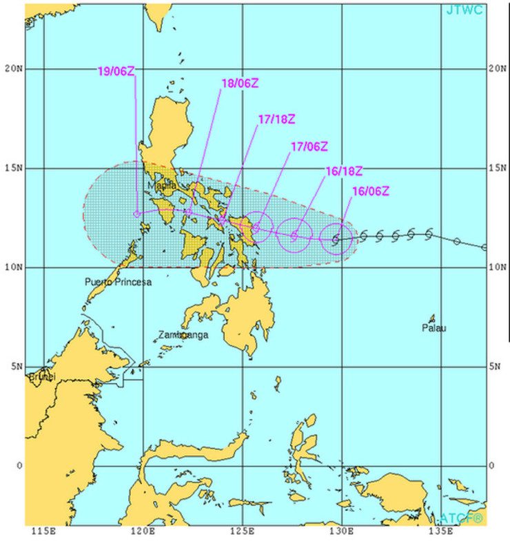
The US weather station JTWC also predicts an Eastern Visayas landfall but has a very different track compared to PAGASA, Weather Philippines and JMA.
Instead of veering northeast, Amang is shown to move westward over Masbate (southern part of Bicol region) and then toward Mindoro island before leaving Philippine landmass. – Rappler.com
Add a comment
How does this make you feel?
There are no comments yet. Add your comment to start the conversation.