SUMMARY
This is AI generated summarization, which may have errors. For context, always refer to the full article.
What’s the weather like in your area? Tweet us the situation: Use #weatheralert and tag @rapplerdotcom
MANILA, Philippines – Within 24 hours, Public Storm Warning Signal No 1 will be raised over Bicol and Samar region in preparation for Typhoon Maysak, state weather bureau PAGASA announced during a Wednesday, April 1, press briefing.
These regions are likely the first to be affected by the typhoon, which will be named “Chedeng” when it enters the Philippine Area of Responsibility (PAR).
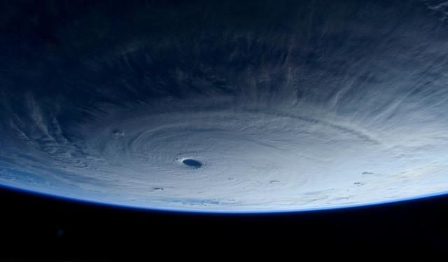
Maysak was spotted 1,165 kilometers east of Guiuan, Eastern Samar at 4 pm on Wednesday, April 1.
It had maximum sustained winds of 190 kilometers/hour (km/h) with gusts of up to 230 km/h, showing the typhoon has weakened. But PAGASA Administrator Vicente Malano says to still take caution.
“It will still be a strong typhoon. There is no room for complacency,” he said.
Even if the typhoon weakens, it is still likely to have wind speeds of 150 to 170 km/h at the time of landfall.
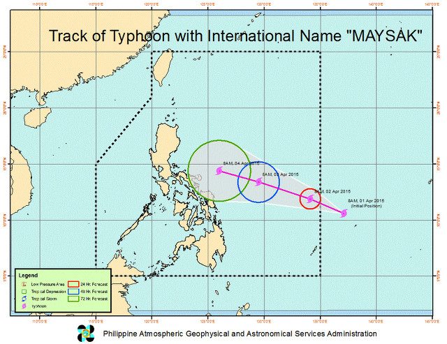
It is expected to enter the PAR either late Wednesday, April 1, or early Thursday morning, April 2. PAGASA and other foreign weather forecasting agencies predict roughly the same track for the storm.
Different forecast models show it will make landfall either late Saturday, April 4, or early Sunday, April 5, in 3 possible areas: Aurora, Quezon, and Isabela.
Maysak is still expected to weaken as it approaches Philippine landmass. This is because ocean temperatures around the archipelago are not very high, depriving Maysak of a source of energy to get stronger.
High ocean temperatures are typically what strengthens typhoons.
Safe to travel?
Those traveling during the Holy Week may have to adjust their plans given Maysak’s approach.
Malano said it may still be safe to travel by land up to Friday morning, April 3. But by Friday evening, strong winds and rain will already be felt, making it unwise.
Of particular danger is travel by land through mountainous areas, said Malano. Winds and rain are likely to cause landslides which could hit unwary vehicles or clog up roads resulting in traffic or bottlenecks.
The travel of boats, meanwhile, will be suspended as soon as Public Storm Warning Signal No. 1 is raised in areas where the boats will pass.
As for air travel, advisories will come from the Civil Aviation Authority of the Philippines (CAAP), which is already coordinating with PAGASA.
Though Maysak has weakened, it may still generate storm surges along coastal areas that could go up to 3 meters (10 feet) high.
Baler in Aurora, a popular surfing spot, is particularly susceptible.
“There is a history of storm surges occurring in Baler Bay. In 1981, during a storm with 200 km/h winds, storm surges reached 4 to 5 meters,” he said.
Maysak is expected to leave the PAR on Tuesday, April 7, or Wednesday, April 8.
Still fair weather on Thursday
Maysak is still too far to be affecting the archipelago. On Thursday, April 2, only cloudy skies are expected in Cagayan Valley, Cordillera, and Ilocos.
Metro Manila and the rest of the country may experience only isolated rainshowers or thunderstorms.
Light to moderate winds will prevail in all regions resulting in slight to moderate seas. – Rappler.com
Add a comment
How does this make you feel?
There are no comments yet. Add your comment to start the conversation.