SUMMARY
This is AI generated summarization, which may have errors. For context, always refer to the full article.
What’s the weather like in your area? Tweet us the situation: Use #weatheralert and tag @rapplerdotcom
MANILA, Philippines – More provinces in Luzon are under storm signals as Typhoon Chedeng (international name: Maysak) weakens ahead of its expected landfall this weekend.
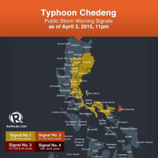
State weather bureau PAGASA put Catanduanes under Public Storm Warning Signal 2, and raised signal number 1 in 12 provinces in its 11 pm update on Friday, April 3.
PAGASA said Catanduanes will have stormy weather with heavy to intense rain. Residents along coastal areas in the island province are alerted against possible storm surges of up to two meters.
In Catanduanes, travel by all types of sea vessels and aircraft are risky. Billboards and signs may also be toppled. The province is already on high alert for Chedeng.
The provinces under signal number 1 are:
- Camarines Sur
- Camarines Norte
- Quezon including Polilio Island
- Rizal
- Bulacan
- Nueva Ecija
- Aurora
- Quirino
- Nueva Vizcaya
- Ifugao
- Isabela
- Mountain Province
These areas will have occasional rain with gusty winds. Sea travel of small vessels and fishing boats is risky.
Residents in low-lying and mountainous areas of provinces under signals number 1 and 2 are warned against possible flashfloods and landslides.
Storm surges and sea surface waves of up to 2 meters (6.6 feet) are also possible over the eastern coast of Aurora, Quezon and Isabela.

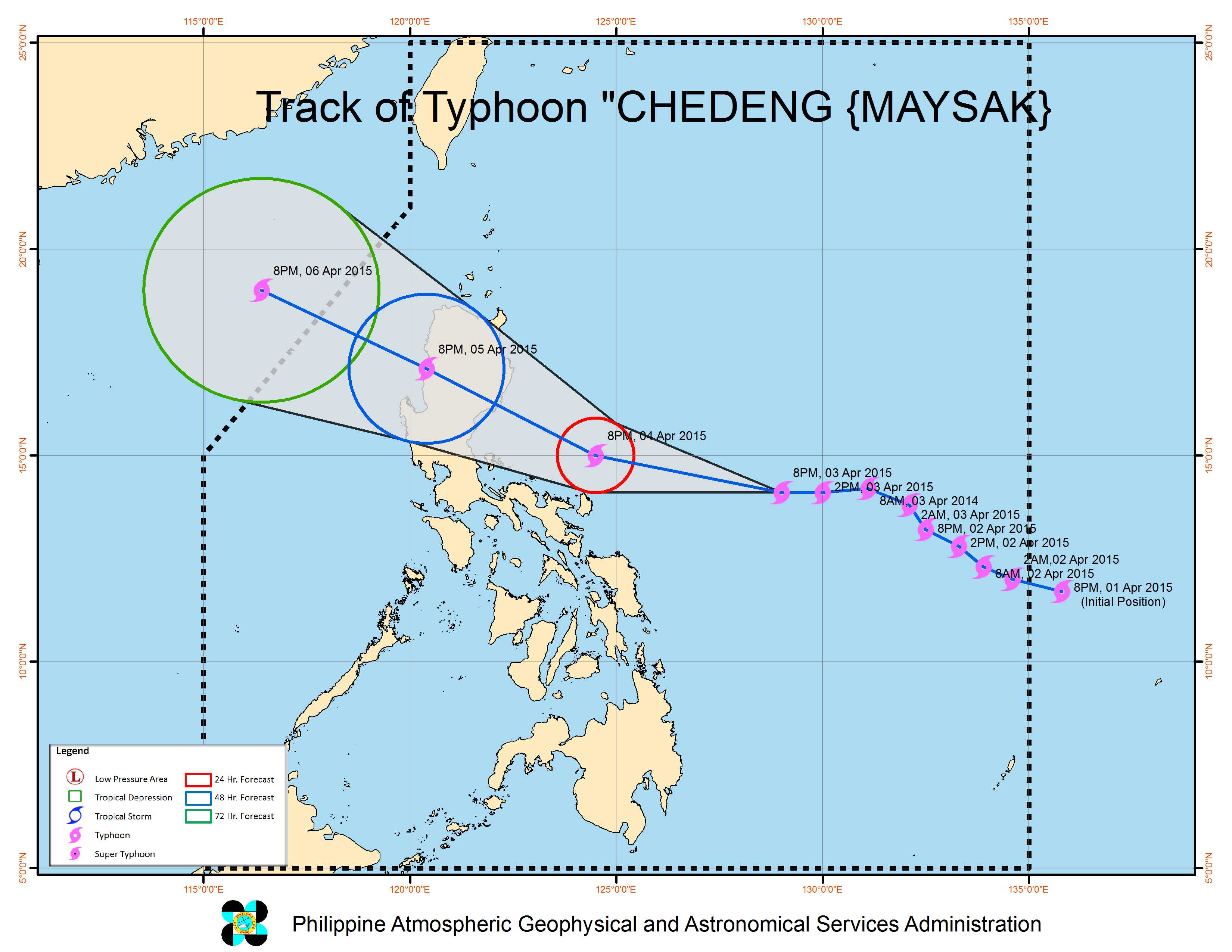
At 10 pm of Friday, Chedeng was 730 kilometers east southeast of Casiguran, Aurora.
The typhoon packed maximum sustained winds of up to 130 km/h near the center, and gustiness of up to 160 km/h. The winds weakened further compared to those reported in PAGASA’s 11 am and 5 pm advisories on Friday.
Chedeng is forecast to move west northwest at 19 km/h.
It is expected to hit land over the coast of the Aurora-Isabela area by Sunday morning, April 5, exit landmass via Ilocos Sur by Sunday evening, and leave the Philippine Area of Responsibility by Monday morning. – Rappler.com
Add a comment
How does this make you feel?
There are no comments yet. Add your comment to start the conversation.