SUMMARY
This is AI generated summarization, which may have errors. For context, always refer to the full article.
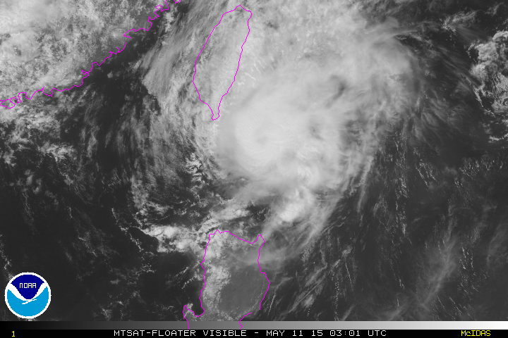
MANILA, Philippines – Typhoon Dodong (international codename Noul) has sped up as it passes by Batanes late Monday morning, May 11, state weather bureau PAGASA said.
The center of the typhoon was located 65 km north northeast of Basco, Batanes as of 10 am, still carrying maximum sustained winds of 160 km/h near the center and gusts of up to 195 km/h, the bureau said in its 11 am bulletin.
Batanes remains under storm signal number 3, and is expected to experience winds between 121-170 km/h.
In the open seas around the province, ocean wave heights can exceed 14 meters.
Signal Number 2 is hoisted over the Babuyan and Calayan island groups, while Signal Number 1 is in effect over northern Cagayan.
Storm signals elsewhere have been lowered, the bureau said.
The typhoon is still carrying moderate to heavy rainfall, affecting areas with its 100 km diameter.
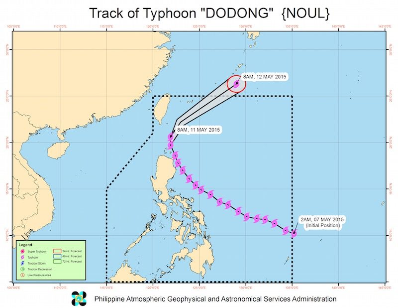
Dodong is currently moving at a pace of 20 km/h towards the north northeast, and is expected to be outside the Philippine Area of Responsibility (PAR) by Tuesday morning, May 12.
The next bulletin on the typhoon will be issued at 5 pm Monday. – Rappler.com
Add a comment
How does this make you feel?
There are no comments yet. Add your comment to start the conversation.