SUMMARY
This is AI generated summarization, which may have errors. For context, always refer to the full article.
What’s the weather like in your area? Tweet us the situation: Use #weatheralert and tag @rapplerdotcom
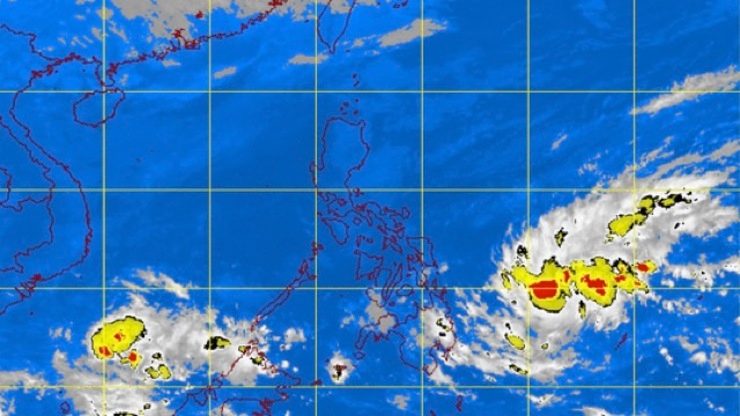
MANILA, Philippines – It’s going to be another cloudy and rainy day for most of the Philippines, as the tail-end of a cold front affects the Bicol region and a low pressure area (LPA) hovers closer to Surigao del Sur.
Aside from the cold front and the low pressure area, the northeast monsoon is also affecting northern and central Luzon, state weather bureau PAGASA said in its Saturday, December 27 forecast.
According to PAGASA, the Bicol, Eastern Visayas, Caraga, Davao and Northern Mindanao regions, as well as the province of Quezon will see cloudy skies with light to moderate rain showers and thunderstorms.
PAGASA had earlier said the LPA would affect the Eastern Visayas, Caraga, and Davao regions, bringing cloudy skies and moderate to occasionally heavy rain showers and thunderstorms to those areas.
Meanwhile, the Cagayan Valley, Cordillera, Ilocos Region and Central Luzon will see cloudy skies with light rain.
Metro Manila and the rest of the country can expect partly cloudy to cloudy skies with isolated rain showers or thunderstorms.
As of 4 am Saturday, the LPA was found some 660 kilometers east of Hinatuan, Surigao Del Sur. The LPA entered the Philippine area of responsibility Friday morning.
Moderate to rough seas will be experienced in the country as moderate to strong winds from the northeast prevail over the archipelago, said PAGASA.
No rainfall warnings have been issued by PAGASA as of posting. – Rappler.com
Add a comment
How does this make you feel?
There are no comments yet. Add your comment to start the conversation.