SUMMARY
This is AI generated summarization, which may have errors. For context, always refer to the full article.
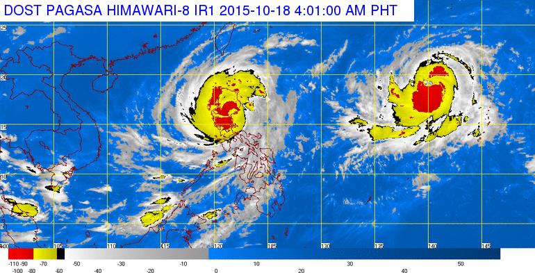
MANILA, Philippines (2nd UPDATE) – Typhoon Lando (international codename Kappu) has weakened slighty and has picked up some speed late Sunday morning, October 18, as it crosses Nueva Ecija, heading towards the Cordilleras.
As of 10 am, Lando’s center was located in the vicinity of Pantabangan, Nueva Ecija, with maximum sustained winds of 150 km/h near the center and gusts of up to 185 km/h, state weather bureau PAGASA said in its 11 am bulletin.
Public storm warning signal number 4 has been lowered, and the following areas are now under signal number 3:
- Aurora
- Quirino
- Nueva Vizcaya
- Nueva Ecija
- Benguet
- Ifugao
- Mountain Province
- Kalinga
- La Union
- Pangasinan
Meanwhile, the following areas are under signal number 2:
- Cagayan
- Isabela
- Abra
- Apayao
- Ilocos Norte
- Ilocos Sur
- Zambales
- Bataan
- Tarlac
- Pampanga
- Bulacan
- Rizal
- Northern Quezon and Polilio Islands
- Metro Manila
These areas are under signal number 1.
- Batanes
- Cavite
- Laguna
- Batangas
- Rest of Quezon
Storm warnings in other places have been lowered.
The storm is set to bring heavy to intense rainfall within its 500 km diameter, and seas around Luzon, Visayas, and northern and eastern Mindanao are dangerous, the bureau warned.
The storm has sped up a bit, moving at a speed of 5 km/h towards the west-northwest.
It will linger in the northern parts of Luzon until Friday, October 23, the bureau said.
Despite the slight weakening of the typhoon, the bureau warned that the system is still a strong typhoon, and residents in affected areas should still stay in safe areas.
Landfall
The typhoon earlier made landfall at around 1 am Sunday, in the vicinity of Casiguran town.
As it hit land, it continued to pack maximum sustained winds of 185 km/h near the center and gustiness of up to 220 km/h.
The United States Navy’s Joint Typhoon Warning Center (JTWC) upgraded Typhoon Lando (Koppu) to super typhoon status on Saturday at 11 pm, October 17.
Independent local weather organization Weather Philippines followed suit an hour after, 12 am, Sunday, October 18, calling Lando “a dangerous Super Typhoon” as it continues to move slowly westward in the past 6 hours approaching the shoreline of Aurora.
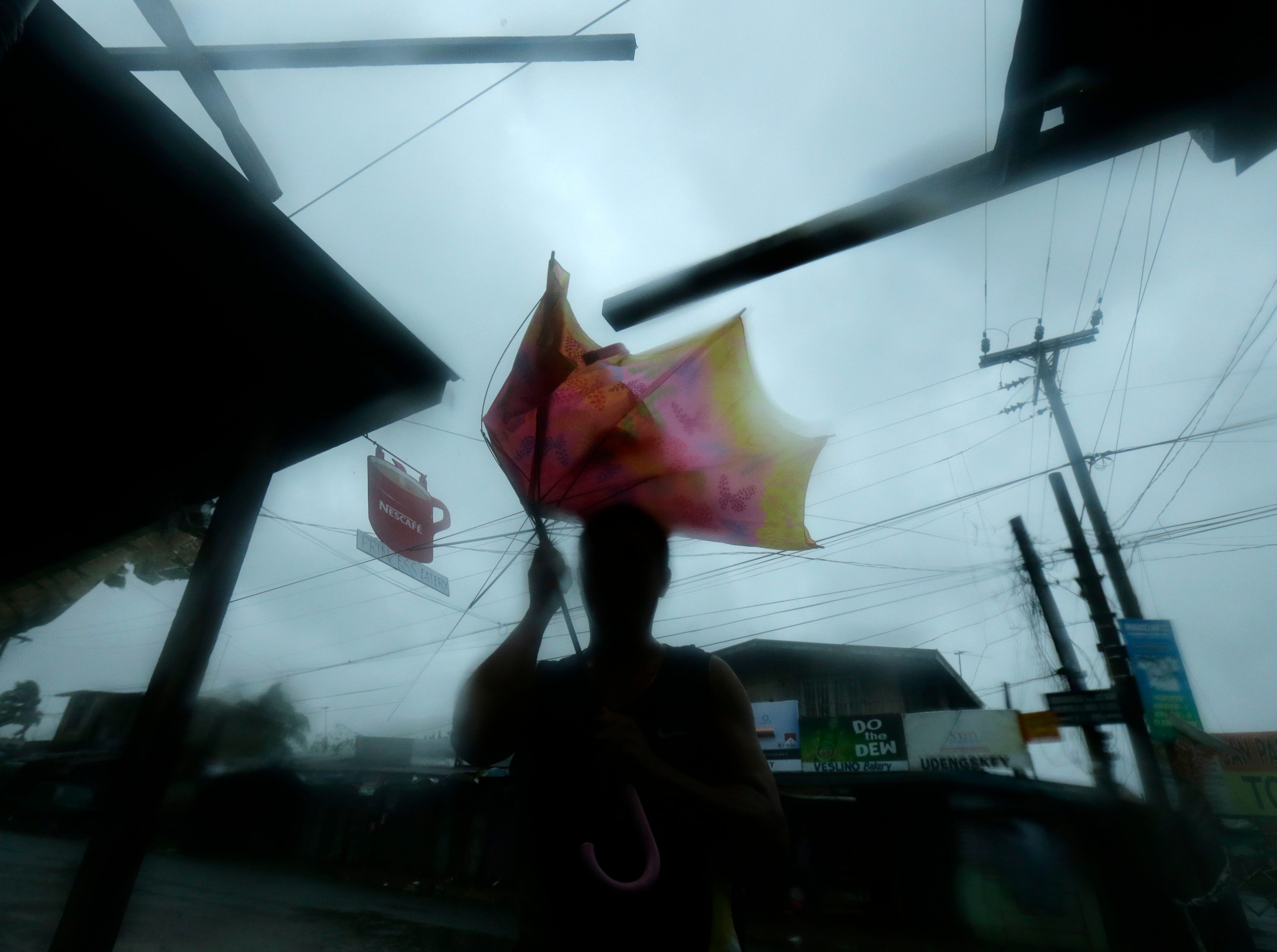
“This cyclone will bring powerful winds and heavy rains across the eastern sections of Northern Luzon today through Sunday,” Weather Philippines said in its advisory.
Zero casualty so far
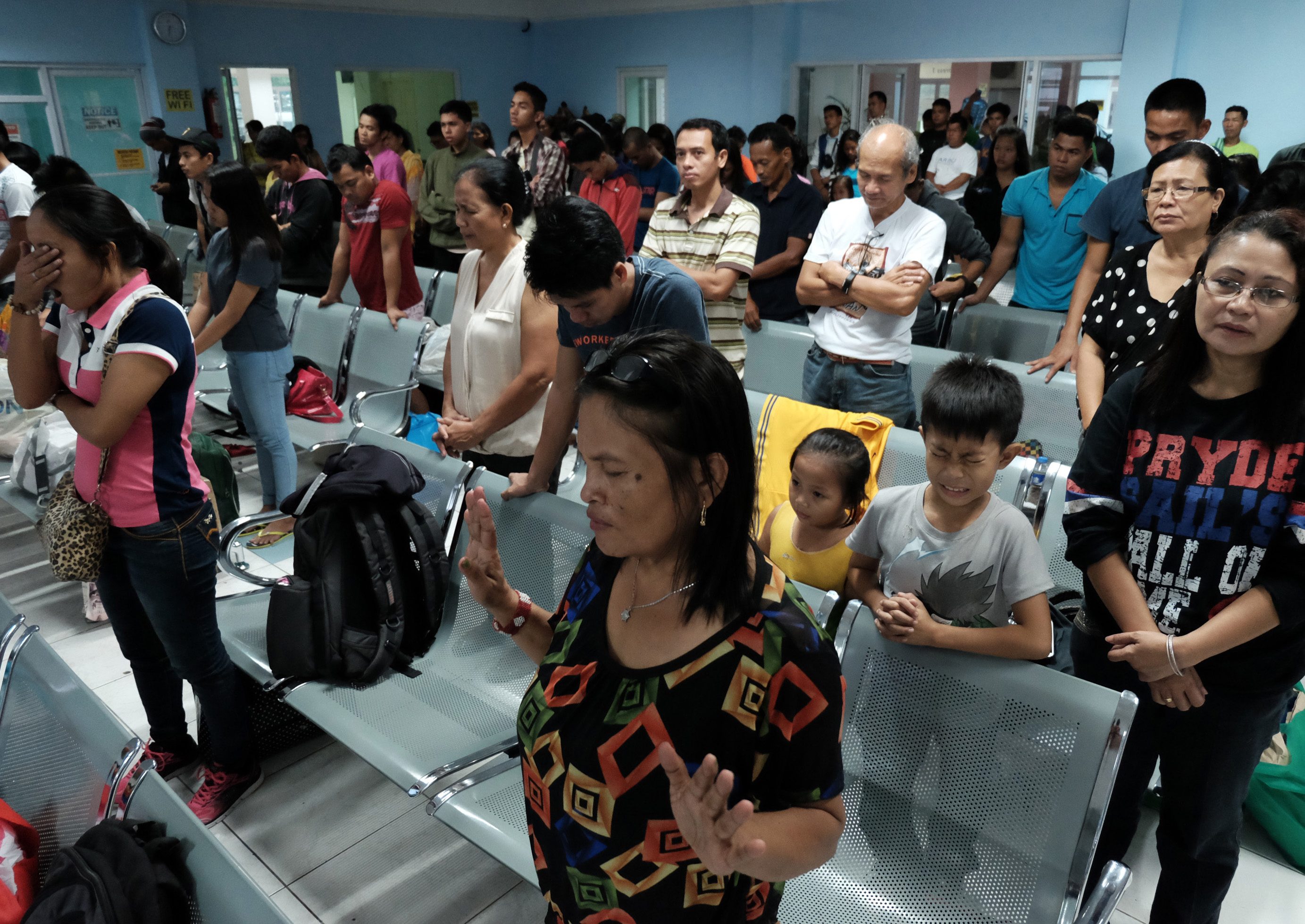
No casualties have been reported but about 6,500 people were evacuated from their homes and taken to safer ground, and the number was expected to rise as the storm slowly grinds inland across the main island of Luzon, the civil defense office said.
“It looks likely this deluge will be with us for days,” weather forecaster Gladys Saludes told Agence France-Presse, adding the typhoon was not likely to leave Luzon until Tuesday.
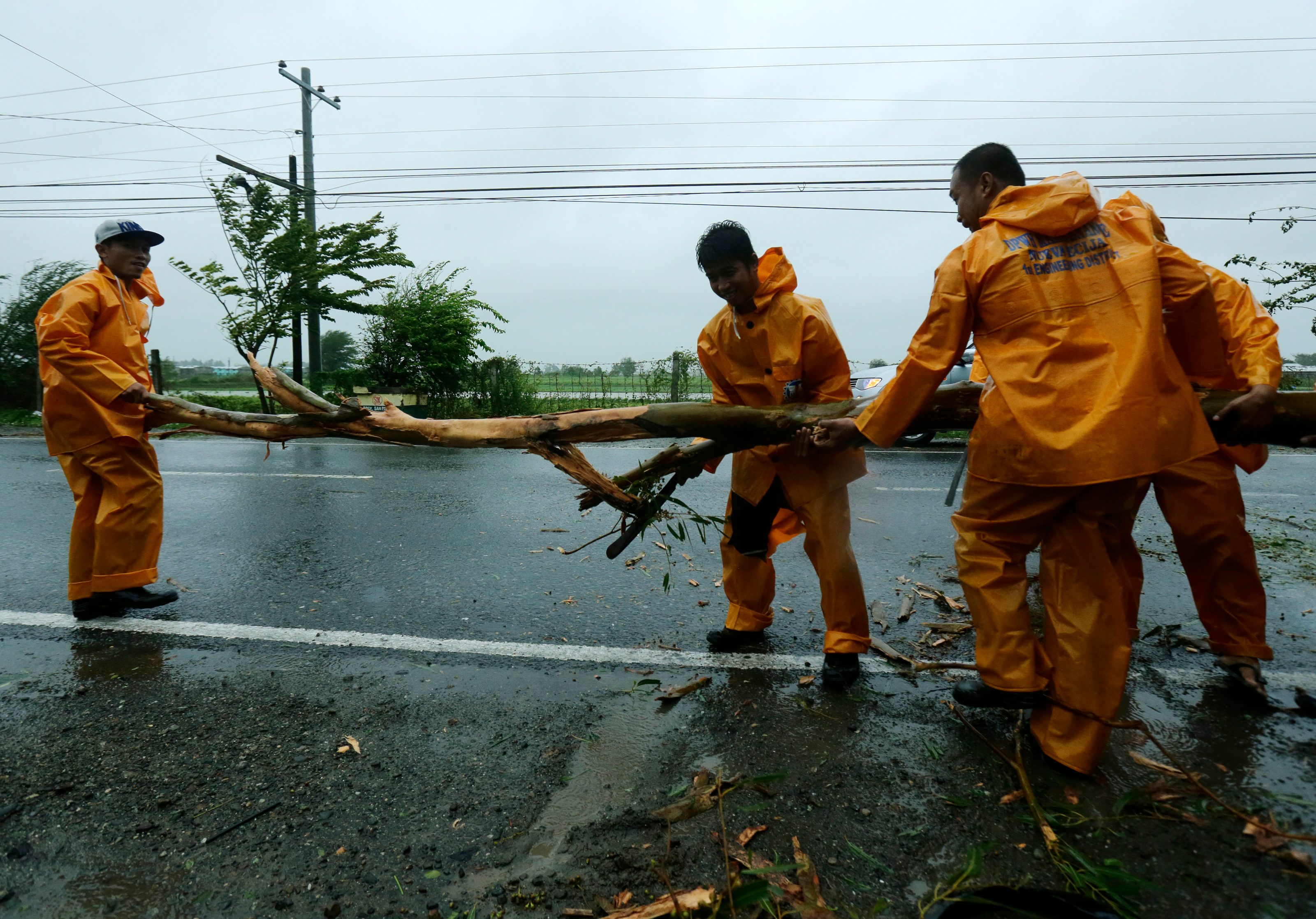
Koppu downed trees and pylons, leaving two cities and 22 towns without power, while landslides and floods cut off 10 roads and 8 bridges across the region, National Disaster Risk Reduction and Management Council (NDRRMC) chief Alexander Pama told reporters.
He said ferry services across the island, home to about half the Asian archipelago’s population of 100 million people, were suspended amid rough seas while commercial aviation was also disrupted with 30 flights suspended, two of them on international routes.
‘This is just the start’
Pama said communications links had also been cut in many of the affected areas, while the authorities were working to evacuate more people deemed at risk and trying to clear blocked roads so aid could get through.
“I must emphasize that this is just the start. People must remain alert while we try to pick up the pieces in areas already hit,” Pama added.
Residents of communities in the typhoon’s expected path were hunkering down under darkening skies, said Kate Marshall, part of an advance reconnaissance team of the International Committee of the Red Cross to the region.
“There is a bit of debris around but nothing major as yet. The trees are beginning to sway a lot more,” Marshall told Agence France-Presse from Solano town, about 100 kilometres inland.
“We have seen people checking roofs and putting stuff away. There are not that many people on the road…. I would say people are prepared,” she said, adding local officials have prepared evacuation centers in case they are needed.

Saludes, the weather forecaster, said that due to Koppu’s unusually slow pace, the mountainous areas and farmlands along river valleys in the area were expected to be pummelled by intense rain for days.
This could leave them exposed to floods and landslides, among other hazards, she said.
Although the storm will not directly hit the capital, Manila, the weather service said it would affect a 600-kilometre swathe so that other regions were likely to be affected by strong winds and rain. – With reports from Agence France-Presse / Rappler.com
Add a comment
How does this make you feel?
There are no comments yet. Add your comment to start the conversation.