SUMMARY
This is AI generated summarization, which may have errors. For context, always refer to the full article.
What’s the weather like in your area? Tweet us the situation: Use #weatheralert and tag @rapplerdotcom.
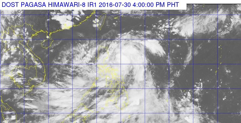
MANILA, Philippines – Tropical Depression Carina intensified into a tropical storm on Saturday afternoon, July 30.
In its bulletin issued 5 pm, state weather bureau PAGASA said Carina now has maximum winds of up to 65 kilometers per hour (km/h) and gustiness of up to 80 km/h.
Moderate to heavy rains are expected within the 400-km diameter of the tropical storm.
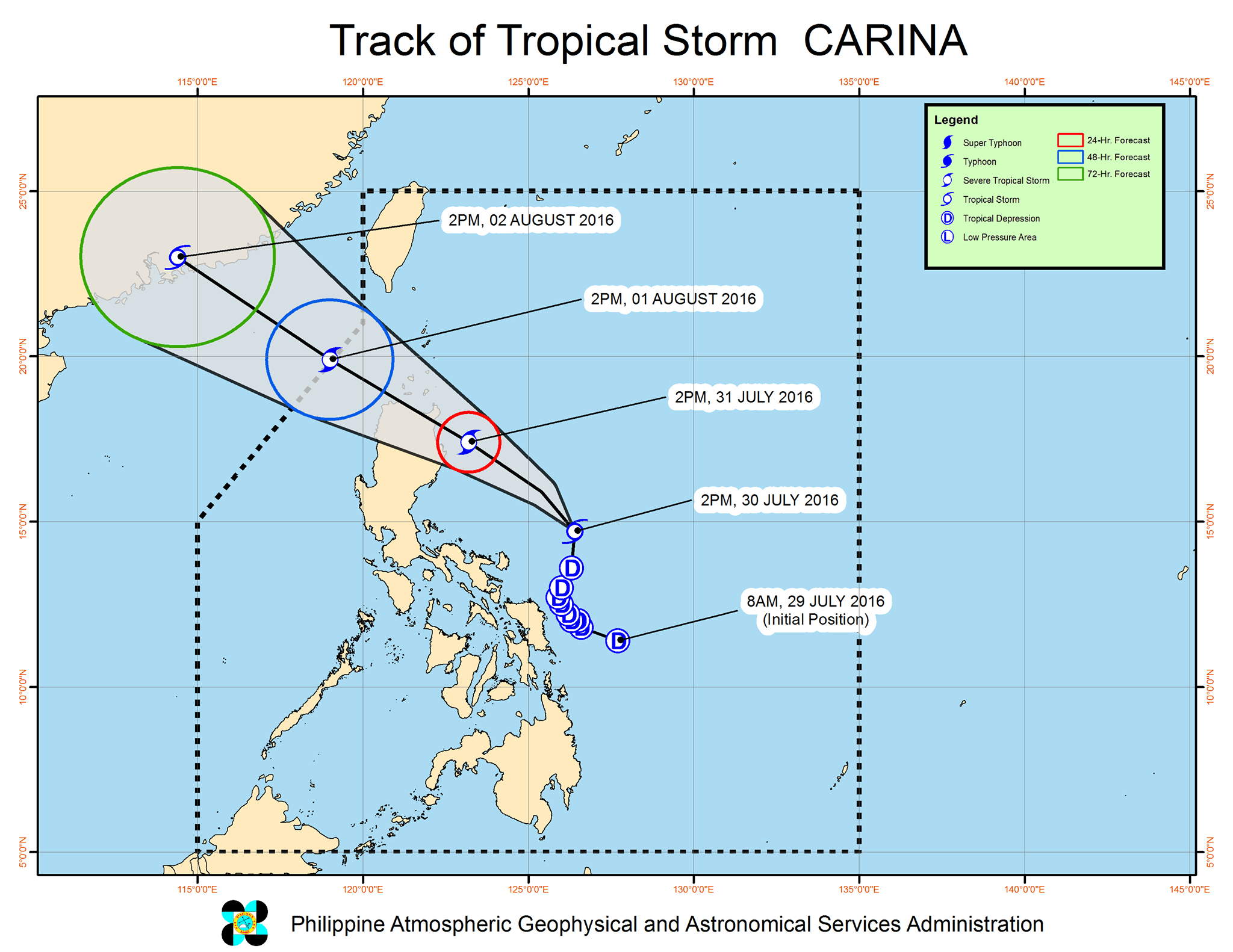
As of 4 pm, Carina was 290 km northeast of Virac, Catanduanes, moving north northwest toward Northern Luzon at 18 km/h.
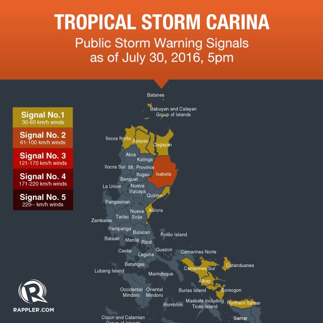
Signal number 2 has been raised in Isabela as of 5 pm.
The following provinces, meanwhile, are under signal number 1:
- Cagayan including Babuyan Group of Islands
- Apayao
- Ilocos Norte
- Aurora
- Catanduanes
- Camarines Sur
- Albay
- Sorsogon
- Northern Samar
These provinces should be on alert for possible floods and landslides.
PAGASA also warned fishermen that coastal waters in the eastern seaboards of Camarines Norte and Quezon, including Polillo Island, would be rough to very rough.
Carina is expected to leave the Philippine Area of Responsibility (PAR) on Monday, August 1.
– Rappler.com
Add a comment
How does this make you feel?
There are no comments yet. Add your comment to start the conversation.