SUMMARY
This is AI generated summarization, which may have errors. For context, always refer to the full article.
What’s the weather like in your area? Report the situation through Rappler’s Agos or tweet us at @rapplerdotcom.
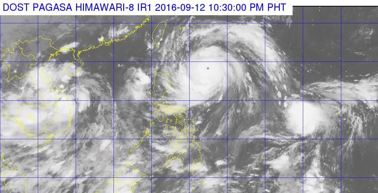
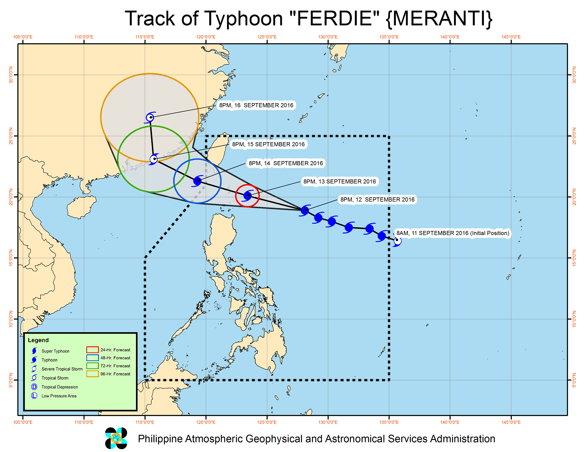
MANILA, Philippines – Typhoon Ferdie (Meranti) intensified further on Monday evening, September 12, as it continued heading for extreme Northern Luzon.
In its bulletin issued 11 pm on Monday, state weather bureau PAGASA said Ferdie now has maximum winds of up to 195 kilometers per hour (km/h) and gustiness of up to 230 km/h.
The typhoon is located 645 km east of Aparri, Cagayan, moving west northwest at 21 km/h.
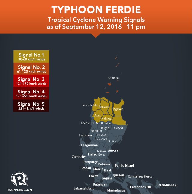
Signal number 2 is now up in these areas:
- Batanes
- Babuyan Group of Islands
Signal number 1, meanwhile, is raised over the following:
- rest of Cagayan
- northern Isabela
- Kalinga
- Apayao
- Abra
- Ilocos Norte
PAGASA warned residents of these areas to watch out for the effects of the rain and very strong winds. Moderate to heavy rain is expected within the 500-km diameter of the typhoon.
By Wednesday morning, September 14, Ferdie is expected to be in the vicinity of Batanes.
The latest forecast track shows the typhoon will leave the Philippine Area of Responsibility (PAR) on Wednesday evening.
PAGASA said, however, that a tropical depression will also enter PAR on Wednesday. It is not expected to make landfall in the country.
– Rappler.com
Add a comment
How does this make you feel?
There are no comments yet. Add your comment to start the conversation.