SUMMARY
This is AI generated summarization, which may have errors. For context, always refer to the full article.
What’s the weather like in your area? Report the situation through Rappler’s Agos or tweet us at @rapplerdotcom.
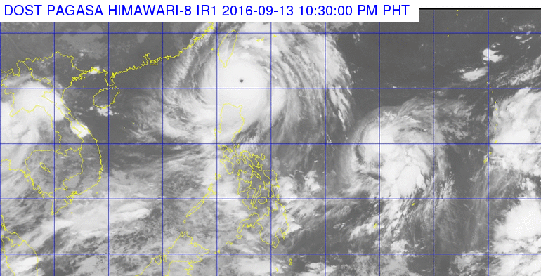
MANILA, Philippines – Typhoon Ferdie (Meranti) will make landfall in Batanes between 11 pm on Tuesday, September 13 and 1 am on Wednesday, September 14.
In its bulletin issued 11 pm on Tuesday, state weather bureau PAGASA said Ferdie was 60 kilometers east of Basco, Batanes, still moving west northwest at 24 kilometers per hour (km/h).
It maintained its strength, with maximum winds of up to 220 km/h and gustiness of up to 255 km/h.
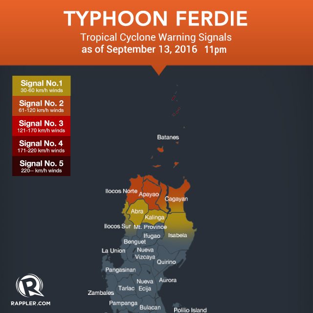
Signal number 4 remains raised over Batanes, while signal number 3 is still up over the Babuyan Group of Islands.
Signal number 2, meanwhile, is raised over the following:
- Ilocos Norte
- Apayao
- northern Cagayan
Signal number 1 is also up in these areas:
- rest of Cagayan
- northern Isabela
- Kalinga
- Abra
- northern Ilocos Sur
PAGASA warned residents of areas under warning signals to watch out for the effects of the rain and very strong winds. Moderate to heavy rain is expected within the 600-km diameter of the typhoon.
Ferdie is expected to leave the Philippine Area of Responsibility (PAR) on Wednesday, between 10 am and noon.
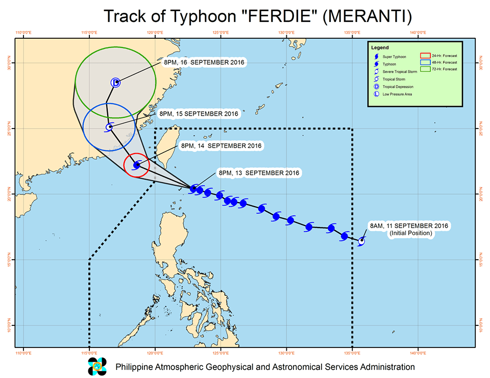
But as Ferdie exits, a tropical storm is also expected to enter PAR on Wednesday. This tropical storm has the international name Malakas and will be called Gener when it enters PAR.
It is expected to enhance the southwest monsoon. – Rappler.com
Add a comment
How does this make you feel?
There are no comments yet. Add your comment to start the conversation.