SUMMARY
This is AI generated summarization, which may have errors. For context, always refer to the full article.
What’s the weather like in your area? Report the situation through Rappler’s Agos or tweet us at @rapplerdotcom.
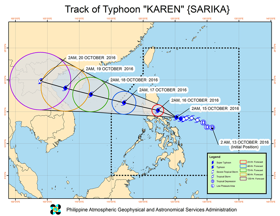
MANILA, Philippines – Typhoon Karen (Sarika) intensified further as it moved closer to Catanduanes early Saturday morning, October 15.
In its bulletin issued 5 am on Saturday, state weather bureau PAGASA said Karen now has maximum winds of up to 130 kilometers per hour (km/h) and gustiness of up to 180 km/h.
It is already 125 kilometers northeast of Virac, Catanduanes, moving west northwest at a slightly faster 13 km/h from the previous 9 km/h.
Signal number 3 is still raised in Catanduanes.
Signal number 2 is up in these areas:
- Camarines Norte
- Camarines Sur
- Aurora
- northern Quezon including Polillo Island
PAGASA warned that storm surges are possible in coastal areas of provinces under signal numbers 2 and 3.
The following areas, meanwhile, are under signal number 1:
- Albay
- Sorsogon
- Masbate including Ticao Island and Burias Island
- rest of Quezon
- Isabela
- Romblon
- Marinduque
- Oriental Mindoro
- Batangas
- Laguna
- Cavite
- Rizal
- Metro Manila
- Bulacan
- Pampanga
- Bataan
- Zambales
- Tarlac
- Nueva Ecija
- Nueva Vizcaya
- Pangasinan
- Quirino
- La Union
- Benguet
- Ifugao
- Northern Samar
Moderate to heavy rain is expected within the 500-km diameter of the typhoon. Residents of areas under warning signals should watch out for possible floods and landslides.
PAGASA also warned that sea travel in the seaboard of Eastern Samar is risky.
Karen could pass close to Polillo Island early Sunday morning, October 16, then make landfall in the Quezon-Aurora area before noon.
The typhoon is expected to leave the Philippine Area of Responsibility (PAR) on Monday, October 17.
PAGASA is also monitoring a tropical depression east of Mindanao which could enter PAR on Tuesday, October 18. – Rappler.com
Add a comment
How does this make you feel?
There are no comments yet. Add your comment to start the conversation.