SUMMARY
This is AI generated summarization, which may have errors. For context, always refer to the full article.
What’s the weather like in your area? Report the situation through Rappler’s Agos or tweet us at @rapplerdotcom.
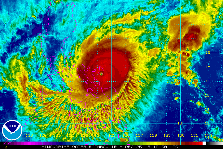
MANILA, Philippines – Typhoon Nina (Nock-ten) made landfall in Catanduanes at 6:30 pm on Sunday, December 25.
State weather bureau PAGASA made the announcement on its Twitter account shortly after the powerful typhoon hit land.
Catanduanes as well as Camarines Sur were earlier placed under signal number 4. (Check the full list of areas under warning signals as of 5 pm here.)
After hitting land in Catanduanes, Nina will cross Albay, Camarines Sur, Camarines Norte, southern Quezon, Laguna, Batangas, and Cavite.
PAGASA also earlier said Metro Manila will feel Nina’s impact from Sunday night to Monday, December 26.
Moderate to heavy rain is expected within Nina’s 500-km diameter, which could bring floods and landslides. Strong winds may damage medium- to high-risk structures, uproot trees, and destroy crops, added PAGASA.
The state weather bureau also warned that storm surges up to 2.5 meters high are possible in coastal areas in Camarines Sur, Camarines Norte, Albay, Sorsogon, and Catanduanes. Sea travel is risky in the seaboards of Luzon.
Nina is expected to leave the Philippine Area of Responsibility (PAR) on Wednesday, December 28.
PAGASA will release the next bulletin on the typhoon at 8 pm. – Rappler.com
Add a comment
How does this make you feel?
There are no comments yet. Add your comment to start the conversation.