SUMMARY
This is AI generated summarization, which may have errors. For context, always refer to the full article.
MANILA, Philippines – Parts of Mindanao is still affected by the intertropical convergence zone (ITCZ) Thursday, November 29, as a tropical storm in the Pacific is seen to make its way towards the Philippine Area of Responsibility (PAR) in a few days.
For Thursday, PAGASA forecasts cloudy skies with occasional light to moderate rain and thunderstorms over the Davao and Soccsksargen regions.
The rest of the archipelago, on the other hand, will experience partly cloudy skies with isolated brief rain or thunderstorms, the bureau said.
Prevailing winds will come from the northeast to east.
While there is currently no major weather disturbance within the PAR, tropical storm Bopha, which is currently in the open ocean southeast of Guam, is seen to enter the area in the next few days.
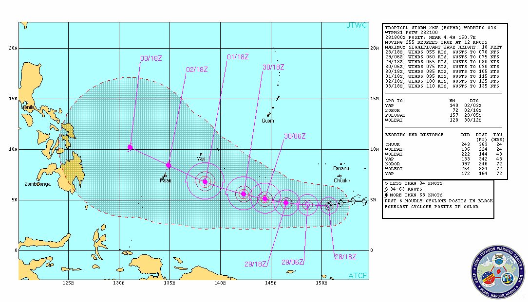
As of 6 am Japan time (5 am Philippine time) , the Japan Meteorological Agency (JMA) spotted Bopha 4°35’N, 150°25’E, and is forecast to move towards the west or northwest.
The US Navy’s Joint Typhoon Warning Center (JTWC) forecasts Bopha to intensify in the next few days, and is seen to possibly move towards Palau and then to the Philippines.
The JTWC forecasts the storm to be east of northern Mindanao by Monday, December 3. – Rappler.com
Add a comment
How does this make you feel?
There are no comments yet. Add your comment to start the conversation.