SUMMARY
This is AI generated summarization, which may have errors. For context, always refer to the full article.

MANILA, Philippines – In devastated areas like New Bataan in Compostela Valley, residents have begun to stock up on canned goods and emergency kits, fearing another weather disturbance that could make landfall on Christmas.
But on Friday morning, December 21, the state weather bureau quelled fears of another storm in the Philippines – a threat to a country still reeling from Typhoon “Pablo” (Bopha), which killed over 1,000 and damaged properties, agriculture and infrastructure worth P34.4-B.
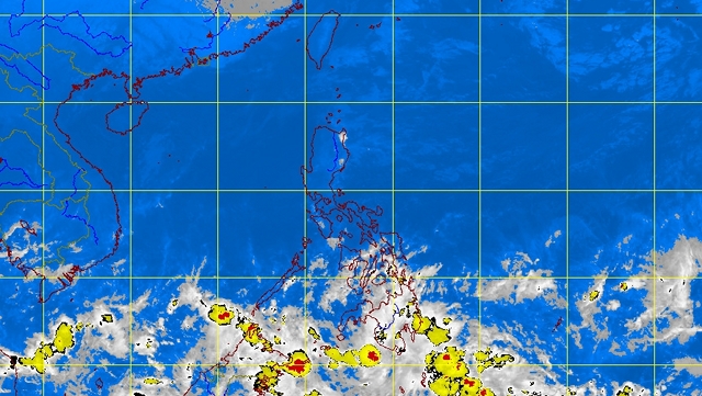
Weather forecaster Alvin Pura said a low pressure area (LPA) was indeed 2,700 kilometers away from the Philippine area of responsibility as of Friday morning. But Pura said it is unlikely to worsen in a major way, according to models by the Philippine Atmospheric, Geophysical, and Astronomical Services Administration (PAGASA).
“Sabi po ng mga models hindi po siya magiging bagyo. Low pressure area lang po siya, pero magdudulot po siya ng pag-ulan,” Pura told Rappler in a phone interview. (Models show it is unlikely to become a storm. It is just a low pressure area, but it will likely cause rain.)
Pura said the LPA is likely to enter the Philippines by Sunday or Monday, December 23 or December 24. He said it may trigger rain in Mindanao – probably in the same area devastated by Pablo – on Monday or Tuesday, Christmas Day.
It is too early, he noted, to estimate the amount of rainfall the LPA will dump on the Philippines.
What is clear for PAGASA, however, is that the new weather disturbance appears much weaker than Pablo.
Several days before entering the Philippines, in fact, Pablo was already a storm then a typhoon. The new weather disturbance remained an LPA two days before it is projected to enter the country.
Nevertheless, rain continues to pour in Compostela Valley even before the LPA enters the Philippines.
In its 5 am weather bulletin, PAGASA said the Davao, Caraga, and Soccsksargen regions will experience cloudy skies, with moderate to heavy rainshowers and thunderstorms, due to an intertropical convergence zone. The ITCZ is affecting southern Mindanao, PAGASA said. This could trigger flash floods and landslides.
This is bad enough for a region that has barely recovered from Pablo. (Editor’s note: Rappler on Friday launches an SMS donation drive for Pablo’s victims.)
In an interview with ABS-CBN, New Bataan Mayor Lorenzo Balbin said they hope a possible storm will not worsen their condition. “Sana wala na. Mahirap na kung dagdagan pa.” (We hope it will not happen. It will be difficult if it does.) – Rappler.com
Add a comment
How does this make you feel?


There are no comments yet. Add your comment to start the conversation.