SUMMARY
This is AI generated summarization, which may have errors. For context, always refer to the full article.
What’s the weather like in your area? Report the situation through Rappler’s Agos or tweet us at @rapplerdotcom.
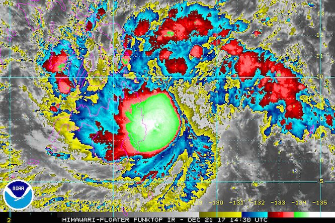
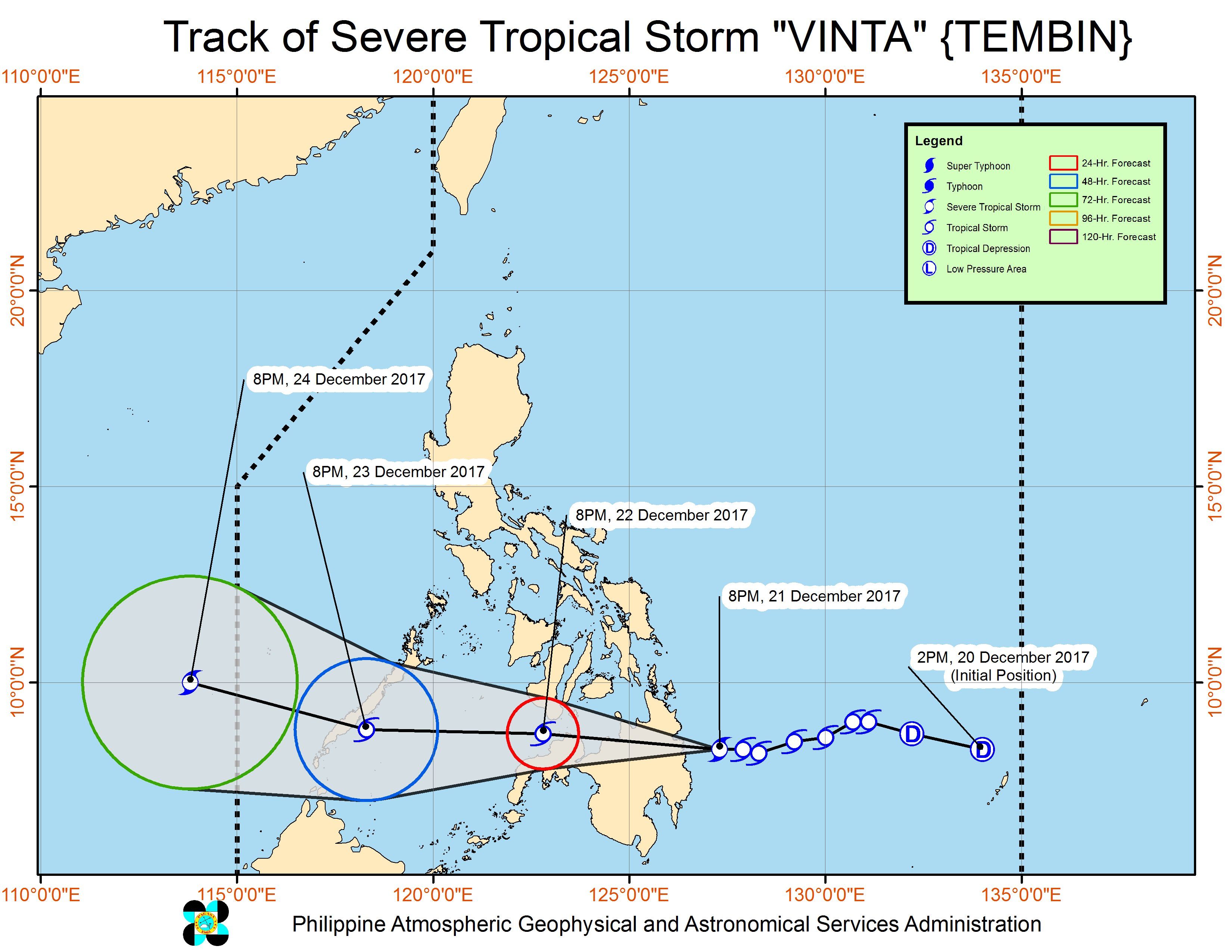
MANILA, Philippines – Tropical Storm Vinta (Tembin) intensified into a severe tropical storm late Thursday evening, December 21, shortly before its expected landfall in the province of Surigao del Sur.
In a bulletin issued 11 pm on Thursday, PAGASA said Vinta now has maximum winds of 90 kilometers per hour (km/h) from the previous 85 km/h and gustiness of up to 125 km/h from the previous 120 km/h.
The tropical storm is already 85 kilometers east southeast of Hinatuan, Surigao del Sur, moving west at a slightly faster 20 km/h from the previous 19 km/h. (READ: EXPLAINER: How tropical cyclones form)
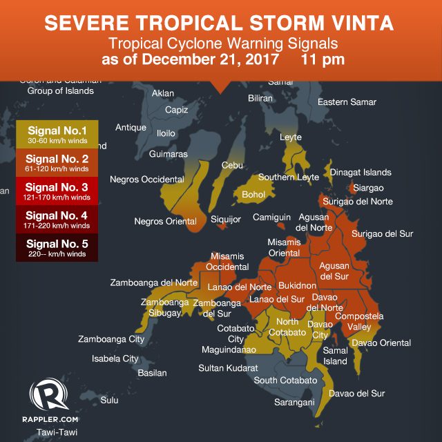
Signal number 2 is raised in:
- Siquijor
- southern Negros Oriental
- Surigao del Norte including Siargao Island
- Surigao del Sur
- Agusan del Norte
- Agusan del Sur
- northern Davao Oriental
- Compostela Valley
- Davao del Norte
- Camiguin
- Bukidnon
- Misamis Oriental
- Misamis Occidental
- Lanao del Norte
- Lanao del Sur
- eastern Zamboanga del Norte
- eastern Zamboanga del Sur
Signal number 1, meanwhile, is up over:
- Southern Leyte
- southern part of Leyte
- southern part of Cebu
- Bohol
- northern Negros Oriental
- southern Negros Occidental
- Dinagat Islands
- southern Davao Oriental
- Davao del Sur
- North Cotabato
- Maguindanao
- western Zamboanga del Norte
- western Zamboanga del Sur
- Zamboanga Sibugay
PAGASA also warned that scattered to widespread rains are expected in the Visayas, Caraga, Davao, Northern Mindanao, the Zamboanga Peninsula, Lanao del Sur, Maguindanao, and North Cotabato within the next 24 hours. Residents of these areas should be on alert for possible flash floods and landslides. (READ: What are the hazard-prone areas along Vinta’s path?)
Sea travel is also risky in areas under signal numbers 1 and 2. (READ: FAST FACTS: Tropical cyclones, rainfall advisories)
PAGASA earlier warned the public to take Vinta seriously, saying they should prepare and closely monitor updates.
After landfall, Vinta is expected to cross Caraga, Northern Mindanao, the Zamboanga Peninsula, and southern Palawan.
It will then leave PAR on Christmas Eve, December 24.
Eastern Visayas is still reeling from the damage wrought by Tropical Depression Urduja (Kai-tak), which battered the region as a tropical storm. National disaster management authorities said 45 people were killed and 46 others remain missing. Urduja left the Philippine Area of Responsibility (PAR) last Tuesday, December 19.
Meanwhile, the tail-end of a cold front will bring more light to heavy rain to the regions of Bicol, Mimaropa, and Calabarzon, as well as the provinces of Aurora and Quezon. Flash floods and landslides are possible.
The northeast monsoon will also continue to affect Metro Manila, Ilocos, Cagayan Valley, Cordillera, and the rest of Central Luzon, but PAGASA said the scattered rainshowers will have “no significant impact.” – Rappler.com
Add a comment
How does this make you feel?
There are no comments yet. Add your comment to start the conversation.