SUMMARY
This is AI generated summarization, which may have errors. For context, always refer to the full article.
What’s the weather like in your area? Report the situation through Rappler’s Agos or tweet us at @rapplerdotcom.
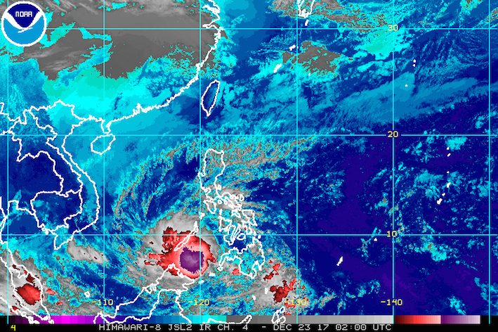
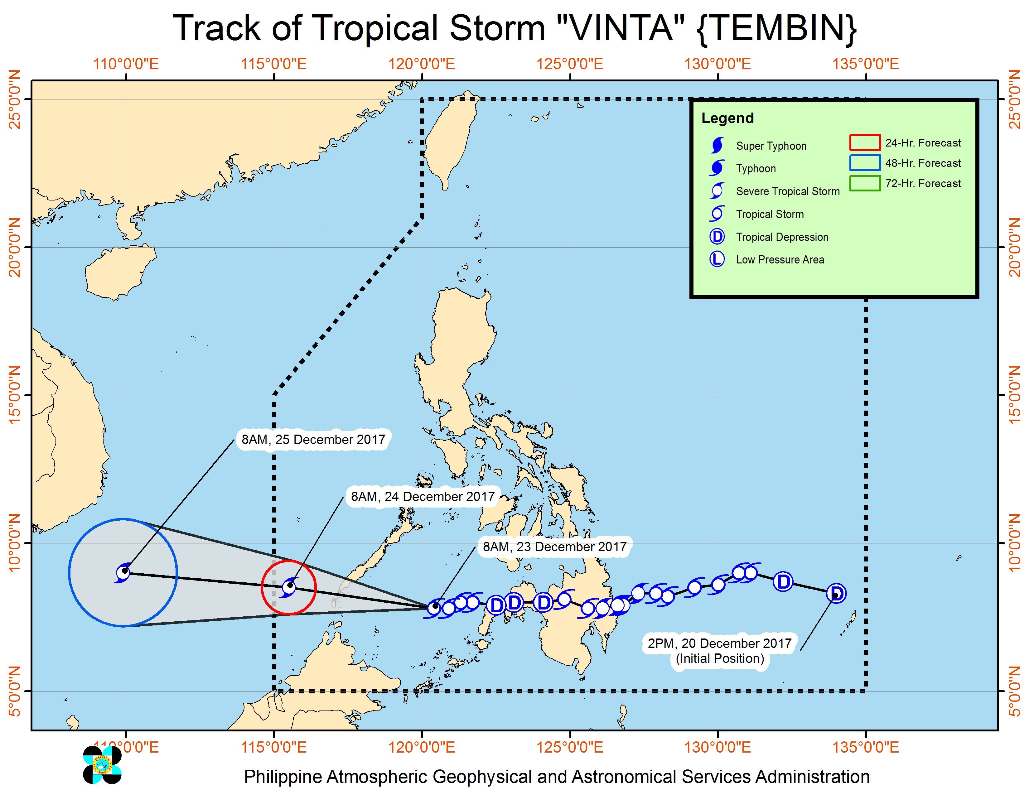
MANILA, Philippines – Tropical Storm Vinta (Tembin) maintained its strength late Saturday morning, December 23, as it continued heading for southern Palawan.
In a bulletin issued 11 am on Saturday, state weather bureau PAGASA said Vinta still has maximum winds of 80 kilometers per hour (km/h) and gustiness of up to 95 km/h.
The tropical storm is already 245 kilometers west northwest of Zamboanga City, still moving west at 20 km/h. (READ: EXPLAINER: How tropical cyclones form)
Its final stop in the Philippines is southern Palawan, which is now under signal number 2. Northern Palawan, meanwhile, is under signal number 1. Moderate to heavy rain is expected in the province, which may trigger flash floods and landslides.
PAGASA also said light to heavy rain is still expected in Mindanao, the Visayas, Bicol, and the rest of Mimaropa within the next 24 hours. (READ: FAST FACTS: Tropical cyclones, rainfall advisories)
Sea travel also remains risky in Palawan, the southern seaboard of the Mindoro provinces, and the western seaboard of Aklan and Antique. Thousands of passengers have been stranded due to Vinta.
Vinta had made landfall in Cateel, Davao Oriental as a severe tropical storm at 1:45 am on Friday, December 22. (READ: Nearly 16,000 evacuate as Vinta hits Davao Oriental)
An Agence France-Presse report said the death toll from Vinta has risen to 30, based on information from local police and civil defense officials. Four others have been reported missing.
Lanao del Sur and Cagayan de Oro are among the areas that experienced heavy flooding. Hundreds of residents also evacuated in Davao City on Friday night after a river overflowed. (READ: #ReliefPH: Help victims of Vinta)
Vinta is expected to leave the Philippine Area of Responsibility (PAR) on Christmas Eve, December 24, either in the morning or afternoon.
Eastern Visayas is still reeling from the damage wrought by Tropical Depression Urduja (Kai-tak), which battered the region as a tropical storm. National disaster management authorities said 45 people were killed and 46 others remain missing. Urduja left PAR last Tuesday, December 19.
Meanwhile, the northeast monsoon will continue to bring scattered rain to Metro Manila, Cagayan Valley, and Cordillera, as well as the provinces of Aurora and Quezon, but PAGASA said there will be “no significant impact.” – Rappler.com
Add a comment
How does this make you feel?
There are no comments yet. Add your comment to start the conversation.