SUMMARY
This is AI generated summarization, which may have errors. For context, always refer to the full article.
What’s the weather like in your area? Report the situation through Rappler’s Agos or tweet us at @rapplerdotcom.
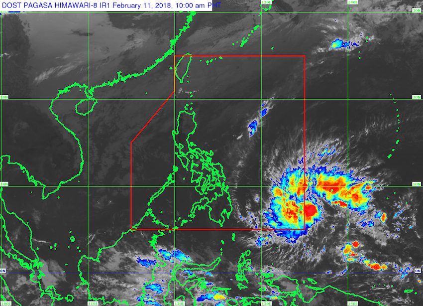
MANILA, Philippines – A tropical depression is expected to enter the Philippine Area of Responsibility (PAR) by Sunday night, February 11 – the country’s second tropical cyclone for 2018. It will be given the local name Basyang.
In a bulletin issued 11 am on Sunday, state weather bureau PAGASA said the tropical depression is already 1,200 kilometers east of Mindanao, moving west northwest at a relatively fast 27 kilometers per hour (km/h).
The tropical depression has maximum winds of 55 km/h and gustiness of up to 65 km/h.
Since it is not yet inside PAR, it has no direct effect on the country yet. But PAGASA warned that once the tropical depression enters PAR on Sunday night, maritime operations along the eastern seaboards of the Visayas and of Mindanao may be disrupted.
Initial projections show that the tropical depression could intensify into a tropical storm before making landfall in Northern Mindanao or in the southern part of the Visayas on Monday afternoon or evening, February 12.
Meanwhile, the northeast monsoon continues to affect Northern Luzon. It is bringing scattered rainshowers to Cagayan Valley, Cordillera, and Ilocos, but PAGASA said there is “no significant impact.”
The rest of the country, including Metro Manila, will only have localized thunderstorms. (READ: FAST FACTS: Tropical cyclones, rainfall advisories) – Rappler.com
Add a comment
How does this make you feel?
There are no comments yet. Add your comment to start the conversation.