SUMMARY
This is AI generated summarization, which may have errors. For context, always refer to the full article.
What’s the weather like in your area? Report the situation through Rappler’s Agos or tweet us at @rapplerdotcom.
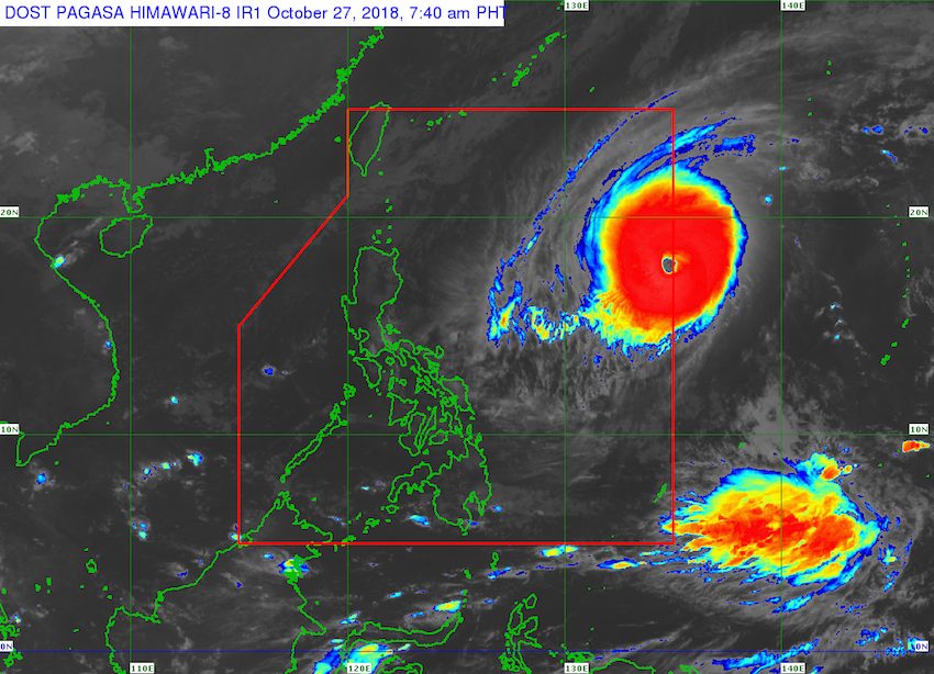
MANILA, Philippines – Typhoon Yutu entered the Philippine Area of Responsibility (PAR) at 6:30 am on Saturday, October 27, becoming the country’s 18th tropical cyclone for 2018. It has been given the local name Rosita.
The Philippine Atmospheric, Geophysical, and Astronomical Services Administration (PAGASA) announced Typhoon Rosita’s entry in a Facebook post on Saturday morning.
The first bulletin on Rosita will be issued at 11 am on Saturday. (READ: LIST: PAGASA’s names for tropical cyclones in 2018)
PAGASA earlier said before dawn on Saturday that the typhoon was located more than 1,000 kilometers east of Northern Luzon, still moving west at 20 kilometers per hour (km/h).
Rosita still has maximum winds of 185 km/h and gustiness of up to 225 km/h. (READ: FAST FACTS: Tropical cyclones, rainfall advisories)
PAGASA said tropical cyclone warning signals may be raised in parts of Northern Luzon and Central Luzon as early as Sunday evening, October 28, or Monday morning, October 29.
Rosita might make landfall in Northern Luzon on Tuesday, October 30, though there is still a chance its track could change.
PAGASA also warned that sea travel is risky in the northern and eastern seaboards of Luzon as well as in the eastern seaboard of the Visayas. This is due to the northeast monsoon enhanced by Rosita.
A gale warning was issued at 5 am on Saturday for Batanes, the Babuyan Group of Islands, Calayan, Cagayan, Isabela, the northern coast of Ilocos Norte, Camarines Norte, Camarines Sur, Catanduanes, the eastern coast of Albay, the eastern coast of Sorsogon, the eastern coast of Quezon including Polillo Island, Northern Samar, and Eastern Samar.
Seas off those areas are rough to very rough, with wave heights reaching 2.6 meters to 4.5 meters.
PAGASA advised fishermen and others with small vessels not to set sail in areas covered by the gale warning. Larger vessels should watch out for big waves.
The Philippines usually gets an average of 20 tropical cyclones per year.
The northeast monsoon will also trigger light rain in Batanes, the Babuyan Group of Islands, Ilocos Region, the Cordillera Administrative Region, and Cagayan Valley on Saturday. But PAGASA said there will be “no significant impact.”
The rest of the country will also have localized thunderstorms on Saturday, mostly in the afternoon or evening. Flash floods and landslides are possible if the thunderstorms bring heavy rain.
PAGASA declared the start of the rainy season last June 8. – Rappler.com
Add a comment
How does this make you feel?
There are no comments yet. Add your comment to start the conversation.